Julian Holland - Railway Day Trips - 160 classic train journeys around Britain
Здесь есть возможность читать онлайн «Julian Holland - Railway Day Trips - 160 classic train journeys around Britain» — ознакомительный отрывок электронной книги совершенно бесплатно, а после прочтения отрывка купить полную версию. В некоторых случаях можно слушать аудио, скачать через торрент в формате fb2 и присутствует краткое содержание. Жанр: unrecognised, на английском языке. Описание произведения, (предисловие) а так же отзывы посетителей доступны на портале библиотеки ЛибКат.
- Название:Railway Day Trips: 160 classic train journeys around Britain
- Автор:
- Жанр:
- Год:неизвестен
- ISBN:нет данных
- Рейтинг книги:3 / 5. Голосов: 1
-
Избранное:Добавить в избранное
- Отзывы:
-
Ваша оценка:
Railway Day Trips: 160 classic train journeys around Britain: краткое содержание, описание и аннотация
Предлагаем к чтению аннотацию, описание, краткое содержание или предисловие (зависит от того, что написал сам автор книги «Railway Day Trips: 160 classic train journeys around Britain»). Если вы не нашли необходимую информацию о книге — напишите в комментариях, мы постараемся отыскать её.
Railway Day Trips: 160 classic train journeys around Britain — читать онлайн ознакомительный отрывок
Ниже представлен текст книги, разбитый по страницам. Система сохранения места последней прочитанной страницы, позволяет с удобством читать онлайн бесплатно книгу «Railway Day Trips: 160 classic train journeys around Britain», без необходимости каждый раз заново искать на чём Вы остановились. Поставьте закладку, и сможете в любой момент перейти на страницу, на которой закончили чтение.
Интервал:
Закладка:
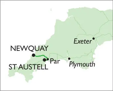
North of St Blazey, the railway threads through the heavily wooded Luxulyan Valley, now designated a World Heritage Site for its early 19th-century industrial remains, before passing under Treffry Viaduct. Built in 1844 this historic structure carried an aqueduct and a horsedrawn tramway serving local mines. West of tiny Luxulyan station – now a request stop, as are all the other intermediate stations on the line –Goonbarrow Junction is the limit of the china clay service and also the site of the only passing loop (still controlled by semaphore signals) on this single-track branch line. After Bugle and Roche stations the railway crosses a nature reserve on Goss Moor before reaching St Columb Road station. The view to the south along this stretch is dominated by huge china clay workings, which have the surreal appearance of a lunar landscape. A freight-only branch from Burngullow (west of St Austell) to Parkandillack still serves the china clay industry. Quintrell Downs is the penultimate station, followed by our journey’s end at Newquay station. The current single-platform affair here is in marked contrast to the original 3-platform structure that was also served by trains from Chacewater and Perranporth until the line’s closure in 1963. The world-famous surfing beaches of Newquay are but a short walk from the station.
DESTINATION HIGHLIGHTS
harbour; Discovery Trail; 9 beaches; surfing from Fistral Beach; Trenance Gardens; South West Coast Path
FREQUENCY OF TRAINS
6 per day (Mon-Sat)
5 per day (Sun, summer)
3 per day (Sun, winter)
25¼ MILES
1 HOUR 20 MINUTES
NUMBER OF CHANGES: 1
(Par)

Fistral Beach in Newquay is one of the premier surfing locations in Britain.
PLYMOUTH TO LOOE
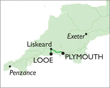
For the first 17¾ miles of this scenic rail journey trains from Plymouth travel along the route of Brunel’s heavily engineered former broad-gauge Cornwall Railway, which opened in 1859 and still links Cornwall with the rest of Britain’s rail network via the magnificent Royal Albert Bridge over the River Tamar. After crossing the wrought-iron single-track bridge from which there are fine views of the Tamar Estuary and the distant Devonport Royal Naval Dockyard, the railway heads through Saltash and St Germans stations, crossing creeks and rivers on the first of many viaducts that span the narrow valleys along this route. Winding its way through low hills past Menheniot station, the railway then approaches the historic market town of Liskeard over the 720-ft-long Liskeard Viaduct from where the single-track branch line to Looe can be seen 150 ft below.
At Liskeard, trains for Looe depart from a separate platform set at a right angle to the main line before descending a steeply graded 180-degree loop, which was opened by the Great Western Railway in 1901, to remote Coombe Junction. Here the guard changes the points before the train reverses direction to head south down the picturesque wooded valley of the East Looe River along the route of the Liskeard & Looe Railway that opened alongside the Liskeard & Looe Union Canal in 1860 – both canal and railway were originally built to carry minerals from mines and quarries on Bodmin Moor down to Looe Harbour. Keeping company with the river and disused canal, the railway passes through request stops at St Keyne Wishing Well, Causeland and Sandplace before slowing for a riverside road crossing at Terras Crossing. The journey ends at the modern minimal station at Looe from where it is but a short walk to the harbour, fish market, beach and quaint narrow streets of East Looe.
DESTINATION HIGHLIGHTS
beach; harbour; fish market; quaint streets (East Looe); boat hire on West Looe River; boat trips to Looe Island; shark fishing; Old Guildhall Museum; South West Coast Path
FREQUENCY OF TRAINS
1 per hour
26½ MILES
1 HOUR 10 MINUTES
NUMBER OF CHANGES: 1
(Liskeard)
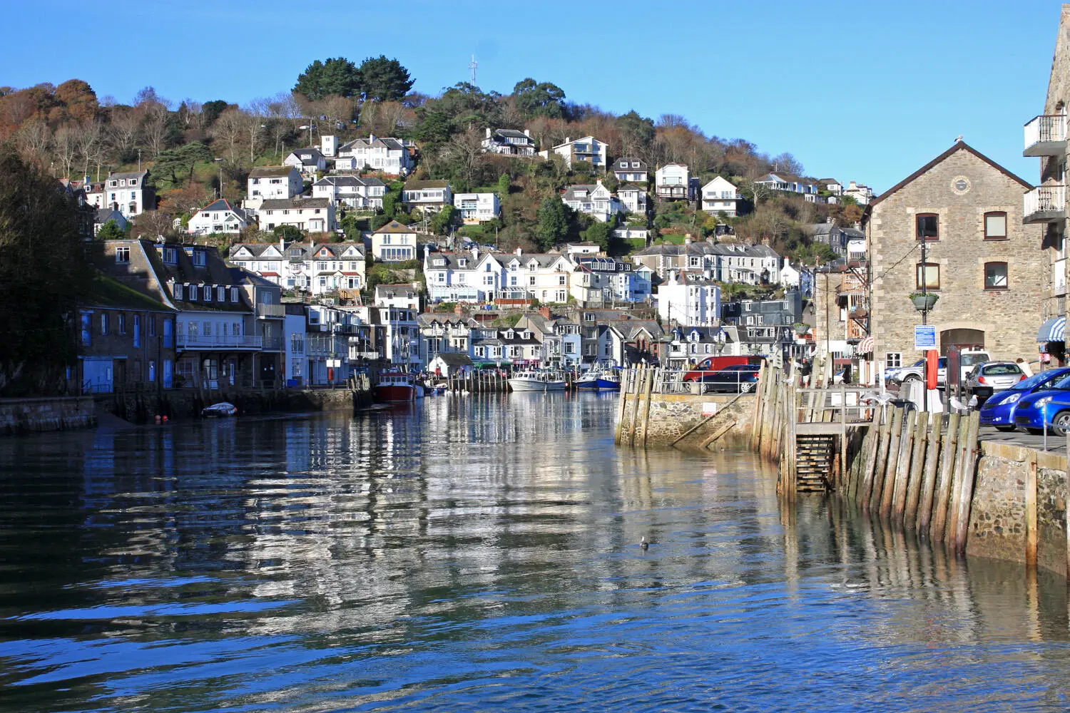
The picturesque harbour at Looe is the jumping-off point for boat trips up the West Looe River and to St George’s Island.
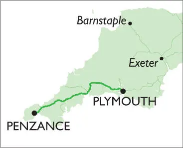
PLYMOUTH TO PENZANCE
Diesel trains for the scenic, switchback line to Penzance follow the same route as the day trip to Looeas far as Liskeard. Trains leave Liskeard in a westerly direction to cross the valley of the East Looe River on the imposing Moorswater Viaduct (147 ft high and 954 ft long). To the north lie the former granite quarries on Bodmin Moor while to the south the single-track branch line wends its way down the valley to Looe. After climbing to Doublebois, trains begin their descent of the wooded Fowey Valley to call at Bodmin Parkway station, junction for the steam-operated Bodmin & Wenford Railway. The heavily engineered section from Doublebois to Bodmin Parkway features no less than 7 viaducts. Originally designed by Isambard Kingdom Brunel in the 1850s with timber spans supported on masonry piers, the timber spans were later replaced by masonry arches. From here, the line heads south, continuing down the valley to Lostwithiel, junction for the freight-only line to Carne Point, near Fowey.
From Lostwithiel, the railway climbs away from the valley to pass through Treverran Tunnel before descending to Par station, junction for the Newquay branch line. Leaving Par behind, the line heads along the Carlyon Bay coastline before climbing inland to St Austell, Cornwall’s largest town and centre of the china clay industry. Westwards from here, the railway follows a switchback route to Truro, crossing steep-sided river valleys on 8 viaducts and boring through the hills in two tunnels. West of Truro (junction for Falmouth), it climbs steadily up through the hills to Redruth before descending to call at Camborne, Hayle and St Erth (junction for St Ives). The line then cuts across the Cornish peninsula to follow the shore of Mount’s Bay past Long Rock depot to reach Penzance station.
DESTINATION HIGHLIGHTS
Art Deco Jubilee Bathing Pool; Morrab Gardens; Golowan Festival (June); Newlyn Art Gallery; Penlee House Art Gallery & Museum; St Michael’s Mount (by bus to Marazion)
FREQUENCY OF TRAINS
1 per hour
79½ MILES
2 HOURS
NUMBER OF CHANGES: 0
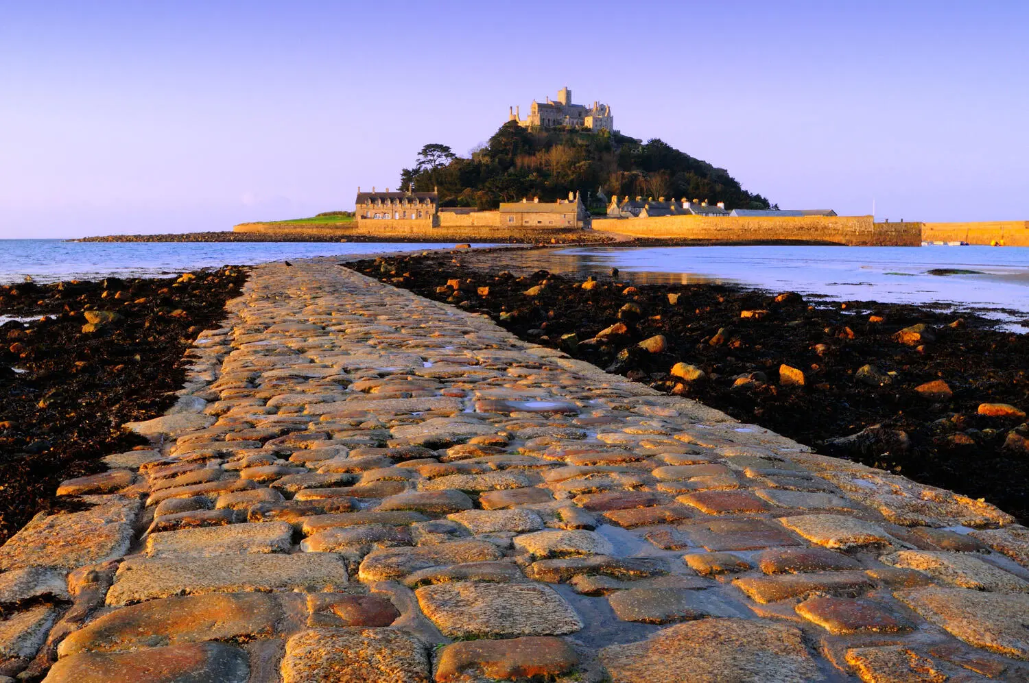
Owned by the National Trust, St Michael’s Mount near Penzance can be reached via an ancient causeway at low tide.
PLYMOUTH TO EXETER
Интервал:
Закладка:
Похожие книги на «Railway Day Trips: 160 classic train journeys around Britain»
Представляем Вашему вниманию похожие книги на «Railway Day Trips: 160 classic train journeys around Britain» списком для выбора. Мы отобрали схожую по названию и смыслу литературу в надежде предоставить читателям больше вариантов отыскать новые, интересные, ещё непрочитанные произведения.


Обсуждение, отзывы о книге «Railway Day Trips: 160 classic train journeys around Britain» и просто собственные мнения читателей. Оставьте ваши комментарии, напишите, что Вы думаете о произведении, его смысле или главных героях. Укажите что конкретно понравилось, а что нет, и почему Вы так считаете.