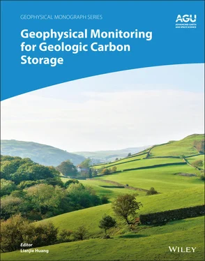
Geophysical Monitoring for Geologic Carbon Storage
Здесь есть возможность читать онлайн «Geophysical Monitoring for Geologic Carbon Storage» — ознакомительный отрывок электронной книги совершенно бесплатно, а после прочтения отрывка купить полную версию. В некоторых случаях можно слушать аудио, скачать через торрент в формате fb2 и присутствует краткое содержание. Жанр: unrecognised, на английском языке. Описание произведения, (предисловие) а так же отзывы посетителей доступны на портале библиотеки ЛибКат.
- Название:Geophysical Monitoring for Geologic Carbon Storage
- Автор:
- Жанр:
- Год:неизвестен
- ISBN:нет данных
- Рейтинг книги:4 / 5. Голосов: 1
-
Избранное:Добавить в избранное
- Отзывы:
-
Ваша оценка:
- 80
- 1
- 2
- 3
- 4
- 5
Geophysical Monitoring for Geologic Carbon Storage: краткое содержание, описание и аннотация
Предлагаем к чтению аннотацию, описание, краткое содержание или предисловие (зависит от того, что написал сам автор книги «Geophysical Monitoring for Geologic Carbon Storage»). Если вы не нашли необходимую информацию о книге — напишите в комментариях, мы постараемся отыскать её.
Geophysical Monitoring for Geologic Carbon Storage
Volume highlights include: Geophysical Monitoring for Geologic Carbon Storage
The American Geophysical Union promotes discovery in Earth and space science for the benefit of humanity. Its publications disseminate scientific knowledge and provide resources for researchers, students, and professionals.
Geophysical Monitoring for Geologic Carbon Storage — читать онлайн ознакомительный отрывок
Ниже представлен текст книги, разбитый по страницам. Система сохранения места последней прочитанной страницы, позволяет с удобством читать онлайн бесплатно книгу «Geophysical Monitoring for Geologic Carbon Storage», без необходимости каждый раз заново искать на чём Вы остановились. Поставьте закладку, и сможете в любой момент перейти на страницу, на которой закончили чтение.
Интервал:
Закладка:
11 Ferretti, A., Prati, C. & Rocca, F. (2001). Permanent scatterers in SAR interferometry. IEEE Transactions on Geoscience and Remote Sensing, 39(1), 8–20.
12 Finley, R. J., Frailey, S. M., Leetaru, H. E., Senel, O., Coueslan, M. L., & Marsteller, S. (2013). Early operational experience at a one‐million tonne CCS demonstration project, Decatur, Illinois. Energy Procedia, 37, 6149–6155.
13 Finley, R. J., Greenberg, S. D., Frailey, S. M., Krapac, I. G., Leetaru, H. E., & Marsteller, S. (2011). The path to a successful one‐million tonne demonstration of geological sequestration: Characterization, cooperation, and collaboration. Energy Procedia, 4, 4770–4776.
14 Gibson‐Poole, C. M., & Raikes, S. (2010). Enhanced understanding of CO2 storage at Krechba from 3D seismic. Proceedings of the 9th Annual Conference on Carbon Capture and Sequestration, Pittsburgh, PA, May 10–13, 2010.
15 Hisz, D. B., Murdoch, J. C., & Germanovich, L. N. (2013). A portable extensometer and tiltmeter for characterizing aquifers. Water Resources Research, 49, 7900–7910. https://doi.org/10.1002.wrcr.20500
16 Joyce, K. E., Samsonov, S. V., Levick, S. R., Engelbrecht, J. & Belliss, S. (2014). Mapping and monitoring geological hazards using optical, LiDAR, and synthetic aperture RADAR image data. Natural Hazards, 73, 137–163.
17 Kaven, J. O., Hickman, S. H., McGarr, A. F., Walter, S., & Ellsworth, W. L. (2014). Seismic monitoring at the Decatur, IL, CO2 sequestration demonstration site. Energy Procedia, 63, 4264–4272.
18 Massonnet, D., & Feigl, K. L. (1998). Radar interferometry and its applications to changes in the Earth's surface. Reviews of Geophysics, 36, 441–500.
19 Mathieson, A. Midgley, J., Dodds, K., Wright, I., Ringrose, P., & Saoula, N. (2010). CO2 sequestration monitoring and verification technologies applied at Krechba, Algeria. The Leading Edge, 29, 216–222.
20 Mogi, K. (1958). Relations between the eruptions of various volcanoes and the deformation of the ground surfaces above them. University of Tokyo Earthquake Research Institute Bulletin, 36, 99–134.
21 Moreau, F., & Dauteuil, O. (2013). Geodetic tools for hydrogeological surveys: 3D‐displacements above a fractured aquifer from GPS time series. Engineering Geology, 152, 1–9.
22 Norford, B., Haidl, R., Bezys, F. M., Cecile, M., McCabe, H., & Paterson, D. (1994). Middle Ordovician to Lower Devonian strata of the western Canada sedimentary basin. In G. Mossop & I. Shetson (comp.), Geological atlas of the western Canada sedimentary basin (pp. 109–127). Canadian Society of Petroleum Geologists, Calgary, Alberta and Alberta Research Council, Edmonton, Alberta.
23 Rickett, J., Duranti, L., Hudson, T., Regel, B., & Hodgson, N. (2007). 4D time strain and the seismic signature of geomechanical compaction at Genesis. The Leading Edge, 26, 644–647.
24 Ringrose, P. S., Mathieson, A. S., Wright, I. W., Selama, F., Hansen, O., Bissell, R., & Midgley, J. (2013). The In Salah CO2 storage project: Lessons learned and knowledge transfer. Energy Procedia, 37, 6226–6236.
25 Rosen, P., Hensley, S., Joughin, I., Li, F., Madsen, S. N., Rodriguez, E., & Goldstein, R. (2000). Synthetic aperture radar interferometry. Proceedings of the IEEE, 88(3), 333–382.
26 Rucci, A., Vasco, D. W., & Novali, F. (2010). Fluid pressure arrival‐time tomography: Estimation and assessment in the presence of inequality constraints with an application to production in the Krechba field, Algeria. Geophysics, 75, O39–O55.
27 Rucci, A., Vasco, D. W., & Novali, F. (2013). Monitoring the geologic storage of carbon dioxide using multicomponent SAR interferometry. Geophysical Journal International, 193(1), 197–208.
28 Samsonov, S., & d'Oreye, N. (2012). Multidimensional time series analysis of ground deformation from multiple InSAR data sets applied to Virunga Volcanic Province. Geophysical Journal International, 191, 1095–1108. https://doi.org/10.1111/j.1365‐246X.2012.05669.x
29 Samsonov, S., Czarnogorska, M., & White, D. (2015). Satellite interferometry for high‐precision detection of ground deformation at a carbon‐dioxide storage site. International Journal of Greenhouse Gas Control, 42, 188–199.
30 Schuite J., Longuevergne, L., Bour, O., Burbey, T. J., Boudin, F., Lavenant, N. & Davy, P. (2017). Understanding the hydromechanical behavior of a fault zone from transient surface tilt and fluid pressure observations at hourly time scales. Water Resources Research, 53, 10558–10582. https://doi.org/10.1002/2017WR020588
31 Vasco, D. W. (2004). Estimation of flow properties using surface deformation and head data: A trajectory‐based approach. Water Resources Research, 40, 1–14. https://doi.org/10.1029/2004WR003272
32 Vasco, D. W., & Datta‐Gupta, A. (2016). Subsurface fluid flow and imaging. Cambridge: Cambridge University Press.
33 Vasco, D. W., Ferretti, A., & Novali, F. (2008). Estimating permeability from quasi‐static deformation: Temporal variations and arrival time inversion. Geophysics, 73, O37–O52. https://doi.org/10.1190/1.2978164
34 Vasco, D. W., Johnson, L. R., & Goldstein, N. E. (1988). Using surface deformation and strain to determine deformation at depth, with an application to Long Valley, Caldera, California. Journal of Geophysical Research, 93, 3232–3242.
35 Vasco, D. W., Karasaki, K., & Keers, H. (2000). Estimation of reservoir properties using transient pressure data: An asymptotic approach. Water Resources Research, 36, 3447–3465. http://dx.doi.org/10.1029/2004WR003272
36 Vasco, D. W., Rucci, A., Ferretti, A., Novali, F., Bissell, R. C., Ringrose, P. S., Mathieson, A. S., et al. (2010). Satellite‐based measurements of surface deformation reveal fluid flow associated with the geological storage of carbon dioxide. Geophysical Research Letters, 37, L03303, 1–5. https://doi.org/10.1029/2009GL041544
37 Wang, R., Lorenzo‐Martin, F. & Roth, F. (2006). PSGRN/PSCMP: A new code for calculating co‐ and post‐seismic deformation, geoid and gravity changes based on the viscoelastic‐gravitational dislocation theory. Computers & Geosciences, 32, 527–541.
38 Worth, K., White, D., Chalaturnyk, R., Sorensen, J., Hawkes, C., Rostron, B., Johnson, J., et al. (2014). Aquistore project measurement, monitoring and verification: From concept to CO2 injection. Energy Procedia, 63, 3202–3208. https://doi.org/10.1016/j.egypro.2014.11.345
39 Wright, C. A. (1998). Tiltmeter fracture mapping: From the surface and now downhole. Petroleum Engineer International, 71, 50–63.
40 Zhang, R., Vasco, D. W., & Daley, T. M. (2016). Study of seismic diffraction wave caused by a fracture zone at the In Salah carbon dioxide storage project. International Journal of Greenhouse Gas Control, 42, 75–86. https://doi.org/10.1016/j.i.jggc.2015.07.033
41 Zhang, R., Vasco, D. W., Daley, T. M., & Harbert, W. (2015). Characterization of a fracture zone using seismic attributes at the In Salah CO2 storage project. Interpretation, May, SM37–SM46. https://doi.org/10.1190/INT‐2014‐0141.1
3 Surface Monitoring, Verification, and Accounting (MVA) for Geologic Sequestration Storage
Samuel Clegg1, Kristy Nowak-Lovato1, Robert Currier1, Julianna Fessenden2, and Ronald Martinez1
1 Chemistry Division, Los Alamos National Laboratory, Los Alamos, New Mexico, USA
2 Earth and Environmental Sciences, Los Alamos National Laboratory, Los Alamos, New Mexico, USA
ABSTRACT
Geologic sequestration of carbon dioxide (CO 2) is one of the immediate solutions to the permanent storage of greenhouse gases. Geologic storage of CO 2requires monitoring, verification, and accounting (MVA) to assess the location of the sequestered material as well as track the plume movement. Surface MVA techniques have been developed to detect CO 2emissions should some of the injected CO 2migrate to the surface. Most of these techniques involve monitoring absolute changes in bulk CO 2concentration, which is complicated by the diurnal cycle. Changes in the carbon stable isotope ratio in CO 2has been shown to be a more sensitive diagnostic to distinguish anthropogenic and natural CO 2. Both cavity ringdown spectroscopy (CRS) and frequency modulated spectroscopy (FMS) are sensitive spectroscopic techniques that have been developed to measure these stable isotope ratios. While CRS is limited to analysis of point source emission samples, field experiments of FMS instruments have been demonstrated in both captured samples and in remote configurations. In this chapter, the application of FMS to the MVA of carbon dioxide is reviewed.
Читать дальшеИнтервал:
Закладка:
Похожие книги на «Geophysical Monitoring for Geologic Carbon Storage»
Представляем Вашему вниманию похожие книги на «Geophysical Monitoring for Geologic Carbon Storage» списком для выбора. Мы отобрали схожую по названию и смыслу литературу в надежде предоставить читателям больше вариантов отыскать новые, интересные, ещё непрочитанные произведения.
Обсуждение, отзывы о книге «Geophysical Monitoring for Geologic Carbon Storage» и просто собственные мнения читателей. Оставьте ваши комментарии, напишите, что Вы думаете о произведении, его смысле или главных героях. Укажите что конкретно понравилось, а что нет, и почему Вы так считаете.
