Position, Navigation, and Timing Technologies in the 21st Century
Здесь есть возможность читать онлайн «Position, Navigation, and Timing Technologies in the 21st Century» — ознакомительный отрывок электронной книги совершенно бесплатно, а после прочтения отрывка купить полную версию. В некоторых случаях можно слушать аудио, скачать через торрент в формате fb2 и присутствует краткое содержание. Жанр: unrecognised, на английском языке. Описание произведения, (предисловие) а так же отзывы посетителей доступны на портале библиотеки ЛибКат.

- Название:Position, Navigation, and Timing Technologies in the 21st Century
- Автор:
- Жанр:
- Год:неизвестен
- ISBN:нет данных
- Рейтинг книги:5 / 5. Голосов: 1
-
Избранное:Добавить в избранное
- Отзывы:
-
Ваша оценка:
Position, Navigation, and Timing Technologies in the 21st Century: краткое содержание, описание и аннотация
Предлагаем к чтению аннотацию, описание, краткое содержание или предисловие (зависит от того, что написал сам автор книги «Position, Navigation, and Timing Technologies in the 21st Century»). Если вы не нашли необходимую информацию о книге — напишите в комментариях, мы постараемся отыскать её.
Volume 1 of
contains three parts and focuses on the satellite navigation systems, technologies, and engineering and scientific applications. It starts with a historical perspective of GPS development and other related PNT development. Current global and regional navigation satellite systems (GNSS and RNSS), their inter-operability, signal quality monitoring, satellite orbit and time synchronization, and ground- and satellite-based augmentation systems are examined. Recent progresses in satellite navigation receiver technologies and challenges for operations in multipath-rich urban environment, in handling spoofing and interference, and in ensuring PNT integrity are addressed. A section on satellite navigation for engineering and scientific applications finishes off the volume.
Volume 2 of
consists of three parts and addresses PNT using alternative signals and sensors and integrated PNT technologies for consumer and commercial applications. It looks at PNT using various radio signals-of-opportunity, atomic clock, optical, laser, magnetic field, celestial, MEMS and inertial sensors, as well as the concept of navigation from Low-Earth Orbiting (LEO) satellites. GNSS-INS integration, neuroscience of navigation, and animal navigation are also covered. The volume finishes off with a collection of work on contemporary PNT applications such as survey and mobile mapping, precision agriculture, wearable systems, automated driving, train control, commercial unmanned aircraft systems, aviation, and navigation in the unique Arctic environment.
In addition, this text:
Serves as a complete reference and handbook for professionals and students interested in the broad range of PNT subjects Includes chapters that focus on the latest developments in GNSS and other navigation sensors, techniques, and applications Illustrates interconnecting relationships between various types of technologies in order to assure more protected, tough, and accurate PNT
will appeal to all industry professionals, researchers, and academics involved with the science, engineering, and applications of position, navigation, and timing technologies.pnt21book.com
Position, Navigation, and Timing Technologies in the 21st Century — читать онлайн ознакомительный отрывок
Ниже представлен текст книги, разбитый по страницам. Система сохранения места последней прочитанной страницы, позволяет с удобством читать онлайн бесплатно книгу «Position, Navigation, and Timing Technologies in the 21st Century», без необходимости каждый раз заново искать на чём Вы остановились. Поставьте закладку, и сможете в любой момент перейти на страницу, на которой закончили чтение.
Интервал:
Закладка:
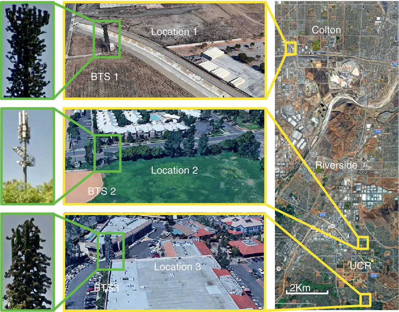
Figure 38.59 Locations of the cellular CDMA BTSs: Colton, California; Riverside, California; and the University of California–Riverside (UCR).
Map data: Google Earth (Khalife et al. [12]; Khalife and Kassas [22]). Source: Reproduced with permission of Institute of Navigation, IEEE.
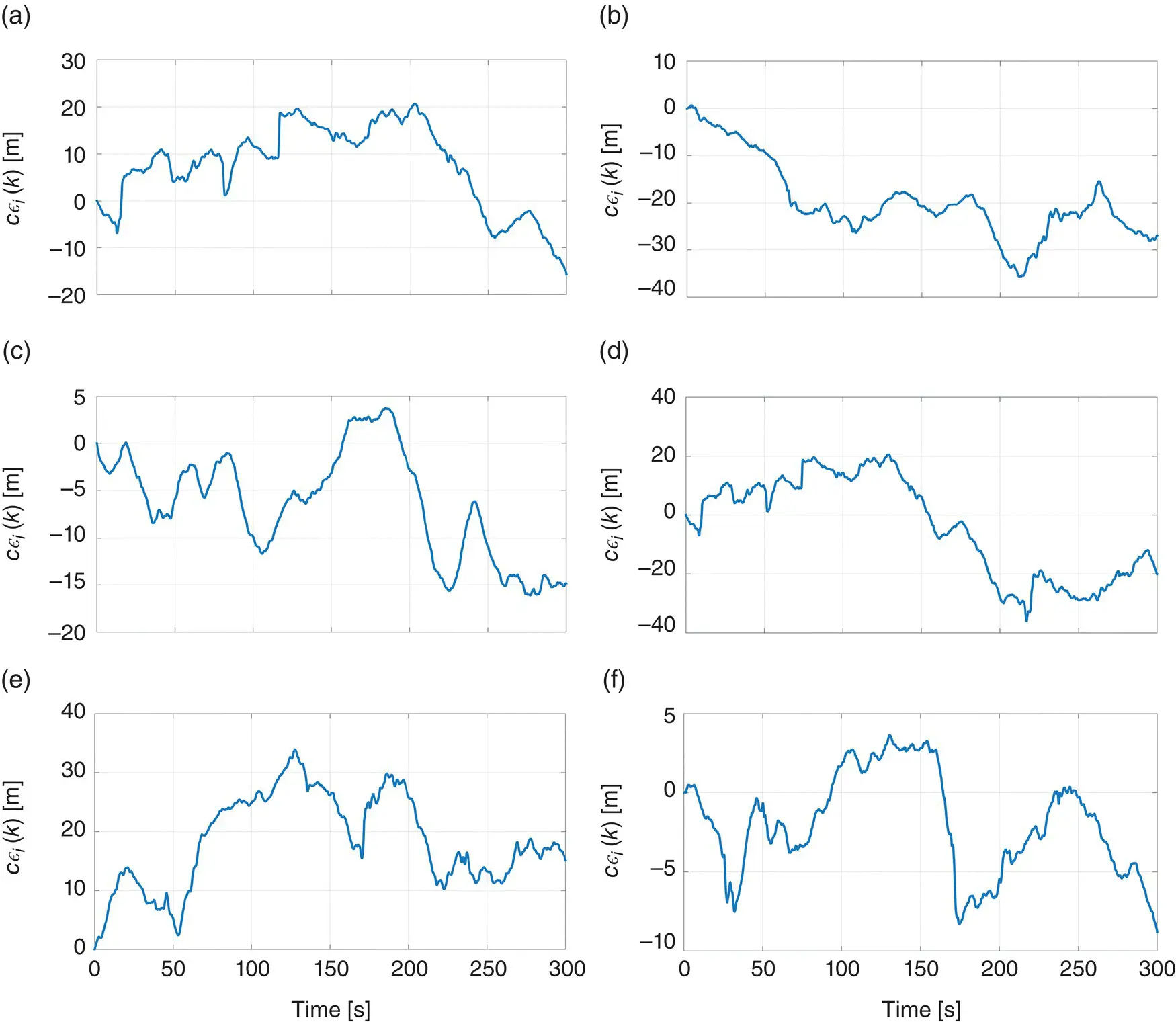
Figure 38.60 Six realizations, five minutes each, of the sector clock bias discrepancy for the tests in Table 38.5(Khalife et al. [12]; Khalife and Kassas [22]).
Source: Reproduced with permission of Institute of Navigation, IEEE.
38.8 Multi‐Signal Navigation: GNSS and Cellular
The quality of the GNSS navigation solution is determined by both the pseudorange measurement noise statistics and the spatial geometry of GNSS SVs. GNSS position solutions suffer from a relatively high vertical estimation uncertainty due to the lack of GNSS SV angle diversity (SVs are usually above the receiver). To address this, an external sensor (e.g. a barometer) is typically fused with a GNSS receiver. Cellular towers are abundant and available at varying geometric configurations unattainable by GNSS SVs. For example, BTSs could be below an aerial vehicle‐mounted receiver. Therefore, fusing cellular signals with GNSS signals would yield a more accurate navigation solution, particularly in the vertical direction. This section highlights the benefits of fusing cellular signals with GNSS signals.
This section is organized as follows. Section 38.8.1studies the dilution of precision (DOP) reduction due to fusing cellular signals with GNSS signals. Section 38.8.2shows experimental results with ground and aerial vehicles.
38.8.1 DOP Reduction
To study the DOP reduction due to the fusion of cellular and GNSS signals, consider an environment comprising a receiver making pseudorange measurements on M GNSS SVs and N terrestrial cellular BTSs. The pseudorange measurements are fused through a WNLS estimator to estimate the states of the receiver 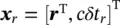 , where
  and δt rare the 3D position and clock bias of the receiver, respectively, and c is the speed of light. To simplify the discussion, assume that the measurement noise is independent and identically distributed across all channels with variance σ 2. If the measurement noise was not independent and identically distributed, the weighted DOP factors must be considered [84]. The estimator produces an estimate
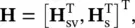
  and an associated estimation error covariance matrix P= σ 2( H T H) −1, where His the measurement Jacobian matrix. Without loss of generality, assume an east, north, up (ENU) coordinate frame to be centered at
  . Then, the Jacobian in this ENU frame can be expressed as
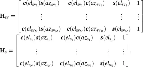
where c(·) and s(·) are the cosine and sine functions, respectively;  and
and  are the elevation and azimuth angles, respectively, of the m ‐th GNSS SV; and
  and
and  are the elevation and azimuth angles, respectively, of the n ‐th cellular tower as observed from the receiver. Therefore, G≜ ( H T H) −1is completely determined by the receiver‐to‐SV and receiver‐to‐BTS geometry. The diagonal elements of G, denoted g ii, are the DOP factors: geometric DOP (GDOP), horizontal DOP (HDOP), and vertical DOP (VDOP)

With the exception of GNSS receivers mounted on high‐flying aerial vehicles and SVs, all GNSS SVs are typically above the receiver [85]; that is, the elevation angles in H svare theoretically limited between 0° and 90°. Moreover, GNSS receivers typically ignore signals arriving from GNSS SVs below a certain elevation mask (typically 0° to 20°), since such signals are heavily degraded due to the ionosphere, troposphere, and multipath. When using GNSS together with cellular signals for navigation, the elevation angle span may effectively double to be between −90° and 90°. For ground vehicles, useful measurements can be made on cellular towers at elevation angles of  . For aerial vehicles, cellular BTSs can reside at elevation angle as low as
  , for example, if the vehicle is flying directly above the BTS.
To compare the DOP of a GNSS‐only navigation solution with a GNSS + cellular navigation solution, a receiver position expressed in an Earth‐Centered Earth‐Fixed (ECEF) coordinate frame was set to  . The elevation and azimuth angles of the GPS SV constellation above the receiver over a 24 hour period was computed using GPS SV ephemeris files from the Garner GPS Archive [86]. The elevation mask was set to el sv, min≡ 20 °. The azimuth and elevation angles of three towers, which were calculated from surveyed terrestrial cellular CDMA tower positions in the receiver’s vicinity, were
 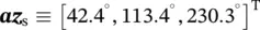 and
and 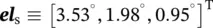 . The resulting VDOP, HDOP, GDOP, and associated number of available GPS SVs for a 24 hour period starting from midnight, September 1, 2015, are plotted in Figure 38.61. These results were consistent for different receiver locations and the corresponding GPS SV configurations. The following can be concluded from these plots for using N ≥ 1 cellular towers. First, the resulting VDOP using GPS + N cellular towers is always less than the resulting VDOP using GPS alone. Second, using GPS + N cellular towers prevents large spikes in VDOP when the number of GPS SVs drops. Third, using GPS + N cellular towers also reduces both HDOP and GDOP. Additional analysis is given in [7, 8].
Интервал:
Закладка:
Похожие книги на «Position, Navigation, and Timing Technologies in the 21st Century»
Представляем Вашему вниманию похожие книги на «Position, Navigation, and Timing Technologies in the 21st Century» списком для выбора. Мы отобрали схожую по названию и смыслу литературу в надежде предоставить читателям больше вариантов отыскать новые, интересные, ещё непрочитанные произведения.


Обсуждение, отзывы о книге «Position, Navigation, and Timing Technologies in the 21st Century» и просто собственные мнения читателей. Оставьте ваши комментарии, напишите, что Вы думаете о произведении, его смысле или главных героях. Укажите что конкретно понравилось, а что нет, и почему Вы так считаете.