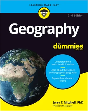
Jerry T. Mitchell - Geography For Dummies
Здесь есть возможность читать онлайн «Jerry T. Mitchell - Geography For Dummies» — ознакомительный отрывок электронной книги совершенно бесплатно, а после прочтения отрывка купить полную версию. В некоторых случаях можно слушать аудио, скачать через торрент в формате fb2 и присутствует краткое содержание. Жанр: unrecognised, на английском языке. Описание произведения, (предисловие) а так же отзывы посетителей доступны на портале библиотеки ЛибКат.
- Название:Geography For Dummies
- Автор:
- Жанр:
- Год:неизвестен
- ISBN:нет данных
- Рейтинг книги:5 / 5. Голосов: 1
-
Избранное:Добавить в избранное
- Отзывы:
-
Ваша оценка:
- 100
- 1
- 2
- 3
- 4
- 5
Geography For Dummies: краткое содержание, описание и аннотация
Предлагаем к чтению аннотацию, описание, краткое содержание или предисловие (зависит от того, что написал сам автор книги «Geography For Dummies»). Если вы не нашли необходимую информацию о книге — напишите в комментариях, мы постараемся отыскать её.
Geography For Dummies
Geography For Dummies
Geography For Dummies — читать онлайн ознакомительный отрывок
Ниже представлен текст книги, разбитый по страницам. Система сохранения места последней прочитанной страницы, позволяет с удобством читать онлайн бесплатно книгу «Geography For Dummies», без необходимости каждый раз заново искать на чём Вы остановились. Поставьте закладку, и сможете в любой момент перейти на страницу, на которой закончили чтение.
Интервал:
Закладка:
9 Part 5: The Part of Tens Chapter 19: Ten Organizations for Geography in Action American Association of Geographers (AAG) American Geographical Society (AGS) National Aeronautics and Space Administration (NASA) National Council for Geographic Education (NCGE) National Geographic Society (NGS) National Oceanic and Atmospheric Administration (NOAA) Population Reference Bureau (PRB) Royal Geographical Society (RGS) United States Census Bureau United States Geological Survey (USGS) Chapter 20: Ten Interesting Career Paths for Geographers Area Specialist Educator Environmental Manager GIS Technician Health Services Planner Location Analyst Market Analyst Remote Sensing Analyst Transportation Planner Urban Planner Chapter 21: Ten Things You Can Forget The Bermuda Triangle Cold Canadian Air “Coming Out of Nowhere” “The Continent” The Democratic Republic of … The Flat Earth Society Land of the Midnight Sun “The Rain in Spain Stays Mainly on the Plain” The Seven Seas Tropical Paradise Chapter 22: Ten Great Places for Online Geography Any County/Local GIS Department Geocaching Geoguessr Geoinquiries Google Earth Google Lit Trips Perry-Castañeda Library Map Collection World Bank Open Data World Factbook Your State’s Geographic Alliance
10 Index
11 About the Author
12 Advertisement Page
13 Connect with Dummies
14 End User License Agreement
List of Tables
1 Chapter 11TABLE 11-1 The 10 Most Populous Countries in 2021
2 Chapter 12TABLE 12-1 Top 10 Sources of U.S. Immigrants Historically and RecentlyTABLE 12-2: The 15 fastest growing cities in the United States, 2000–2020 (100,0...
3 Chapter 13TABLE 13-1 Some Cultural UniversalsTABLE 13-2 How People “Sing” in Four Languages
4 Chapter 17TABLE 17-1 The 10 Largest Metropolitan Areas in 2020
List of Illustrations
1 Chapter 2FIGURE 2-1: A map of the historical geography of the African lion. FIGURE 2-2: Potential sites for a gas station.
2 Chapter 3FIGURE 3-1: A map of Gridville. FIGURE 3-2: The basics of the global grid. FIGURE 3-3: A representation of a portion of Earth’s grid. FIGURE 3-4: Degrees, minutes, and seconds.
3 Chapter 4FIGURE 4-1: Map projection. FIGURE 4-2: New York City to Singapore: Map # 1. FIGURE 4-3: New York City to Singapore: Map #2. FIGURE 4-4: Families of map projections. FIGURE 4-5: The Mercator projection. FIGURE 4-6: Goode’s Interrupted Homolosine projection. FIGURE 4-7: Lambert Conformal Conic projection. FIGURE 4-8: The Peters projection.
4 Chapter 5FIGURE 5-1: Three ways to indicate the scale of a map. FIGURE 5-2: These three maps have different scales, and therefore differ in are...FIGURE 5-3: The terrain of a make-believe place, as depicted three ways. FIGURE 5-4: This map uses proportional circles to indicate the size of cities. FIGURE 5-5: This map uses flow lines of different widths to indicate hypothetic...FIGURE 5-6: This map uses nominal area symbols to identify the distribution of ...FIGURE 5-7: This choropleth map uses shades of gray to show population density ...FIGURE 5-8: Geographic Information Systems (GIS) use layers of locational and a...
5 Chapter 6FIGURE 6-1: A cut-away view of Earth. FIGURE 6-2: Plates and plate boundaries. FIGURE 6-3: A folded landscape. FIGURE 6-4: A photograph of exposed anticlines and synclines in Crete. FIGURE 6-5: Types of faults. FIGURE 6-6: A church in Chillán, Chile designed as one large arch – structurall...FIGURE 6-7: The process of subduction.
6 Chapter 7FIGURE 7-1: The Grand Canyon is a product of gradational force. FIGURE 7-2: Mammoth Cave is an example of chemical weathering. Note the size of...FIGURE 7-3: Rivers may flow through different landscapes on their journey to th...FIGURE 7-4: Deltas are formed from sediments deposited at river mouths. FIGURE 7-5: Extent of continental glaciers in North America during the last Ice...FIGURE 7-6: The geography of loess deposits in the United States.
7 Chapter 8FIGURE 8-1: The desert island of Aruba, home to more than 100,000 residents and...FIGURE 8-2: The Indian Ocean and parts thereof. FIGURE 8-3: Profile of the continental shelf. FIGURE 8-4: Singapore, a coastal city with much infrastructure and population a...FIGURE 8-5: The water cycle. FIGURE 8-6: The Ogallala Aquifer.
8 Chapter 9FIGURE 9-1: Solar energy strikes the Earth at three latitudes. FIGURE 9-2: Earth’s inclination at different points in its orbit of the Sun. FIGURE 9-3: The tilted Earth showing special lines of latitude. FIGURE 9-4: From Pau, France, one can see the snow-capped Pyrenees Mountains, d...FIGURE 9-5: Given a dominant wind direction, mountains and mountain ranges may ...FIGURE 9-6: A generalized geography of ocean surface currents. FIGURE 9-7: Conditions associated with El Niño (top) and La Niña (bottom). FIGURE 9-8: A cross-section of high- and low-atmospheric pressure-systems. FIGURE 9-9: Inter-tropical convergence zone and sub-tropical high-pressure belt...FIGURE 9-10: The sand dunes of the Sahara? No, these travelers are wandering co...FIGURE 9-11: Pressure belt locations during the wet and dry monsoons.
9 Chapter 10FIGURE 10-1: The hypothetical sequence of natural vegetation from the equator t...FIGURE 10-2: The geography of humid tropical climates. FIGURE 10-3: Fire is used to clear land for a type of agriculture — shifting cu...FIGURE 10-4: A savanna landscape surrounds Mount Kilimanjaro in Kenya and Tanza...FIGURE 10-5: The geography of dry climates. FIGURE 10-6: The desert landscape of central New Mexico. FIGURE 10-7: Steppe agricultural production can have disastrous outcomes as sho...FIGURE 10-8: The geography of humid mesothermal climates. FIGURE 10-9: Chile produces a variety of (mostly) red and white wines in its Va...FIGURE 10-10: The geography of humid microthermal climates. FIGURE 10-11: The geography of polar climates.
10 Chapter 11FIGURE 11-1: Global population density by country in 2020. FIGURE 11-2: Global population growth. FIGURE 11-3: The demographic transition model shows the relationship between bi...FIGURE 11-4: Wealth (Gross National Income per capita). FIGURE 11-5: Percent of population ages 0–14. FIGURE 11-6: Infant mortality rate. FIGURE 11-7: A photo of a slum in a developing country. The low quality of life...FIGURE 11-8: A photo of a high-yield rice paddy. High-yield rice is one reason ...
11 Chapter 12FIGURE 12-1: The world at the height of the last ice age. The space between the...FIGURE 12-2: U.S. population growth by state, 1980–2020. FIGURE 12-3: Mental map of state desirability as perceived by South Carolina co...
12 Chapter 13FIGURE 13-1: Your friendly neighborhood snake charmer with his two basketed fri...FIGURE 13-2 A, B, AND C: The three standard modes of cultural diffusion. FIGURE 13-3: Predominant religious groups around the world. FIGURE 13-4: The geography of English is shown by the dark shade.
13 Chapter 14FIGURE 14-1: The Great Wall of China is an enduring symbol of the human fondnes...FIGURE 14-2: Three border options in a hypothetical region. FIGURE 14-3: Examples of natural and geometric boundaries in the United States....FIGURE 14-4: The horn region of East Africa. FIGURE 14-5 A AND B: The Rumaila Oil Field and Georges Bank. FIGURE 14-6: The world’s land-locked states. FIGURE 14-7: Different shapes of countries. FIGURE 14-8 A AND B: These diagrams show two kinds of gerrymandering: diluting ...FIGURE 14-9: An oddly shaped congressional district drawn to favor one politica...
14 Chapter 15FIGURE 15-1: This open pit gold mine in Australia is an example of primary econ...FIGURE 15-2: The generalized relationship between development and the proportio...FIGURE 15-3: The traditional American “Manufacturing Belt” is located close to ...FIGURE 15-4: Memphis, Tennessee, is the principal hub of the FedEx route system...FIGURE 15-5: A container ship unloads at port.
Читать дальшеИнтервал:
Закладка:
Похожие книги на «Geography For Dummies»
Представляем Вашему вниманию похожие книги на «Geography For Dummies» списком для выбора. Мы отобрали схожую по названию и смыслу литературу в надежде предоставить читателям больше вариантов отыскать новые, интересные, ещё непрочитанные произведения.
Обсуждение, отзывы о книге «Geography For Dummies» и просто собственные мнения читателей. Оставьте ваши комментарии, напишите, что Вы думаете о произведении, его смысле или главных героях. Укажите что конкретно понравилось, а что нет, и почему Вы так считаете.


