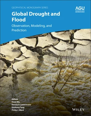
Part III provides a review of recent advances in drought and flood damage estimation and risk assessment, and in‐depth discussions on challenges in humanitarian response and management activities when integrating the hazard information from multiple products and data sources. Flood risk assessment under climate change is first introduced and discussed. Then practical activities in hazard response from national and international agencies are detailed in the next two chapters. The final chapter of this section describes the emerging role of the Global Flood Partnership (GFP), a network of scientists, users, and private and public organizations active in global flood response and risk management. The GFP shares flood information in near real‐time for national environmental agencies and humanitarian organizations to support emergency operations and to reduce the overall socioeconomic impacts of disasters. A conclusion summarizes the whole book, with a brief discussion on existing challenges and the strategies of improving the monitoring and prediction of drought and flood.
Drought and floods have unsurprisingly become the hot topics of several recently published books. The uniqueness of this book, however, lies in the fact that: (a) it represents most of the ongoing modeling efforts, including current widely used products, and as chapter contributors are the developers of these products, this allows them to describe in detail and depth the strengths, weaknesses, advances and challenges in their further development and integration; (b) it brings together contributors from humanitarian, government, and development sectors, describing how these products are used in risk assessment and catastrophe response activities from a users’ standpoint, shedding light on how to narrow the gap between product providers and users in both expectation and communication. As a result, this book should appeal to a broad community of researchers, engineers, practitioners, policy makers, and decision makers, from various national and international agencies and nongovernmental organizations (NGOs) working in drought and flood disaster management, and in sustainable and resilient construction. It should also be of interest to college students and teachers with interests in subjects including hydrology, remote sensing, meteorology, natural hazards, emergency management, and global change.
Last, we note that many of the chapters on floods are born out of presentations given at recent American Geophysical Union’s Fall Meeting sessions on “Global Floods: Forecasting, Monitoring, Risk Assessment, and Socioeconomic Response” and the annual meetings of the Global Flood Partnership (GFP). These sessions and meetings foster global flood forecasting, monitoring, and impact assessment efforts with the aim to strengthen preparedness and response and to reduce global flood losses.
Huan Wu Sun Yat‐sen University, China
Dennis P. Lettenmaier University of California, Los Angeles, USA
Qiuhong Tang Chinese Academy of Sciences, China
Philip J. Ward Vrije Universiteit Amsterdam, The Netherlands
Part I Remote Sensing for Global Drought and Flood Observations
1 Progress, Challenges, and Opportunities in Remote Sensing of Drought
Arash Modarresi Rad1, Amir AghaKouchak2, Mahdi Navari3, and Mojtaba Sadegh4
1 Department of Computing, Boise State University, Boise, Idaho, USA
2 Department of Civil and Environmental Engineering, and Department of Earth System Science, University of California Irvine, Irvine, California, USA
3 NASA Goddard Space Flight Center, Greenbelt, Maryland, USA
4 Department of Civil Engineering, Boise State University, Boise, Idaho, USA
Drought, one of the most daunting natural hazards, is linked to other hazards such as heatwaves and wildfires, and is related to global and regional food security. Given the severe environmental and socioeconomic ramifications of droughts, comprehensive and timely analysis of droughts’ onset, development, and recovery at proper spatial and temporal scales is of paramount importance. Droughts are categorized by different variables, such as precipitation, soil moisture, and streamflow, depending on the target of the analysis. The root cause of droughts, however, is sustained below‐average precipitation. Large‐scale oceanic and atmospheric circulations drive precipitation variability, and hence droughts should be analyzed from a continental to global perspective. Given the spatial scale of interest, as well as the poor spatial resolution and temporal inconsistency of ground observations, multisensor remotely sensed climatological, hydrological, and biophysical variables offer a unique opportunity to model droughts from different perspectives (meteorological, agricultural, hydrological, and socioeconomic) and at the global scale. It is also often required to model droughts using multiple indices and analyze feedbacks between droughts and other hazards, such as heatwaves. Multiple satellites, missions, and sensors offer invaluable information for multi‐indicator modeling of droughts and their feedbacks with other natural hazards in an era of big data. Remote sensing satellite data, however, are associated with major challenges including temporal limitations, consistency within and between multiple sensors and data sets, reliability, lack of uncertainty assessment, managing data volumes, and paucity of research on translating remote sensing of drought into actionable science. With challenge comes opportunity. The focus of the scientific community should be on merging the information provided from different satellites and sensors, to underpin their uncertainties, and to offer long‐term and consistent data sets for drought analysis.
Drought is a recurring natural feature of climate and is defined as below‐normal precipitation, usually over an extended period of time (Wilhite & Buchanan‐Smith, 2005). Droughts cause billions of dollars of damage to multiple sectors globally, specifically to agriculture. Droughts may also cause, or co‐occur with, other hazards such as heatwaves, which collectively escalate the ramifications of this natural hazard (Raei et al. 2018). Indeed, the concurrence of climatic extremes, in particular droughts and heat waves, can result in forest fires (Goulden, 2018; Silva et al., 2018; Taufik et al., 2017), land degradation and desertification (Hutchinson & Herrmann, 2016; Olagunju, 2015; Vicente‐Serrano et al., 2015), water shortage for agriculture and urban water supply (AghaKouchak, Farahmand, et al., 2015; Gober et al., 2016; Khorshidi et al., 2019; Van Loon et al., 2016), and economic impacts, and may prompt water bankruptcy (Howitt et al., 2014; Madani et al., 2016). Therefore, the impacts of drought are complex and can propagate to regions outside the area of its occurrence. Drought is often categorized in four groups: meteorological, agricultural, hydrological, and socioeconomic (Dracup et al., 1980). Meteorological drought is defined as precipitation deficiency over a long period, and it best represents the onset of drought (Utah Division of Water Resources, 2007). An extended period of meteorological drought results in soil moisture deficit as evapotranspiration continues despite the lack of precipitation, which leads to agricultural drought (Cunha et al., 2015). Persistence of metrological drought ultimately reduces overall water supply and drought is manifested in a hydrological form (Modaresi Rad et al., 2016). Socioeconomic drought then occurs as supply and demand of some economic goods are impacted by meteorological, agricultural, and hydrological droughts (Shiferaw et al., 2014). The observed changes in temporal patterns of precipitation associated with unsustainable water withdrawal may escalate the drought severity around the globe (Mallakpour et al., 2018; U.S. Global Change Research Program, 2018); and large‐scale changes in weather patterns are likely to affect water storage around the globe and threaten water supply particularly in arid and semi‐arid regions (Ault et al., 2014).
Читать дальше


