Lace PadillaDepartment of Psychology Northwestern University Evanston, Illinois, USA
Erin Coughlan de PerezInternational Research Institute for Climate and Society The Earth Institute, Columbia University Palisades, New York, USA; and Red Cross Red Crescent Climate Centre The Hague, The Netherlands; and Vrije Universiteit Amsterdam Amsterdam, The Netherlands
Christel PrudhommeEuropean Centre for Medium‐range Weather Forecasts Reading, United Kingdom; and Centre for Ecology and Hydrology Wallingford, United Kingdom; and Department of Geography and Environment Loughborough University Loughborough, United Kingdom
Arash Modarresi RadDepartment of Computing Boise State University Boise, Idaho, USA
Lauro RossiCIMA Research Foundation Savona, Italy
Roberto RudariCIMA Research Foundation Savona, Italy
Mojtaba SadeghDepartment of Civil Engineering Boise State University Boise, Idaho, USA
Peter SalamonDisaster Risk Management Unit European Commission Joint Research Centre Ispra, Italy
Chris SampsonFathom Global Bristol, United Kingdom
Mitchell SchullNOAA NESDIS Center for Satellite Applications and Research College Park, Maryland, USA; and UMD‐CISESS Cooperative Institute for Satellite Earth System Studies College Park, Maryland, USA
Guy J.‐P. SchumannSchool of Geographical Sciences University of Bristol Bristol, United Kingdom; and Institute of Arctic and Alpine Research University of Colorado Boulder, Colorado, USA
Kara SiahaanInternational Federation of Red Cross and Red Crescent Societies Geneva, Switzerland
Andy SmithFathom Global Bristol, United Kingdom
Jonathan A. SullivanSchool for Environment and Sustainability University of Michigan Ann Arbor, Michigan, USA
Donglian SunDepartment of Geography and Geo‐Information Science George Mason University Fairfax, Virginia, USA
Qiuhong TangInstitute of Geographic Sciences and Natural Resources Research Chinese Academy of Sciences Beijing, China
Jing TaoEarth System Science Interdisciplinary Center University of Maryland College Park, Maryland, USA; and Lawrence Berkeley National Laboratory Berkeley, California, USA; and Department of Civil and Environmental Engineering University of Washington Seattle, Washington, USA
Beth TellmanCloud to Street New York, New York, USA; and The Earth Institute, Columbia University Palisades, New York, USA
Mark A. TriggSchool of Civil Engineering University of Leeds Leeds, United Kingdom
Philip J. WardInstitute for Environmental Studies Vrije Universiteit Amsterdam Amsterdam, The Netherlands
Albrecht WeertsDeltares Delft, The Netherlands; and Wageningen University and Research Centre Wageningen, The Netherlands
Huan WuSchool of Atmospheric Sciences Sun Yat‐sen University Guangdong, China; and Southern Marine Science and Engineering Laboratory Guangdong, China; and Earth System Science Interdisciplinary Center University of Maryland College Park, Maryland, USA
Dai YamazakiInstitute of Industrial Science The University of Tokyo Tokyo, Japan
Hongxiang YanPacific Northwest National Laboratory U. S. Department of Energy Richland, Washington, USA
Siquan YangDivision of Science and Informatization Ministry of Emergency Management of the People’s Republic of China Beijing, China
Aizhong YeState Key Laboratory of Earth Surface and Ecological Resources Faculty of Geographical Science Beijing Normal University Beijing, China
Jifu YinNOAA NESDIS Center for Satellite Applications and Research College Park, Maryland, USA; and UMD‐CISESS Cooperative Institute for Satellite Earth System Studies College Park, Maryland, USA
Mahkameh ZarekariziCenter for Complex Hydrosystems Research Department of Civil, Construction, and Environmental Engineering The University of Alabama Tuscaloosa, Alabama, USA
Xiwu ZhanNOAA NESDIS Center for Satellite Applications and Research College Park, Maryland, USA
Shuai ZhangDepartment of Geological Sciences University of North Carolina at Chapel Hill Chapel Hill, North Carolina, USA
Fang ZhaoKey Laboratory of Geographic Information Science (Ministry of Education)School of Geographic Sciences East China Normal University Shanghai, China; and Potsdam Institute for Climate Impact Research Potsdam, Germany
Gang ZhaoZachry Department of Civil and Environmental Engineering Texas A&M University College Station, Texas, USA
Ervin ZsoterEuropean Centre for Medium‐range Weather Forecasts Reading, United Kingdom
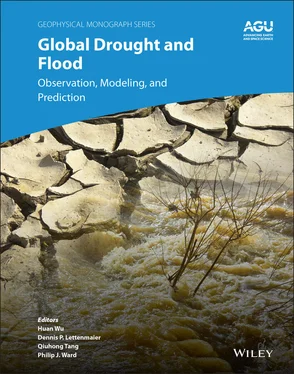
The increase in the frequency of drought and flood events due to changes in the global water and energy cycle poses higher risks to human settlements, especially those in floodplains and areas with frequent heat waves and deficit in precipitation, in an era of rapid population growth. Monitoring and forecasting of the occurrence, intensity, and evolution of drought and flood events are considered to be more and more important by humanitarian and government agencies for issuing timely warnings, monitoring ongoing hazards, and developing short‐term and long‐term risk assessments and management plans. In the past two decades, there have been significant advances in both numerical modeling and remote sensing approaches. These complementary approaches have been critical components in producing integrated information for droughts and floods.
This monograph reviews recent advances in the modeling and remote sensing of droughts and floods, covering many relevant topics including: (a) the currently available, widely used techniques and products for obtaining timely and accurate global‐scale or continental‐scale drought and flood information; (b) the features, strengths and weaknesses, and advances and challenges in each of these global products; (c) how these products have been used by humanitarian, government, and development sectors in recent natural disaster cases; and (d) discussions about the gaps between the products and end users, and insights for further improving the workflow in response activities from perspectives of both hazard information providers and users.
This book is organized into three closely connected sections. Part I focuses on remote sensing approaches for global drought and flood mapping. It starts with an overview of progress, challenges, and opportunities in remote sensing of drought. As critical components for drought monitoring, two well recognized remote‐sensing‐based products for evapotranspiration measurement and reservoir parameters (elevation, storage, and area) are then introduced and discussed in the following two chapters. Two widely used remote‐sensing‐based flood mapping products are described in the next two chapters, respectively, followed by a thoughtful chapter proposing an integration of Earth Observation (EO) data and numerical models, with the latter as the focus of the next section.
Part II summarizes current widely used modeling approaches and systems, including model physics, features, validation, strength, limitations, and challenges in their further improvement and applications. In this section, the first three chapters are focused on modeling of drought using statistical, process‐based or hybrid approaches. For flood modeling, an overview of the state‐of‐the‐art flood models is presented in a dedicated chapter. An open challenge for almost all global flood models, i.e., large‐scale calibration of models, is discussed in the following chapter. The rest of the section then focuses on two common data sets, i.e., derivations based on digital elevations model (DEM), and land use and land cover (LULC), which are fundamental for both drought and flood simulations.
Читать дальше
