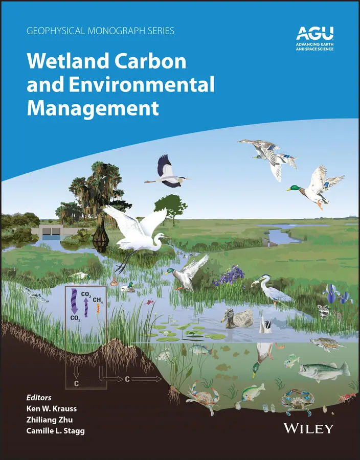
Wetland Carbon and Environmental Management
Здесь есть возможность читать онлайн «Wetland Carbon and Environmental Management» — ознакомительный отрывок электронной книги совершенно бесплатно, а после прочтения отрывка купить полную версию. В некоторых случаях можно слушать аудио, скачать через торрент в формате fb2 и присутствует краткое содержание. Жанр: unrecognised, на английском языке. Описание произведения, (предисловие) а так же отзывы посетителей доступны на портале библиотеки ЛибКат.
- Название:Wetland Carbon and Environmental Management
- Автор:
- Жанр:
- Год:неизвестен
- ISBN:нет данных
- Рейтинг книги:4 / 5. Голосов: 1
-
Избранное:Добавить в избранное
- Отзывы:
-
Ваша оценка:
Wetland Carbon and Environmental Management: краткое содержание, описание и аннотация
Предлагаем к чтению аннотацию, описание, краткое содержание или предисловие (зависит от того, что написал сам автор книги «Wetland Carbon and Environmental Management»). Если вы не нашли необходимую информацию о книге — напишите в комментариях, мы постараемся отыскать её.
Wetland Carbon and Environmental Management Volume highlights include:
Overview of carbon storage in the landscape Introduction to wetland management practices Comparisons of natural, managed, and converted wetlands Impact of wetland management on carbon storage or loss Techniques for scientific assessment of wetland carbon processes Case studies covering tropical, coastal, inland, and northern wetlands Primer for carbon offset trading programs and how wetlands might contribute The American Geophysical Union promotes discovery in Earth and space science for the benefit of humanity. Its publications disseminate scientific knowledge and provide resources for researchers, students, and professionals.
Wetland Carbon and Environmental Management — читать онлайн ознакомительный отрывок
Ниже представлен текст книги, разбитый по страницам. Система сохранения места последней прочитанной страницы, позволяет с удобством читать онлайн бесплатно книгу «Wetland Carbon and Environmental Management», без необходимости каждый раз заново искать на чём Вы остановились. Поставьте закладку, и сможете в любой момент перейти на страницу, на которой закончили чтение.
Интервал:
Закладка:
1.3.3. Ecosystem Modeling
Modeling approaches used to estimate above‐ and belowground stocks of wetland carbon can be partitioned to diagnostic and prognostic approaches. Diagnostic modeling tends to rely more heavily on observational data, such as remote‐sensing derived vegetation distributions, to initialize and update model states over time. In contrast, prognostic modeling relies on “first principles,” where fundamental relationships linking biophysical information, carbon uptake, carbon allocation, and carbon turnover determine vegetation and soil carbon stocks. Many examples of diagnostic and prognostic wetland modeling comparisons exist in the literature and the uncertainties between and among these approaches remains high (Fisher et al., 2015).
To some extent, all the estimates of above‐ and belowground carbon stocks require empirical or process‐based models either to scale site‐level measurement, or convert volumetric to mass‐based estimates, or to attribute changes over time due to climate and land use. However, the relationship of the models to underlying data reflects a gradient of data‐constrained to process‐based representation of how estimates are made. The estimates provided in this chapter span this gradient, with some emphasizing empirical approaches, where carbon density is multiplied by wetland area, others using semi‐empirical methods, where the carbon densities are spatially constrained by remote sensing observations, or where prognostic models are used to assess long‐term historical or future climate feedbacks on carbon turnover and respiration losses.
1.4. ESTIMATES OF WETLAND STOCKS BY WETLAND TYPES
1.4.1. Mangroves
Mangroves and other tidal wetlands have the highest carbon density among terrestrial ecosystems (McLeod et al., 2011). Although they only represent 0.3% of the total forest area (or 0.1 % of land area), C emissions from mangrove destruction alone at current rates could be equivalent to up to 1–10% of carbon emissions from deforestation (Donato et al., 2011; Richards et al., 2020). From 1996 to 2016, 158.4 Mt of C (1.8%) was lost from mangrove ecosystems (Richards et al., 2020), with total emissions per year ranging from 25–29 Tg CO 2‐equivalent (Friess, 2019). Due to their location along highly populated coastlines, they are under significant threat from anthropogenic activity as well as sea level rise and climate extremes. In fact, it is estimated that over 50% of mangrove forests and tidal marshes have been destroyed over the past 60 years, at a rate of 1% to 2%/yr (McLeod et al., 2011), although contemporary (2000–2016) rates of loss have reduced (0.13%/yr), particularly from anthropogenic destruction (Goldberg et al., 2020). The high C sequestration coupled with the high risk of future destruction makes mangroves a prime candidate for carbon mitigation initiatives such as the United Nations Collaborative Programme on Reducing Emissions from Deforestation and Degradation in Developing Countries (UNREDD and REDD+).
One of the main challenges to implementing carbon mitigation projects is measuring carbon efficiently, effectively, and safely. In mangroves especially, the extreme difficulty of the terrain has hindered the establishment of sufficient field plots needed to accurately measure carbon on the scale necessary to relate remotely sensed measurements with field measurements at accuracies of 80 to 90% as required for REDD and other carbon trading mechanisms (UNREDD, 2010). Furthermore, most intensive mangrove sites are established in South‐East Asia, Australia, and Latin America, with a large gap in knowledge in African mangrove ecosystems.
Mangrove aboveground biomass (AGB) and aboveground carbon (AGC) are strongly related to mangrove height, thus the largest AGC estimates are found among the world’s tallest stands. Mangrove height is driven by temperature and precipitation and so the largest forests are found close to the equator, with notably large stands on the west coast of Colombia and in Gabon, where the world’s tallest stands of 63 m are found (Simard et al., 2019). Shorter trees are found towards the extremes of their geographic limits, such as in higher‐latitude countries like Japan and New Zealand. However, the maximum height that mangroves are able to achieve is often limited by the occurrence of tropical cyclones and hurricanes (Simard et al., 2019). These extreme weather events limit the height of mangroves in regions where taller mangrove forests would be expected, such as in equatorial East Africa. Mangrove forest height is determined by a number of local scale variables which include salinity, hydraulic conductivity, wave exposure, and soil type, which lead to local and regional variation in height and AGC.
At national and regional levels, total mangrove carbon stocks are also driven by mangrove areal extent. Asia contains 40% of the total global mangrove area, therefore it contains over half (52%) of the total global mangrove AGB. Indonesia alone contains 22% of the global mangrove AGC stock, due to its vast mangrove area and mean mangrove AGB of 215 Mg/ha. The total AGB in mangrove forests globally is estimated at 1.52 (Hu et al., 2020) to 1.75 PgC (Simard et al., 2019), with 20.7% stored in Africa, 11.9% in Oceania, 39.3% in Asia, 27.9% in the Americas, and 0.2% stored in the Middle East. The total mangrove ecosystem carbon, however, is dominated by that which is stored in the soils. The soil C alone has been estimated to range from 1.93 PgC (Ouyang & Lee, 2019) to 6.4 PgC (Sanderman et al., 2018), although the overlap of uncertainty between these estimates is approximately equal. Lower estimates of mangrove soil carbon tend to be more common, from 1.93 to 2.96 PgC (Ouyang & Lee, 2019; Hamilton & Friess, 2018). Africa stores 13–19% of the soil C to 1 m depth with 28% stored in the Americas, 10% stored in Oceania, 42–49% stored in Asia, and no more than 0.2% in the Middle East. The controls on this total soil C are driven by coastal environmental settings (such as Holocene sea level rise and current tidal regimes), which can be divided into classes of deltas (river dominated), estuaries (tide dominated), lagoons (wave dominated), composite (river and wave dominated), bedrock (drowned bedrock valley), and carbonate settings, which contain different mangrove soil C:N:P stoichiometry (Rovai et al., 2018). The use of a model that contained a range of climatic variables (e.g., temperature), biological estimates (e.g., PET) and information on geophysical setting (e.g., runoff), determined global soil C to be controlled by tidal range and temperature (Sanderman et al., 2018). However, although mangrove area is also a determinant in the total quantity of mangrove soil C per region, expressed by the large areal extent of mangrove in Asia, soil C is controlled at the local level by geomorphological settings (Rovai et al., 2018). Based on this review of the literature, for mangroves we therefore estimate aboveground stocks to be 1.52–1.75 PgC and belowground soil carbon to range from 1.93–6.4 PgC, for a total of 3.45–8.15 PgC.
1.4.2. Tidal Salt Marshes
Tidal salt marshes are dynamic ecosystems that can be found in a range of sedimentary coastal settings from the tropical to the arctic climate zone (Mcowen et al., 2017). Marsh plants consist of halophytic herbs, grasses, and low shrubs that are adapted to frequent or occasional inundation by tides (saltwater) and lay approximately between mean high‐water neap and mean high‐water spring tides (Mcowen et al., 2017). Located in the intertidal zone, they can share a similar ecological niche and have overlapping distributions with mangroves in temperate regions (Saintilan et al., 2014; Kelleway et al., 2017).
Table 1.1 Summary of local rates and global estimates of carbon burial and stock in salt marshes
Читать дальшеИнтервал:
Закладка:
Похожие книги на «Wetland Carbon and Environmental Management»
Представляем Вашему вниманию похожие книги на «Wetland Carbon and Environmental Management» списком для выбора. Мы отобрали схожую по названию и смыслу литературу в надежде предоставить читателям больше вариантов отыскать новые, интересные, ещё непрочитанные произведения.


Обсуждение, отзывы о книге «Wetland Carbon and Environmental Management» и просто собственные мнения читателей. Оставьте ваши комментарии, напишите, что Вы думаете о произведении, его смысле или главных героях. Укажите что конкретно понравилось, а что нет, и почему Вы так считаете.