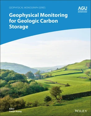
Geophysical Monitoring for Geologic Carbon Storage
Здесь есть возможность читать онлайн «Geophysical Monitoring for Geologic Carbon Storage» — ознакомительный отрывок электронной книги совершенно бесплатно, а после прочтения отрывка купить полную версию. В некоторых случаях можно слушать аудио, скачать через торрент в формате fb2 и присутствует краткое содержание. Жанр: unrecognised, на английском языке. Описание произведения, (предисловие) а так же отзывы посетителей доступны на портале библиотеки ЛибКат.
- Название:Geophysical Monitoring for Geologic Carbon Storage
- Автор:
- Жанр:
- Год:неизвестен
- ISBN:нет данных
- Рейтинг книги:4 / 5. Голосов: 1
-
Избранное:Добавить в избранное
- Отзывы:
-
Ваша оценка:
- 80
- 1
- 2
- 3
- 4
- 5
Geophysical Monitoring for Geologic Carbon Storage: краткое содержание, описание и аннотация
Предлагаем к чтению аннотацию, описание, краткое содержание или предисловие (зависит от того, что написал сам автор книги «Geophysical Monitoring for Geologic Carbon Storage»). Если вы не нашли необходимую информацию о книге — напишите в комментариях, мы постараемся отыскать её.
Geophysical Monitoring for Geologic Carbon Storage
Volume highlights include: Geophysical Monitoring for Geologic Carbon Storage
The American Geophysical Union promotes discovery in Earth and space science for the benefit of humanity. Its publications disseminate scientific knowledge and provide resources for researchers, students, and professionals.
Geophysical Monitoring for Geologic Carbon Storage — читать онлайн ознакомительный отрывок
Ниже представлен текст книги, разбитый по страницам. Система сохранения места последней прочитанной страницы, позволяет с удобством читать онлайн бесплатно книгу «Geophysical Monitoring for Geologic Carbon Storage», без необходимости каждый раз заново искать на чём Вы остановились. Поставьте закладку, и сможете в любой момент перейти на страницу, на которой закончили чтение.
Интервал:
Закладка:
ACKNOWLEDGMENTS
This work was supported by the U.S. Department of Energy (DOE) through the Los Alamos National Laboratory (LANL) operated by Triad National Security, LLC, for the National Nuclear Security Administration (NNSA) of U.S. DOE under Contract No. 89233218CNA000001, and through Lawrence Livermore National Laboratory (LLNL) under Contract DE‐AC52‐07NA27344. We thank the AGU Publications Director Dr. Jenny Lunn and Dr. Estella Atekwana of the AGU Books Editorial Board for their careful review and valuable comments. We also thank David Li of LANL for his review. This chapter is approved for public release by LANL (LA‐UR‐21‐27246) and by LLNL (LLNL‐BOOK‐824879).
2 Geodetic Monitoring of the Geological Storage ofGreenhouse Gas Emissions
Donald Vasco1, Alessandro Ferretti2, Alessio Rucci2, Giacomo Falorni3, Sergey Samsonov4, Don White5, and Magdalena Czarnogorska4
1Energy Geosciences Division, Lawrence Berkeley National Laboratory, Berkeley, California, USA
2 TRE ALTAMIRA Srl, Milan, Italy
3 TRE Altamira Inc., Vancouver, British Columbia, Canada
4 Canada Centre for Mapping and Earth Observation, Natural Resources Canada, Ottawa, Ontario, Canada
5 Geological Survey of Canada, Natural Resources Canada, Ottawa, Ontario, Canada
ABSTRACT
Geodetic monitoring involves the repeated measurement of the deformation of the Earth. As discussed here, it is a cost‐effective approach for inferring reservoir integrity and detecting possible leakage associated with the geological storage of greenhouse gas emissions. Most geodetic methods have favorable temporal sampling, from minutes to months depending upon the technique adopted, and can detect anomalous behavior in a timely fashion. Satellite‐based approaches such as Interferometric Synthetic Aperture Radar (InSAR), with their high spatial resolution and broad coverage, are particularly well suited for monitoring industrial‐scale storage efforts. Multitemporal analysis, such as permanent scatterer techniques, are improving the accuracy of surface displacement measurements to better than 4 – 5 mm. New satellites, including the recent X‐band systems, are allowing for the routine estimation of two components of deformation. Data interpretation and inversion techniques may be used to relate the observed displacements to injection‐related volume change at depth. InSAR monitoring was used successfully at a gas storage site at In Salah, Algeria, where it was determined that the flow in the reservoir was influenced by large‐scale fault/fracture zones. InSAR observations are also key components of the monitoring programs at the Aquistore CO 2storage project in Canada, and the Illinois Basis Decatur Project in the United States. Current InSAR data from both sites indicate no major surface deformation that might be attributed to the stored carbon dioxide, suggesting that the injected fluid remains at depth.
2.1. INTRODUCTION
Geodetic monitoring, the repeated measurement of displacements and strains, both on the surface and within the interior of the Earth, provides an important class of techniques for assuring the safety of geological storage and for detecting leakage. There are important advantages associated with geodetic methods. The observations are usually gathered frequently in time, from every few minutes to every few months, depending upon the type of data. There are a diverse set of instruments for measuring strain and displacement in various configurations, either on the Earth's surface, at depth, or even from space. Thus, geodetic measurement may often be gather remotely, greatly simplifying data collection and allowing for cost‐effective monitoring, particularly in comparison with more intrusive techniques such as seismic surveys. The Earth often deforms in response to fluid injection, particularly at the volumes and rates associated with the geological storage of carbon dioxide. Therefore, geodetic observations are sensitive to fluid volume and pressure changes and may be used to monitor the fate of injected fluids. The magnitude of surface displacement increases dramatically as the source driving the deformation approaches the surface. Thus, geodetic monitoring is well suited to detecting leakage and the upward migration of fluids under pressure. In this chapter, we will discuss the use of geodetic data for monitoring injected carbon dioxide. Our primary focus will be on space‐based Interferometric Synthetic Aperture Radar (InSAR) as this is perhaps the most cost‐effective geodetic technique for land‐based storage sites.
2.2. OBSERVATIONAL METHODS
2.2.1. Overview
Given its practical applications, geodesy, the measurement of distances and changes in distances (displacements), is probably one of the oldest scientific disciplines. Early leveling work and distance‐measuring techniques involving the use of calibrated rods and chains date back to ancient times and continue to this day, though they have largely been replaced by satellite‐based and laser‐based techniques. Another early technique was the measurement of the local slope, the horizontal gradient of surface elevation, using a calibrated bubble level. This has evolved to modern day, highly accurate, capacitance‐based tilt meters, capable of determining angular changes with nanoradian precision (Wright, 1998), optical fiber‐tilt meters (Chawah et al., 2015), and portable tilt meters and extensometers (Hisz et al., 2013). Advanced tilt meters are now self leveling and may be used in boreholes and on the seabed. Trilateration by a constellation of satellites is the basis for the Global Positioning System (GPS), and Global Navigation Satellite Systems (GNSS) in general. This technology appears in many applications including the monitoring of subsurface fluid flow (Moreau & Dauteuil, 2013). Both tilt and GNSS measurements usually have high temporal resolution, with observations gathered every few minutes or hours (Schuite et al., 2017). However, cost often constrains one to a sparse network of instruments, limiting the spatial resolution of the displacement field. Leveling is similarly restricted to point measurements, typically gathered along roads or other open areas.
There is another class of observation techniques that can best be described as scanning systems. In these devices, propagating waves are reflected off objects of interest and the returns are used to estimate distances. Most commonly, electromagnetic waves are utilized. However, there are also sonar (sound waves) and seismic (elastic waves) systems that are used in particular applications. For example, time‐lapse seismic surveys have been used to extract seismic time strains over deforming reservoirs, a measure of the vertical strain in the subsurface. Such a technique has the advantage that the wave is sensing displacements at depth and even within the reservoir. Such displacements will typically be much larger than surface displacements. Shortly after the invention of the laser, the phase shift of its signal was used to measure changes in distance. Such laser ranging has progressed and is now used over a wide range of scales from engineering applications to airborne LiDAR surveys and even satellites (Eitel et al., 2016) and is useful for mapping geologic hazards (Joyce et al., 2014). Longer wavelength microwave signals are used in InSAR imaging, perhaps the most promising geodetic technology for monitoring the geological storage of carbon dioxide (Massonnet & Feigl, 1998; Rosen et al., 2000; Ferretti, 2014). In the next section, we describe this approach in much more detail. In Field Applications, section 2.4, we illustrate the use of InSAR observations at three storage sites.
Читать дальшеИнтервал:
Закладка:
Похожие книги на «Geophysical Monitoring for Geologic Carbon Storage»
Представляем Вашему вниманию похожие книги на «Geophysical Monitoring for Geologic Carbon Storage» списком для выбора. Мы отобрали схожую по названию и смыслу литературу в надежде предоставить читателям больше вариантов отыскать новые, интересные, ещё непрочитанные произведения.
Обсуждение, отзывы о книге «Geophysical Monitoring for Geologic Carbon Storage» и просто собственные мнения читателей. Оставьте ваши комментарии, напишите, что Вы думаете о произведении, его смысле или главных героях. Укажите что конкретно понравилось, а что нет, и почему Вы так считаете.
