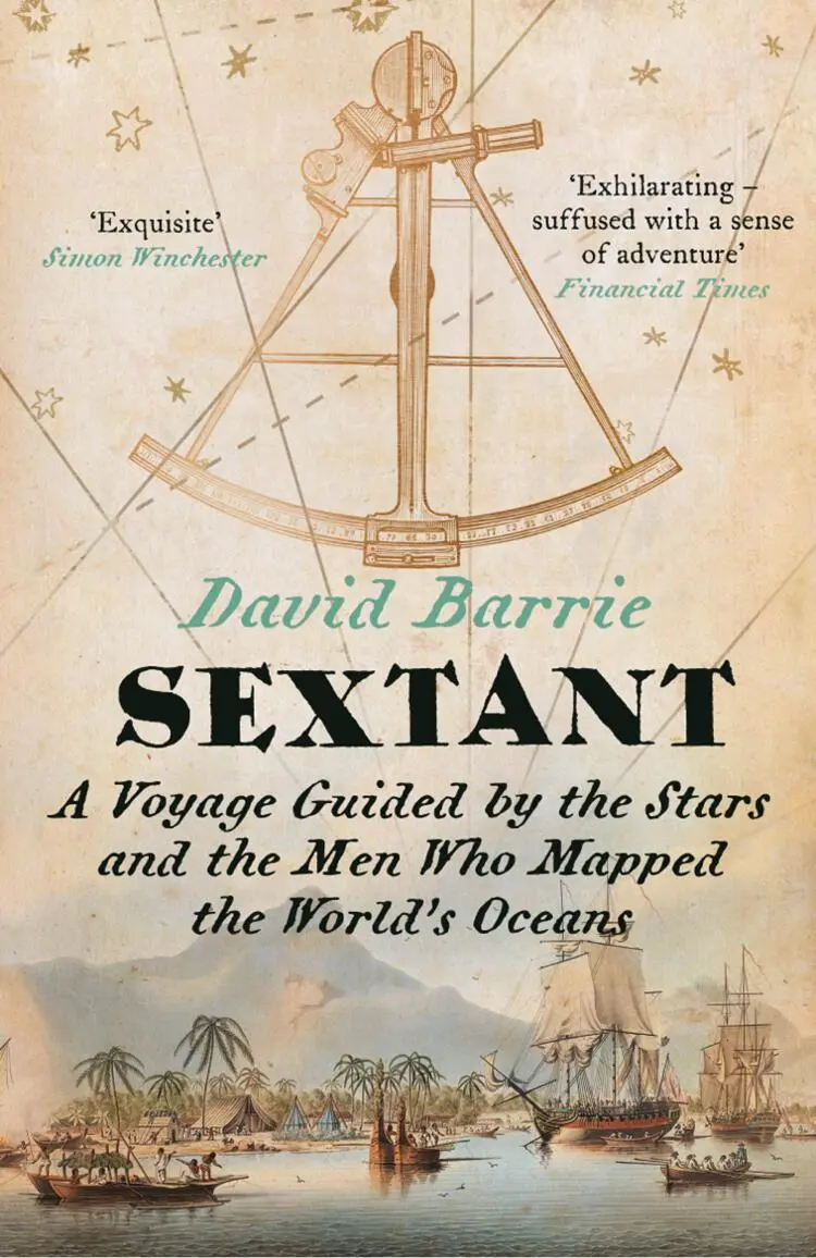
David Barrie - Sextant - A Voyage Guided by the Stars and the Men Who Mapped the World’s Oceans
Здесь есть возможность читать онлайн «David Barrie - Sextant - A Voyage Guided by the Stars and the Men Who Mapped the World’s Oceans» — ознакомительный отрывок электронной книги совершенно бесплатно, а после прочтения отрывка купить полную версию. В некоторых случаях можно слушать аудио, скачать через торрент в формате fb2 и присутствует краткое содержание. Жанр: unrecognised, на английском языке. Описание произведения, (предисловие) а так же отзывы посетителей доступны на портале библиотеки ЛибКат.
- Название:Sextant: A Voyage Guided by the Stars and the Men Who Mapped the World’s Oceans
- Автор:
- Жанр:
- Год:неизвестен
- ISBN:нет данных
- Рейтинг книги:5 / 5. Голосов: 1
-
Избранное:Добавить в избранное
- Отзывы:
-
Ваша оценка:
Sextant: A Voyage Guided by the Stars and the Men Who Mapped the World’s Oceans: краткое содержание, описание и аннотация
Предлагаем к чтению аннотацию, описание, краткое содержание или предисловие (зависит от того, что написал сам автор книги «Sextant: A Voyage Guided by the Stars and the Men Who Mapped the World’s Oceans»). Если вы не нашли необходимую информацию о книге — напишите в комментариях, мы постараемся отыскать её.
Sextant: A Voyage Guided by the Stars and the Men Who Mapped the World’s Oceans — читать онлайн ознакомительный отрывок
Ниже представлен текст книги, разбитый по страницам. Система сохранения места последней прочитанной страницы, позволяет с удобством читать онлайн бесплатно книгу «Sextant: A Voyage Guided by the Stars and the Men Who Mapped the World’s Oceans», без необходимости каждый раз заново искать на чём Вы остановились. Поставьте закладку, и сможете в любой момент перейти на страницу, на которой закончили чтение.
Интервал:
Закладка:
Mendaña himself failed to find the islands he had discovered when he mounted another, completely disastrous transpacific expedition in 1595, accompanied by Pedro Fernández de Quirós as chief pilot. He died in the Santa Cruz Islands – pathetically close to his goal – and Quirós eventually brought the disappointed survivors home to Peru via Manila after ‘incredible hardships and troubles’. 5Later generations of mariners and cartographers, deprived of detailed information about these voyages by the secretive Spanish authorities, struggled to make sense of Mendaña’s claims, and the Solomon Islands shifted giddily about the Pacific, varying in longitude by thousands of miles and even in latitude from 7 degrees to 19 degrees South. In 1768, within the space of a few months, two European mariners – Carteret and Bougainville – passed among the Solomons again, but without even realizing that they were following in Mendaña’s wake. 6They were soon followed by a French trader, Jean de Surville (died 1770), who visited the islands in 1769. Having closely investigated the accounts of these voyagers, and compared them to the descriptions that Mendaña had given, Jean-Nicolas Buache de Neuville (1741–1825) 7understood that the Solomon Islands had at last been rediscovered, though his arguments were not immediately accepted. His fellow countryman La Pérouse was to lose his life in trying to confirm his theory. Rear Admiral Joseph-Antoine Bruny d’Entrecasteaux finally settled the matter when searching for La Pérouse in the 1790s. He recognized many of the islands that Mendaña had described and decently restored to them the Spanish names that had been bestowed on them so long before.
The finding of the Solomon Islands, their subsequent ‘disappearance’ and eventual rediscovery perfectly illustrate the difficulties that confronted transoceanic navigators of the early modern age. It would be easy to multiply examples of this kind, which reveal the intimate, reciprocal dependence of navigation and hydrography – a recurrent theme of this book. The point is a simple one, but easily overlooked. To find the way safely, a mariner needs a chart that accurately records the positions of all that is navigationally significant – from the outlines of the major landmasses to the precise locations of tiny, uninhabited shoals on which a ship could founder. To make such charts, however, the hydrographer must first know the exact positions of everything that is to appear on them. Hydrography serves navigation, but only if nourished first by the fruits of navigation.
Two hundred and fifty years ago it was not just the location of the Solomon Islands that lay in doubt. Though it is hard for us to imagine such a state of affairs, the shapes of whole continents then remained largely unknown, and accurate charts – even of European waters – did not exist. The main reason for this state of ignorance was the imperfection of the art of celestial navigation and in particular the impossibility of determining longitude with any precision on board ship. In 1714 an Act of Parliament was passed in Great Britain designed to encourage the development of a practical shipboard solution to this age-old problem. It was not the first such prize but it turned out to be the last. Within fifty years, and in the space of a single decade, two radically different solutions emerged, one mechanical and the other astronomical (see Chapter 6). The long-running and often ill-informed tussle between the advocates of these two methods has obscured the fact that both depended on a newly developed observational instrument: the sextant. 8Though its praises have seldom been sung, the sextant was to play a crucial part in shaping the modern world – both literally and figuratively.
*
The sextant, like the anchor, is a familiar symbol of the maritime world, but to most people – including many sailors – its purpose is a mystery. One strand of my task is to sketch the developments in astronomy, mathematics and instrument-making that first permitted navigators to fix their position with its help. But I also wish to bring the sextant to life by examining some of the astonishing feats of the explorers who put this ingenious instrument to such good use in making the first accurate charts of the world’s oceans. The work of the pioneering marine surveyors of the late eighteenth and early nineteenth centuries – some of whom are almost forgotten – is another key strand. Because it is such a wide subject I have focused on those who worked in the Pacific, which was then the subject of greatest interest; the examples I have chosen illustrate some of their most remarkable achievements fn1as well as the many challenges they faced. 9I have also squeezed in the stories of three exceptional small-boat voyages, each of which depended crucially on skilful celestial navigation: Captain Bligh’s journey from Tonga to Indonesia after the Bounty mutiny, Joshua Slocum’s circumnavigation of the world in his yacht Spray , and Sir Ernest Shackleton’s remarkable rescue mission crossing the Southern Ocean in the James Caird , piloted by Frank Worsley.
To speak of the ‘discovery’ by European navigators of lands that had long been inhabited by other peoples is obviously absurd, if not insulting, but since the focus of this book is a European invention Europeans unavoidably take centre stage. By way of contrast, I have mentioned briefly the extraordinary skills of the Polynesian navigators, who found their way across the wide expanses of the Pacific using neither instruments nor charts long before the arrival of western explorers. Their achievements deserve to be better known, but they have been well described by others, 10and this is not the place in which to discuss them more fully.
This is not a ‘how to’ guide to celestial navigation, but I hope I have given enough information to enable the reader to grasp its basic principles. I have also tried to give some sense of what it feels like to navigate across an ocean in the old-fashioned way, with sextant and chronometer. Many of the great explorers who wrote about their experiences did so for fellow professionals who needed no explanations, while those who addressed the general public must often have supposed that descriptions of celestial navigation would make dull reading. Anecdotes from Slocum and Worsley have helped me to fill this gap, but I have also drawn on my own – far more modest – experiences, including those recorded in a journal I kept when sailing across the Atlantic as a teenager forty years ago.
For 200 years mastery of the sextant was a vital qualification for every ocean-going navigator. Hundreds of thousands of young men (women seldom had the opportunity) worked hard to learn the theory and practice of celestial navigation, and experts wrote manuals that sold in large numbers to cater for their needs. But the use of the sextant is now an endangered skill that is most commonly learned only to provide a safety net should the now ubiquitous Global Positioning System (GPS) fail. 11Very few practise taking sights at sea as a matter of routine, and most sailors now rely almost entirely on electronic navigation aids. The sextant, if not yet forgotten, has been relegated to a very occasional understudy role. Almost without notice the golden age of celestial navigation has drawn to a close.
If this book has an elegiac tone, it is not merely an exercise in nostalgia. I hope and believe that the sextant has a useful future – that it is not destined to join the many outmoded scientific instruments preserved only in museums. It would, of course, be more than a little eccentric to dismiss the convenience (and reassurance) of electronic guidance systems, but reading off numbers from a digital display is a very thin, prosaic experience compared with the practice of celestial navigation. GPS banishes the need to pay attention to our surroundings, and distances us from the natural world; although it tells us precisely where we are, we learn nothing else from it. Indeed unthinking reliance on GPS weakens our capacity to find our way using our senses. By contrast, the practice of celestial navigation extends our skills and deepens our relationship with the universe around us.
Читать дальшеИнтервал:
Закладка:
Похожие книги на «Sextant: A Voyage Guided by the Stars and the Men Who Mapped the World’s Oceans»
Представляем Вашему вниманию похожие книги на «Sextant: A Voyage Guided by the Stars and the Men Who Mapped the World’s Oceans» списком для выбора. Мы отобрали схожую по названию и смыслу литературу в надежде предоставить читателям больше вариантов отыскать новые, интересные, ещё непрочитанные произведения.


Обсуждение, отзывы о книге «Sextant: A Voyage Guided by the Stars and the Men Who Mapped the World’s Oceans» и просто собственные мнения читателей. Оставьте ваши комментарии, напишите, что Вы думаете о произведении, его смысле или главных героях. Укажите что конкретно понравилось, а что нет, и почему Вы так считаете.