Malcolm Swanston - How to Draw a Map
Здесь есть возможность читать онлайн «Malcolm Swanston - How to Draw a Map» — ознакомительный отрывок электронной книги совершенно бесплатно, а после прочтения отрывка купить полную версию. В некоторых случаях можно слушать аудио, скачать через торрент в формате fb2 и присутствует краткое содержание. Жанр: unrecognised, на английском языке. Описание произведения, (предисловие) а так же отзывы посетителей доступны на портале библиотеки ЛибКат.
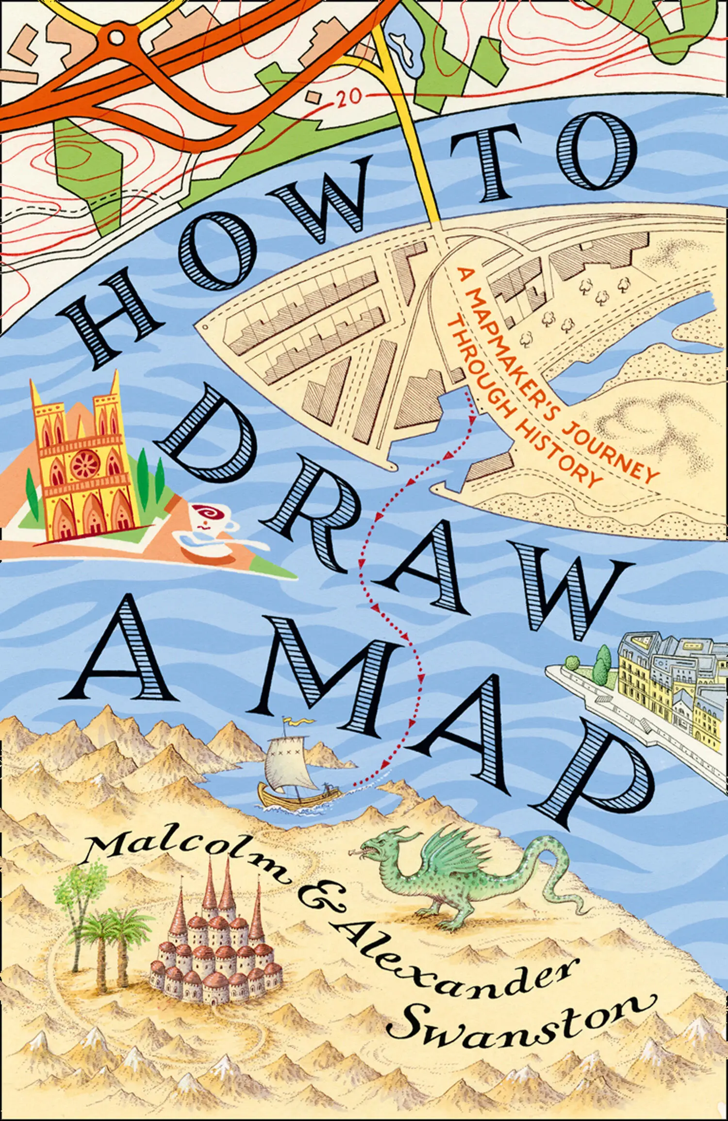
- Название:How to Draw a Map
- Автор:
- Жанр:
- Год:неизвестен
- ISBN:нет данных
- Рейтинг книги:4 / 5. Голосов: 1
-
Избранное:Добавить в избранное
- Отзывы:
-
Ваша оценка:
How to Draw a Map: краткое содержание, описание и аннотация
Предлагаем к чтению аннотацию, описание, краткое содержание или предисловие (зависит от того, что написал сам автор книги «How to Draw a Map»). Если вы не нашли необходимую информацию о книге — напишите в комментариях, мы постараемся отыскать её.
How to Draw a Map — читать онлайн ознакомительный отрывок
Ниже представлен текст книги, разбитый по страницам. Система сохранения места последней прочитанной страницы, позволяет с удобством читать онлайн бесплатно книгу «How to Draw a Map», без необходимости каждый раз заново искать на чём Вы остановились. Поставьте закладку, и сможете в любой момент перейти на страницу, на которой закончили чтение.
Интервал:
Закладка:
Aristarchus of Samos (310–230 BCE) had proposed a theory *that the sun was the centre of the known universe and that the earth revolved around it. He had even suspected that the stars were other suns but much further away. However, it is known that Eratosthenes rejected this idea, as Ptolemy did centuries later.
When the ecliptic was plotted, astronomers also noted that the sun was almost always at an angle to the equator, the imaginary line that divided the celestial sphere of the earth. The sun’s migrations were calculated to go from 24 degrees south to 24 degrees north of the equator, before returning on the same course; this was called the ‘obliquity of the ecliptic’. Now hang in there for a moment …
Though the Greeks spoke of land below the tropics, the consensus of opinion was that people could not live ‘down’ there. However, the development of the idea of the earth as a sphere divided by the equator into hemispheres, with lines of latitude marked by the tropics of Cancer and Capricorn, gave geographers their first three reference lines for the making of maps. The northern tropic was named Cancer, which is when the constellation of the Crab (Cancer) appears in the night sky. Likewise, the southern tropic was named Capricorn after the first appearance of the constellation of Capricorn, the horned goat.
Eratosthenes’ understanding of the cosmos meant that he could now set about measuring the earth. For his calculations, he considered that the sun’s rays would be parallel when they reach earth. Therefore, as the earth was a sphere, the sun’s light must hit different parts at different angles. Now he knew that the sun shone straight down the well at Syene and the town’s buildings cast no shadow when the sun was almost directly above. At the same moment in Alexandria, the buildings cast a shadow. Therefore, he concluded that if he could measure the angle of the shadow on that particular day at high noon, he might just be able to work out the size of the earth.
Eratosthenes understood that Syene was some 5,000 stades (800 kilometres) due south of Alexandria, and thus on the same meridian (a meridian is half of a circle, from pole to pole that crosses the equator at a right angle). If he could determine the distance between the two locations, this would give him the exact length of the arc of the meridian, the part between the two points, and therefore part of the circumference of the earth. This left him with one unknown in his calculation: if the arc between Syene and Alexandria represented 5,000 stades, what fraction of the full circle of the earth did that represent? Eratosthenes used a gnomon to work this out (a vertical pole used to measure time, set in a public place for everyone to use). When the gnomon’s shadow hit the meridian line, the sun was at its zenith. Eratosthenes carefully measured the shadow and the height of the gnomon, which gave him two sides of a triangle. He then drew the third side, and now he could work out the angle of the sun’s rays from the top of the gnomon to the edge of the shadow. This turned out to be 7 degrees 12 minutes, almost one-fiftieth of a complete circle, therefore 50 x 5,000 meant the earth was 250,000 stades in circumference, or about 46,000 kilometres. We now know, of course, that the earth is just over 40,000 kilometres around the equator.
Eratosthenes had come pretty close to the correct answer, based on the tools and geographic knowledge available to him. There were mistakes: the earth is not a perfect sphere; Syene is not exactly on the tropic of Cancer (it is 60 kilometres north) and is not on the same meridian (it is 3 degrees 3 minutes east). However, Eratosthenes had established some of the elementary rules in cartography and, for many mapmakers that would follow, the importance of astronomy in calculating your bearings on earth.
During his lifetime, Eratosthenes’ researches covered many fields – his colleagues nicknamed him ‘Beta’ because he covered so much that he always came second (Beta is the second letter of the Greek alphabet). Perhaps there was a hint of jealousy on their part. Other admirers called him Pentathlos after the Olympian athletes who were all-rounders and capable competitors.
In old age, Eratosthenes contracted ophthalmia and became blind, leaving him no longer able to read the scrolls in the Great Library or to observe nature and the heavens. Frustrated, he chose to starve himself to death, dying in 194 BCE aged 82, probably in his beloved library.
* The Greek Heliocentric Theory.
3 3. The Legacy of Rome 4. The Road to Paradise 5. Visions of a New World 6. Pre-Columbian Voyages in the Atlantic 7. The First Circumnavigation of the World 8. The English World View 9. Mercator Navigates the World 10. Terra Australis (‘South Land’) 11. Enslaved 12. The Cassinis’ Conceptions 13. The Problem with Empires 14. Gone West 15. A World at War 16. The Second Round 17. Cities 18. Another View of Earth Acknowledgements About the Publisher
THE LEGACY OF ROME 3. The Legacy of Rome 4. The Road to Paradise 5. Visions of a New World 6. Pre-Columbian Voyages in the Atlantic 7. The First Circumnavigation of the World 8. The English World View 9. Mercator Navigates the World 10. Terra Australis (‘South Land’) 11. Enslaved 12. The Cassinis’ Conceptions 13. The Problem with Empires 14. Gone West 15. A World at War 16. The Second Round 17. Cities 18. Another View of Earth Acknowledgements About the Publisher
The Greeks had made unparalleled progress in the theories of cosmology and geography. The Romans, however, though heavily influenced by Greek theories, were principally concerned with the practical applications of mapmaking. These were adapted and taken into the service of the Roman state and its empire, whether for planning campaigns or travel, administering trade, establishing new colonies or, if possible, superimposing some sort of standard grid so that Rome’s expanding possessions could be planned and understood as an interconnected whole – and, of course, exploited (or as we now say, taxed). As the Roman author Strabo said:
Political philosophy deals chiefly with the rulers, and if geography supplies the needs of those rulers to govern then geography would seem to have some advantage over political science.
Strabo (64 BCE–24 CE) was born in Amaseia, Asia Minor, to wealthy parents who had been movers and shakers in the administration of King Mithridates VI of Pontus. Strabo was Greek by language and learning, and pro-Roman by political inclination. That was probably the right view for a family wanting to hang on to its wealth, since Pontus had recently fallen into the hands of the Roman Republic. In Strabo’s lifetime, Rome would extend its control in the region. Strabo was educated in Caria in the city of Nysa under the rhetorician Aristodemus, a teacher who also educated the sons of the Roman general who took over Pontus and, perhaps later, may have known or been influenced by the polymath Posidonius (135–31 BCE). He certainly referred to his work in his later description of Gaul and its Celtic inhabitants.
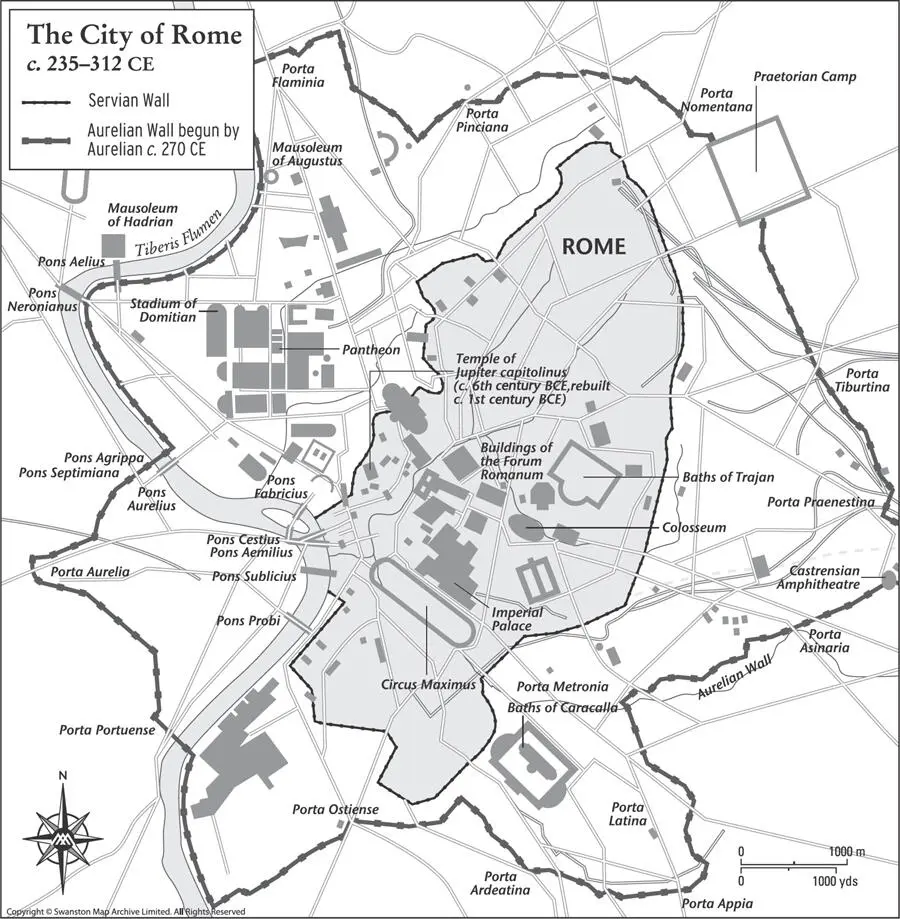
Map 7. The Servian and Aurelian walls were built to protect the city of Rome, which was becoming increasingly vulnerable to attacks from Germanic tribes in the 3rd century CE.
At about 21 years old, Strabo moved to Rome where he continued his studies under the peripatetic Xenarchus. He studied grammar under the famous Tyrannon of Amisus, also in Pontus, a much-respected authority on geography, and a final influential mentor was Athenodorus Canamotes, a philosopher, originally from near Tarsus, who moved to Rome in 44 BCE where he ingratiated himself with the Roman elite. As well as instructing Strabo, he passed on his contacts in the Roman power structure.
Читать дальшеИнтервал:
Закладка:
Похожие книги на «How to Draw a Map»
Представляем Вашему вниманию похожие книги на «How to Draw a Map» списком для выбора. Мы отобрали схожую по названию и смыслу литературу в надежде предоставить читателям больше вариантов отыскать новые, интересные, ещё непрочитанные произведения.


Обсуждение, отзывы о книге «How to Draw a Map» и просто собственные мнения читателей. Оставьте ваши комментарии, напишите, что Вы думаете о произведении, его смысле или главных героях. Укажите что конкретно понравилось, а что нет, и почему Вы так считаете.