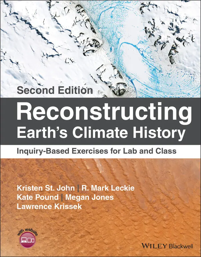
Kristen St. John - Reconstructing Earth's Climate History
Здесь есть возможность читать онлайн «Kristen St. John - Reconstructing Earth's Climate History» — ознакомительный отрывок электронной книги совершенно бесплатно, а после прочтения отрывка купить полную версию. В некоторых случаях можно слушать аудио, скачать через торрент в формате fb2 и присутствует краткое содержание. Жанр: unrecognised, на английском языке. Описание произведения, (предисловие) а так же отзывы посетителей доступны на портале библиотеки ЛибКат.
- Название:Reconstructing Earth's Climate History
- Автор:
- Жанр:
- Год:неизвестен
- ISBN:нет данных
- Рейтинг книги:3 / 5. Голосов: 1
-
Избранное:Добавить в избранное
- Отзывы:
-
Ваша оценка:
Reconstructing Earth's Climate History: краткое содержание, описание и аннотация
Предлагаем к чтению аннотацию, описание, краткое содержание или предисловие (зависит от того, что написал сам автор книги «Reconstructing Earth's Climate History»). Если вы не нашли необходимую информацию о книге — напишите в комментариях, мы постараемся отыскать её.
how we know
what we know
Reconstructing Earth’s Climate History, Second Edition,
Reconstructing Earth's Climate History — читать онлайн ознакомительный отрывок
Ниже представлен текст книги, разбитый по страницам. Система сохранения места последней прочитанной страницы, позволяет с удобством читать онлайн бесплатно книгу «Reconstructing Earth's Climate History», без необходимости каждый раз заново искать на чём Вы остановились. Поставьте закладку, и сможете в любой момент перейти на страницу, на которой закончили чтение.
Интервал:
Закладка:
10 Chapter 10FIGURE 10.1. The Moderate Resolution Imaging Spectroradiometer (MODIS) on NA...FIGURE 10.2. 65 Myr composite recordof benthic foraminiferal stable oxygen ...FIGURE 10.3. Map of the southern Indian Ocean showing sites cored during ODP...FIGURE 10.4. Upper Eocene–lower Oligocene stable isotope dataand ice‐rafted...FIGURE 10.5. Map of all the Ocean Drilling Program (ODP) sites (1985–2003). ...FIGURE 10.6. High‐resolution paleoceanographic records from ODP Site 1218 (8...FIGURE 10.7. Composite digital images of cores taken across the Eocene–Oligo...FIGURE 10.8. Composite digital images of the Eocene–Oligocene transition (in...FIGURE 10.9. Paleogeographic mapof the Tasmanian region at the time of the E...FIGURE 10.10. Summary of the sediment lithogiesfor ODP Leg 189 Sites 1168 t...FIGURE 10.11. Map of the sub‐Antarctic South Atlanticshowing the loca...FIGURE 10.12. Changes in the relative abundance of calcareous microfossils (...FIGURE 10.13. Location of Southern Ocean ODP Sites 689 (Leg 113), 738 (Leg 1...FIGURE 10.14. Relative abundance (%) of nannofossil paleoecological groups (...FIGURE 10.15. Relative abundance (%) of nannofossil paleoecological groups (...FIGURE 10.16. Relative abundance (%) of nannofossil paleoecological groups (...FIGURE 10.17. Global sea level reconstruction( light blue+ black) for the in...FIGURE 10.18. Changes in the relative abundances of select planktic foramini...FIGURE 10.19. Strontium isotopic composition of seawaterfor the past 70 Myr....FIGURE 10.20. This composite figure depicts a simulated initiation of East A...FIGURE 10.21. Antarctica and surrounding continents showing the development ...FIGURE 10.22. Histogram of the number of K‐Ar and 40Ar/39Ar ages from four c...FIGURE 10.23. Cenozoic deep‐sea oxygen isotope data for DSDP sites in the No...FIGURE 10.24. North–South (meridional) profile of the Atlantic Ocean showing...FIGURE 10.25. Conceptual diagram of the global conveyor of ocean circulation...
11 Chapter 11FIGURE 11.1. The ANDRILL drill site on the McMurdo Ice Shelf during the 2006...FIGURE 11.2. View of the Transantarctic Mountains looking north across Caven...FIGURE 11.3. 65 Myr composite record of benthic foraminiferal stable oxygen ...FIGURE 11.4. Map showing distribution of DSDP, ODP, and IODP core locations....FIGURE 11.5. Maps of Antarctica and the Southern Ocean. Extent of sea ice sh...FIGURE 11.6. Map of Antarctica showing location of East Antarctic Ice Sheet ...FIGURE 11.7. Simplified geologic map of McMurdo Sound region showing Ross Is...FIGURE 11.8. Simplified cross section showing transition from a land‐based g...FIGURE 11.9. Portion of geologic map and legend from Geologic Map of Antarct...FIGURE 11.10. Simplified geologic cross‐section of the western Ross Sea regi...FIGURE 11.11. Simplified diagram illustrating some of the systems used to ob...FIGURE 11.12. Geography of McMurdo Sound Region, showing geographic and tect...FIGURE 11.13. Age and characteristics of sediments retrieved from drilling p...FIGURE 11.14. Cross section of the Victoria Land Basin of western Ross Sea r...FIGURE 11.15. General paleoenvironmental settingfor sedimentation along the ...FIGURE 11.16. Cross section showing a conceptual modelfor growth and decay o...FIGURE 11.17. Four core intervals from ANDRILL 1‐B.FIGURE 11.18. Cross section showing part of conceptual model for growth and ...FIGURE 11.19. Example of a sequence motiffrom ANDRILL Core 1‐B, 1053.3 thro...FIGURE 11.20. Core log for ANDRILL 1‐B (ANDRILL “MIS”), from Naish et al. (2...
12 Chapter 12FIGURE 12.1. Pliocene paleogeography of North America (left), and modern geo...FIGURE 12.2. Composite deep‐sea benthic foraminiferal oxygen isotope curve (...FIGURE 12.3. (A) Location map of Lake El'gygytgyn (red star) and other Plioc...FIGURE 12.4. Composite figure showing data for the interval from 2.2–3.6 Ma ...FIGURE 12.5. Geomagnetic polarity time scale and deep‐sea benthic foraminife...FIGURE 12.6. Modernmean annual sea surface temperature (SST).The Western P...FIGURE 12.7. Pliocenereconstruction map (PRISM3) of mean annual sea surface...FIGURE 12.8. Mid‐Pliocene PRISM3 SST anomaly map: these sea surface temperat...FIGURE 12.9. (A) (upper plot): Latitudinal mean annual temperature (MAT) gra...FIGURE 12.10. Map showing how different mean annual temperatures (MATs)were...FIGURE 12.11. Estimates of Plio–Pleistocene atmospheric carbon dioxide conce...FIGURE 12.12. (same asFigure 12.2. ).Composite deep‐sea benthic foraminiferal...FIGURE 12.13. Map of the U.S. East Coast, Gulf Coast, Gulf of Mexico and nor...FIGURE 12.14. Summary diagram showing peak global mean temperature relative ...FIGURE 12.15. Spatial extent of a projected 1‐m (pink) and 6‐m (red) future ...FIGURE 12.16. Population density across the lower 48 states, northern Mexico...FIGURE 12.17. Observed average global sea level since the start of the satel...FIGURE 12.18. This graph shows the average number of days per year on which ...FIGURE 12.19. Map showing the average number of days per year on which coast...FIGURE 12.20. Observed sea level from tide gauges (dark gray) and satellites...FIGURE 12.21. Cumulative coastal populations at risk for a projected 0.9 m s...
13 Chapter 13FIGURE 13.1. The geologic timescale is the common time reference for Earth h...FIGURE 13.2. A simplified depiction of Earth historyhighlighting fundamenta...FIGURE 13.3. Summary diagram of marine animal diversity, sea level change, p...FIGURE 13.4. Global compilation of deep‐sea oxygen and carbon isotope records...FIGURE 13.5. Stratigraphic context of Paleocene–Eocene vertebrate faunal cha...FIGURE 13.6. Stratigraphic ranges of mammalian genera from 294 localitiesar...FIGURE 13.7. Evidence of dwarfing during the PETM (Zone Wa‐0) in several mam...FIGURE 13.8. Teilhardina . (From DiBgd, Creative Commons Attribution‐Share Al...FIGURE 13.9. Correlation of the carbon isotope records of the Paleocene–Eoce...FIGURE 13.10. Paleogeographic map showing a very different distribution of c...FIGURE 13.11. Six successive evolutionary associations of the large Cenozoic...FIGURE 13.12. Modern horse (Equus) meets earliest horse. Sifrhippus sandae , ...FIGURE 13.13. Summary of horse evolution(family Equidae), including phylogen...FIGURE 13.14. Note the dark green shading for mollisol in sod grasslands(wi...FIGURE 13.15. Coevolution of horses and grasses. Note the mollic epipedonin ...FIGURE 13.16. Distribution of the primary sediment types on the seafloor. No...FIGURE 13.17. Global oceanic and terrestrial photoautotroph abundanceas mea...FIGURE 13.18. Annual mean sea surface temperature.FIGURE 13.19. (a) Mean annual sea surface temperature. (b) Mean annual sea s...FIGURE 13.20. Compilation of deep‐sea benthic foraminiferal oxygen isotope d...FIGURE 13.21. (Top) Reconstructions of paleo‐atmospheric CO 2 proxy reco...FIGURE 13.22. Skeletal reconstruction of the basilosaurid Dorudon atrox (Ging...FIGURE 13.23. Generic diversity of Cetacea from the Eocene to the Holocene. ...FIGURE 13.24. Key steps in human evolution. Homininis a general term descri...FIGURE 13.25. A composite picture of global paleoclimatic change and hominin...FIGURE 13.26. Vegetation habitats based on temperature and precipitation....FIGURE 13.27. Comparison of: (a) eccentricity variations (Berger and Loutre ...FIGURE 13.28. Estimate of global human population for the last 10 000 yr bas...FIGURE 13.29. Earth at night.FIGURE 13.30. Contrasting climatic and biotic conditions for five different ...FIGURE 13.31. Colored lines: cumulative percent (%) of vertebrate species re...FIGURE 13.32. Representations of climate stability and change. Climate state...FIGURE 13.33. What path will we take? Stabilized Earth or pushed past a tipp...
Читать дальшеИнтервал:
Закладка:
Похожие книги на «Reconstructing Earth's Climate History»
Представляем Вашему вниманию похожие книги на «Reconstructing Earth's Climate History» списком для выбора. Мы отобрали схожую по названию и смыслу литературу в надежде предоставить читателям больше вариантов отыскать новые, интересные, ещё непрочитанные произведения.


Обсуждение, отзывы о книге «Reconstructing Earth's Climate History» и просто собственные мнения читателей. Оставьте ваши комментарии, напишите, что Вы думаете о произведении, его смысле или главных героях. Укажите что конкретно понравилось, а что нет, и почему Вы так считаете.