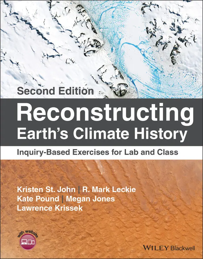
Kristen St. John - Reconstructing Earth's Climate History
Здесь есть возможность читать онлайн «Kristen St. John - Reconstructing Earth's Climate History» — ознакомительный отрывок электронной книги совершенно бесплатно, а после прочтения отрывка купить полную версию. В некоторых случаях можно слушать аудио, скачать через торрент в формате fb2 и присутствует краткое содержание. Жанр: unrecognised, на английском языке. Описание произведения, (предисловие) а так же отзывы посетителей доступны на портале библиотеки ЛибКат.
- Название:Reconstructing Earth's Climate History
- Автор:
- Жанр:
- Год:неизвестен
- ISBN:нет данных
- Рейтинг книги:3 / 5. Голосов: 1
-
Избранное:Добавить в избранное
- Отзывы:
-
Ваша оценка:
Reconstructing Earth's Climate History: краткое содержание, описание и аннотация
Предлагаем к чтению аннотацию, описание, краткое содержание или предисловие (зависит от того, что написал сам автор книги «Reconstructing Earth's Climate History»). Если вы не нашли необходимую информацию о книге — напишите в комментариях, мы постараемся отыскать её.
how we know
what we know
Reconstructing Earth’s Climate History, Second Edition,
Reconstructing Earth's Climate History — читать онлайн ознакомительный отрывок
Ниже представлен текст книги, разбитый по страницам. Система сохранения места последней прочитанной страницы, позволяет с удобством читать онлайн бесплатно книгу «Reconstructing Earth's Climate History», без необходимости каждый раз заново искать на чём Вы остановились. Поставьте закладку, и сможете в любой момент перейти на страницу, на которой закончили чтение.
Интервал:
Закладка:
2 Chapter 2 FIGURE 2.1. Kelsie Dadd (Sedimentologist, Macquarie University, Australia) a... FIGURE 2.2. Physiographic map of the world's oceans, showing bathymetric fea... FIGURE 2.3. Photos of minerals, volcanic glass, and microfossils as seen thr...
3 Chapter 3 FIGURE 3.1. The geologic timescale is the common time reference for Earth hi... FIGURE 3.2. Hypothetical rock sequence displayed as a block diagram. Legend ... FIGURE 3.3. Location of Jokuldalur, Iceland, from Google Earth. FIGURE 3.4. A sketch of the strata at a rock outcrop in Jokuldalur, Iceland.... FIGURE 3.5. The original stratigraphic column(partially shown in Figure 3.4... FIGURE 3.6. Earth's magnetic field during normal and reversed polarity state...FIGURE 3.7. Decay chain for 238U progressing through a series of intermediat...FIGURE 3.8. Growth in activity of 230Th, toward secular equilibriumwith its...FIGURE 3.9. Photographs of the interiors of two speleothems (stalactites, in...FIGURE 3.10. Location of Botuvera´ Cave (27°13´S; 49°09´W) in southeastern B...FIGURE 3.11. A simplified diagram of 230Th/ 234U activity ratio (solid black ...
4 Chapter 4FIGURE 4.1. The Earth's magnetic field (right) protects our planet from much...FIGURE 4.2. Dipole bar magnet with iron filings showing magnetic lines of fo...FIGURE 4.3. World map showing all Deep Sea Drilling Project sites (Legs 1–96...FIGURE 4.4. Two paleomagnetic records from deep‐sea sediments cored in the P...FIGURE 4.5. Earth's magnetic field simulated with a supercomputer model. The...FIGURE 4.6. Cryogenic magnetometer aboard the JOIDES Resolution drillship. T...FIGURE 4.7. Two transects (numbers 21 and 19) of magnetometer datacollected...FIGURE 4.8. Generalized depiction of magnetic anomalies and magnetic “stripe...FIGURE 4.9. Magnetic profiles depicting positive and negative magnetic anoma...FIGURE 4.10. Time scale for geomagnetic reversals. Normal polarity intervalsFIGURE 4.11. Paleomagnetic record preserved in the upper 155 m of Hole 1208A...FIGURE 4.12. Map of magnetic “stripes” on the seafloor south of Iceland. The...FIGURE 4.13. Map of the South Atlantic showing the cruise path and sites dri...FIGURE 4.14. Left: Marine magnetic anomalies of the South Atlantic. Heavy li...FIGURE 4.15. Portion of the geomagnetic polarity timescale used during ODP L...FIGURE 4.16. Paleomagnetic data from ODP Hole 1208A.
5 Chapter 5FIGURE 5.1. Four species of planktic foraminifersfrom the tropical western ...FIGURE 5.2. Calcareous microfossils(calcareous nannofossils and planktic fo...FIGURE 5.3. Generalized abundance and taxonomic diversity(numbers of specie...FIGURE 5.4. Comparison of phytoplankton diversity(numbers of species and ge...FIGURE 5.5. Making a smear slide.FIGURE 5.6. A geoscientist using a transmitted light microscope.FIGURE 5.7. Smear slide of sample 807A‐8H‐5, 51 cm from Ontong Java Plateau ...FIGURE 5.8. Smear slide of sample 807A‐8H‐2 cm from Ontong Java Plateau in t...FIGURE 5.9. Select species of calcareous nannofossilsidentified and illustr...FIGURE 5.10. Location of ODP Site 1208 on Shatsky Rise in the northwest Paci...FIGURE 5.11. Two‐part diagram illustrating how biostratigraphy is applied to...FIGURE 5.12. Biozonesfor planktic forams (N zones) and calcareous nannofossi...FIGURE 5.13. Example of an age–depth plot from ODP Site 846 in the eastern e...FIGURE 5.14. Sites drilled during ODP Leg 165 and location of ODP Site 999 i...FIGURE 5.15. Upper row: Examples of terrestrially derived pollen and spores....FIGURE 5.16. Drawings illustrating how terrestrial pollen and spores are tra...FIGURE 5.17. Generalized bathymetric map of the U.S. continental margin betw...FIGURE 5.18. Relationship between two dinocyst biozonations(onshore Denmark...FIGURE 5.19. Summary of palynomorph results from one of the drillsites of th...
6 Chapter 6FIGURE 6.1. .(a) Volcanic outgassing and lava.(b) Oil refinery, Alaska....FIGURE 6.2. A simplified diagram of the short‐term carbon cycle showing the ...FIGURE 6.3. Anthropogenic (human) and natural radiative forcing factors that...FIGURE 6.4. Compilation of results from temperature sensitivity studies publ...FIGURE 6.5. Atmospheric CO 2concentrations measured at Mauna Loa Observatory...FIGURE 6.6. Atmospheric CO 2concentrations over the last 20 000 yr. Gray sha...FIGURE 6.7. A simplified diagram of the long‐term carbon cycle. Not...FIGURE 6.8. (a) Paleo‐atmospheric CO 2proxy and model data for the Phanerozo...FIGURE 6.9. (a) Paleo‐atmospheric CO 2from proxies (black line) and the GEOC...FIGURE 6.10. IPCC climate model projections of atmospheric CO 2concentration...FIGURE 6.11. Atmospheric CO 2for the past 800 000 yr measured from gases in ...FIGURE 6.12. Average reservoir δ 13C values compiled from Faure (1986), O'Lea...FIGURE 6.13. Atmospheric CO 2(ppm, in blue and red) and δ 13C (per mil, ‰, in...FIGURE 6.14. Benthic foraminiferal marine carbon isotopes (δ 13C) over the pa...
7 Chapter 7FIGURE 7.1. Hydrologic cycle reservoirs. (a) Iceland Vatnajökull ice cap mel...FIGURE 7.2. 125 000 yr record of δ 18O measured in ice cores from two sites o...FIGURE 7.3. 65 Myr composite recordof benthic foraminiferal stable oxygen i...FIGURE 7.4. Two isotopes of oxygen. P indicates the number of protons; N ind...FIGURE 7.5. Schematic diagram showing water movement through time (i.e. Time...FIGURE 7.6. Empirical relationship between modern average annual air tempera...FIGURE 7.7. Generalized map of the δ 18O values of modernprecipitation in No...FIGURE 7.8. A sketch of North America during the late Pleistocene deglaciati...FIGURE 7.9. Comparison of paleotemperature proxies in ice cores from Greenla...FIGURE 7.10. An 800 000 yr record of CO 2(parts per million by volume; ppmv)...FIGURE 7.11. A representative mix of microfossil shells of benthic(bottom t...FIGURE 7.12. Schematic diagram from subtropical to polar latitudes showing w...FIGURE 7.13. Schematic diagrams illustrating the accumulation of benthic and...FIGURE 7.14. Bottom: 65 Myr composite record of deep‐sea benthic foraminifera...
8 Chapter 8FIGURE 8.1. The Earth and Sun.FIGURE 8.2. Hypothetical data displaying cyclicity.FIGURE 8.3. Inferred ancient Antarctic air temperature variations (blue), ca...FIGURE 8.4. Magnetic susceptibility of terrestrial sedimentat two locations...FIGURE 8.5. Abundance of freshwater African diatom Melosira in sediment core...FIGURE 8.6. (a)Locations of the 57 deep‐sea cores used in the Lisiecki and R...FIGURE 8.7. A “stacked” benthic oxygen isotope record constructed by graphic...FIGURE 8.8. Records of the relative abundances of various “palynomorph” micr...FIGURE 8.9. (a)Photo of a Miocene age lacustrine (ancient lake) outcrop of t...FIGURE 8.10. Composite digital core photograph, color reflectance, and bulk ...FIGURE 8.11. Temporal variations of elements enriched in clay‐ and silt‐size...FIGURE 8.12. Bathymetric map of Shatsky Rise and the location of Shatsky Ris...FIGURE 8.13. Representative smear slide images of the light ( Left: 400× magn...FIGURE 8.14. (Left) Zero eccentricity and (right) 0.5 eccentricity, which gr...FIGURE 8.15. Schematic diagram of different tilt angles.FIGURE 8.16. Top: Schematic diagram showing the changing direction of Earth's...FIGURE 8.17. This map shows a reconstruction of the maximum extent of Pleist...FIGURE 8.18. Atmospheric CO 2for the past 800 000 yr measured from gases in ...
9 Chapter 9FIGURE 9.1. Paleocene–Eocene boundary clay marking the PETM in a core collec...FIGURE 9.2. Changes in δ 18O and δ 13C values of planktic foraminifera Acarinin ...FIGURE 9.3. Map of all the Ocean Drilling Program (ODP) sites (1985–2003). N...FIGURE 9.4. Benthic foraminiferal oxygen (lower panel) and carbon (upper pan...FIGURE 9.5. Location of sites drilled on Shatsky Rise during ODP Leg 198. No...FIGURE 9.6. PETM sections on Shatsky Rise. Sites are arranged by increasing...FIGURE 9.7. Hole 1209B was drilled in a water depth of 2387 m on the souther...FIGURE 9.8. Stratigraphic changes in environmental and biotic proxiesthroug...FIGURE 9.9. Map of the central tropical Pacific showing the ODP Leg 199 dril...FIGURE 9.10. Digital images of the Paleocene–Eocene boundary sediments recov...FIGURE 9.11. Comparison of magnetic susceptibility and gamma ray attenuation...FIGURE 9.12. PETM stable isotope data from ODP Site 690near the Weddell Sea...FIGURE 9.13. ODP Leg 208 drill sites on Walvis Ridge. Left: Bathymetric map ...FIGURE 9.14. Digital core photos and weight %CaCO 3across the Paleocene–Eoce...FIGURE 9.15. Bulk sediment carbon isotope recordsacross Walvis Ridge from s...FIGURE 9.16. Composite diagram showing bulk sediment δ 13C and weight %CaCO 3...FIGURE 9.17. Location of two drill sites in New Jersey(Wilson Lake and Bass...FIGURE 9.18. High‐resolution records across the Paleocene–Eocene boundary in...FIGURE 9.19. Paleogeographic reconstruction of the Arctic Basinand Northern...FIGURE 9.20. Core recovery in IODP Hole 302‐4A, and geochemical and palynolo...FIGURE 9.21. Map of the present‐day northern North Atlantic (Greenland–Norwe...FIGURE 9.22. Correlation of continental recordsof well‐dated coal‐bearing t...FIGURE 9.23. Open circles show the locations of Polecat Bench and Cabin Fork...FIGURE 9.24. Carbon isotope records from Cabin Fork (left) and Polecat Bench...FIGURE 9.25. Paleogeographic map showing the distribution of landmasses at t...FIGURE 9.26. A terrestrial record spanning the PETM from the Williston Basin...FIGURE 9.27. Location of ODP Site 690 near the Weddell Sea in the Southern O...FIGURE 9.28. ODP Hole 690B‐Core 19H. The onset of the PETM( CIE= carbon iso...FIGURE 9.29. Geochemical datafor ODP Hole 690B‐Core 19H (167–174 mbsf). From...FIGURE 9.30. X‐ray fluorescence (iron, Fe, and calcium, Ca, counts per secon...FIGURE 9.31. Comparison and correlation of PETM interval at ODP Site 690, We...FIGURE 9.32. Time series data from 1880 to 2020 of annual global average tem...FIGURE 9.33. Global annual anthropogenic carbon emissions and carbon emissio...
Читать дальшеИнтервал:
Закладка:
Похожие книги на «Reconstructing Earth's Climate History»
Представляем Вашему вниманию похожие книги на «Reconstructing Earth's Climate History» списком для выбора. Мы отобрали схожую по названию и смыслу литературу в надежде предоставить читателям больше вариантов отыскать новые, интересные, ещё непрочитанные произведения.


Обсуждение, отзывы о книге «Reconstructing Earth's Climate History» и просто собственные мнения читателей. Оставьте ваши комментарии, напишите, что Вы думаете о произведении, его смысле или главных героях. Укажите что конкретно понравилось, а что нет, и почему Вы так считаете.