Kristen St. John - Reconstructing Earth's Climate History
Здесь есть возможность читать онлайн «Kristen St. John - Reconstructing Earth's Climate History» — ознакомительный отрывок электронной книги совершенно бесплатно, а после прочтения отрывка купить полную версию. В некоторых случаях можно слушать аудио, скачать через торрент в формате fb2 и присутствует краткое содержание. Жанр: unrecognised, на английском языке. Описание произведения, (предисловие) а так же отзывы посетителей доступны на портале библиотеки ЛибКат.
- Название:Reconstructing Earth's Climate History
- Автор:
- Жанр:
- Год:неизвестен
- ISBN:нет данных
- Рейтинг книги:3 / 5. Голосов: 1
-
Избранное:Добавить в избранное
- Отзывы:
-
Ваша оценка:
Reconstructing Earth's Climate History: краткое содержание, описание и аннотация
Предлагаем к чтению аннотацию, описание, краткое содержание или предисловие (зависит от того, что написал сам автор книги «Reconstructing Earth's Climate History»). Если вы не нашли необходимую информацию о книге — напишите в комментариях, мы постараемся отыскать её.
how we know
what we know
Reconstructing Earth’s Climate History, Second Edition,
Reconstructing Earth's Climate History — читать онлайн ознакомительный отрывок
Ниже представлен текст книги, разбитый по страницам. Система сохранения места последней прочитанной страницы, позволяет с удобством читать онлайн бесплатно книгу «Reconstructing Earth's Climate History», без необходимости каждый раз заново искать на чём Вы остановились. Поставьте закладку, и сможете в любой момент перейти на страницу, на которой закончили чтение.
Интервал:
Закладка:
1 Use your library resources and/or the online supplement to read A Record of Climate Change from Owens Lake Sediment by Kirsten Menking. This is a chapter from the 2000 book The Earth Around Us: Maintaining a Livable Planet, edited by Jill Schneiderman.Then use the space on the next page to:Make a visual representation (i.e. a sketch) of the Owens Lake sediment core. Use different patterns or colors to represent the different layers described in the article, with the oldest at the bottom and the youngest at the top.Adjacent to your sketch, list the types of proxy data (e.g. salt layer, pebbles, ash, microfossils,…) obtained from the different intervals of the core.Next to the list of proxies, give an interpretation of the data with respect to past climatic and/or environmental conditions (e.g. dry, cold, volcanic eruption,…).
2 What are three methods used to determine age within the lake core?
3 What evidence is there that part of the Owens Lake record is missing (i.e. that a hiatus exists)?Workspace for Question 1:Sketch of coreType of data analyzedPaleoclimatic/environmenta interpretation of that data
4 What could cause layers of lake sediment to be missing from the record?
5 What evidence would support the hypothesis that humans impacted the environment in and/or around Owens Lake?
6 Use Owens Lake to explain why a multiproxy approach is valuable in reconstructing past climatic and/or environmental change:
References
1 Bender, M., Sowers, T., and Brooke, E. (1997). Gases in ice cores. Proceedings of the National Academy of Sciences of the United States of America 94: 8343–8349.
2 Cronin, T. (1999). Principles of Paleoclimatology, vol. 592. Columbia University Press.
3 Menking, K.M. (2000). A record of climate change from Owens Lake sediment. In: The Earth Around US: Maintaining a Livable Planet (ed. J.S. Schneiderman), 322–335. New York: W.H. Freeman and Company.
4 Ruddiman, W.F. (2008). Earth's Climate Past and Future, 2e, vol. 388. Freeman.
Chapter 2 Seafloor Sediments
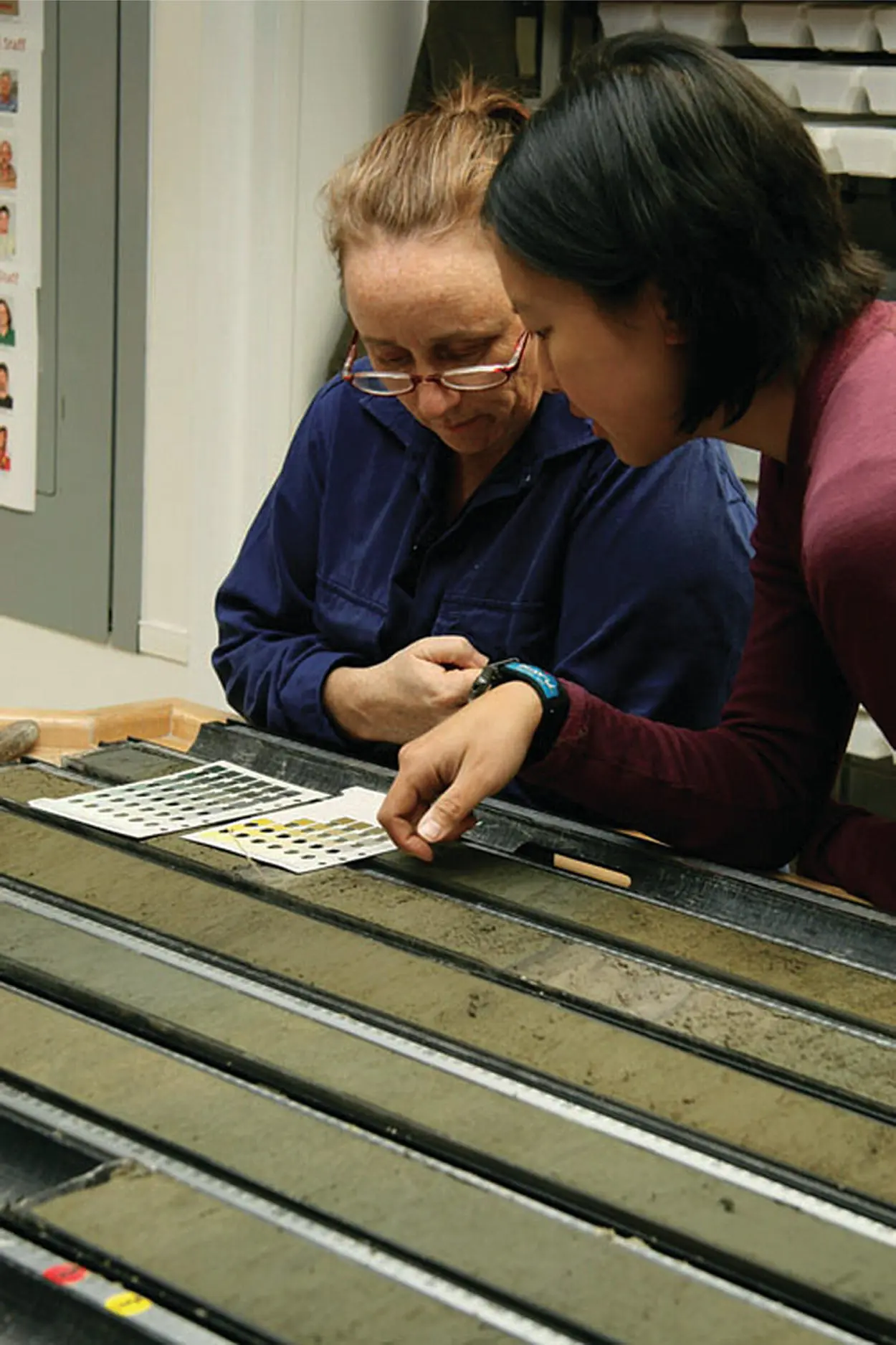
FIGURE 2.1. Kelsie Dadd (Sedimentologist, Macquarie University, Australia) and Mea Cook (Sedimentologist, Williams College, USA) describe the sediment color of a core section from Site U1340 in the Bering Sea.
Photo credit: Carlos Alvarez Zarikian, IODP/TAMU; Photo ID: exp333_083; http://iodp.tamu.edu/scienceops/gallery.html.
SUMMARY
This chapter explores marine sediments using core photos and authentic datasets in an inquiry‐based approach. Your prior knowledge on seafloor sediments is explored in Part 2.1. In Part 2.2, you will observe and describe the physical characteristicsof sediment cores. In Part 2.3, you will use composition and texture datafrom smear slide samples taken from the cores to determine the lithologic namesof the marine sediments. In Part 2.4,you will make a mapshowing the distribution of the primary sediment lithologies of the Pacific and North Atlantic Oceans and develop hypothesesto explain the distribution of the lithologies shown on your map.
Learning Objectives
After completing this chapter, you should be able to:
1 Describe the physical characteristics of sediment cores ( Figure 2.1).
2 Identify major sediment components and their origin.
3 Use composition and texture data from smear slide samples to determine the lithologic names of the marine sediments.
4 Make a map showing the distribution of the primary modern sediment lithologies of the Pacific and North Atlantic Oceans.
5 Explain the distribution of modern marine sediments on your map.
6 Accurately predict what the modern sediment lithologies are at other locations on the seafloor (e.g. in the Indian Ocean).
Part 2.1. Sediment Predictions
1 What kinds of materials do you expect to find on the seafloor?
2 Do you expect any geographic pattern of these materials in the global ocean? Explain your reasoning.
Part 2.2. Core Observation and Description
Introduction
In this exercise, your instructor will assign you one or more cores from Table 2.1 . A corresponding photo of each core can be accessed in the supplemental resources.Note that all of the cores in Table 2.1are either core numbers 1, 2, or 3. This means that these cores are at or close to the top of the sediment sequence on the seafloor. Therefore, the sediment in these cores represents modernor very recent environmental conditions at that location in the ocean. For a review of the nomenclature for core identification, see Chapter 1, Part 2( Figures 1.10and 1.11).
TABLE 2.1. Seafloor cores.
| Core identification: expedition‐site &hole‐core&type 1 | Site location description | Site location (latitude/longitude) | Water depth (m) | References | |
|---|---|---|---|---|---|
| Pacific cores | |||||
| 1 | 112‐687A‐2H | Peru continental shelf | 12.9S/77.0 W | 316 | Suess et al. (1988) |
| 2 | 35‐324‐1 | SE Pacific basin, North of Antarctica | 69S/98.8 W | 4433 | Hollister et al. (1976) |
| 3 | 28‐269‐1 | Ross Sea, South of Australia, margin of Antarctica | 61.7S/140.1E | 4282 | Hayes et al. (1975) |
| 4 | 145‐886B‐2H | Chinook Trough, North Pacific abyssal plain | 44.7 N/168.2 W | 5743 | Rea et al. (1993) |
| 5 | 145‐882A‐2H | Detroit Seamount NW Pacific | 50.36 N/167.6 E | 3243.8 | Rea et al. (1993) |
| 6 | 145‐881A‐1 | NW Pacific, east of the Sea of Okhotsk | 47.1 N/161.5 E | 5531.1 | Rea et al. (1993) |
| 7 | 145‐887C‐2H | Patton‐Murray Seamount, NE Pacific | 54.4 N/148.5 W | 3633.6 | Rea et al. (1993) |
| 8 | 19‐188‐2 | Bering Sea | 53.8 N/178.7 E | 2649 | Creager et al. (1973) |
| 9 | 18‐182‐1 | Alaskan continental slope | 57.9 N/148.7 W | 1419 | Kulm et al. (1973) |
| 10 | 33‐318‐2 | Line Islands Ridge, south central Pacific | 14.8 S/146.9 W | 2641 | Schlanger et al. (1976) |
| 11 | 8‐75‐1 | Marquesas Fracture Zone, central Pacific abyssal plain | 12.5 S/135.3 W | 4181 | Tracey et al. (1971) |
| 12 | 92‐597‐1 | SE Pacific abyssal plain | 18.8 S/129.8 W | 4166 | Leinen et al. (1986) |
| 13 | 178‐1101A‐2H | Antarctic Peninsula continental rise | 64.4 S/70.3 W | 3279.7 | Barker et al. (1999) |
| 14 | 178‐1096A‐1H | Antarctic Peninsula continental rise | 67.57 S/77.0 W | 3152 | Barker et al. (1999) |
| 15 | 178‐1097A‐3R | Antarctic Peninsula shelf | 66.4 S/70.75 W | 551.7 | Barker et al. (1999) |
| 16 | 29‐278‐3 | South of New Zealand | 56.6 S/160.1 E | 3675 | Kennett et al. (1974) |
| 17 | 202‐1236A‐2H | Nazca Ridge, SE Pacific | 21.4 S/81.44 W | 1323.7 | Mix et al. (2003) |
| 18 | 8‐70‐1 | Central equatorial Pacific | 6.3 N/140.4 W | 5059 | Tracey et al. (1971) |
| 19 | 138‐844B‐1 | Eastern equatorial Pacific | 7.9 N/90.5 W | 3425 | Mayer et al. (1992) |
| 20 | 136‐842A‐1H | South of Hawaii | 19.3 N/159.1 W | 4430.2 | Dziewonski et al. (1992) |
| 21 | 198‐1209A‐2H | Shatsky Rise, NW Pacific | 32.7 N/158.5 E | 2387.2 | Bralower et al. (2002) |
| 22 | 199‐1215A‐2H | NE of Hawaii, North Pacific abyssal plain | 26.0 N/147.9 W | 5395.6 | Lyle et al. (2002) |
| 23 | 86‐576‐2 | West of Midway Island, North Pacific abyssal plain | 32.4 N/164.3 E | 6217 | Heath et al. (1985) |
| 24 | 195‐1201B‐2H | Philippine Sea | 19.3 N/135.1 E | 5710.2 | Salisbury et al. (2002) |
| 25 | 130‐807A‐2H | Ontong Java Plateau, western equatorial Pacific | 3.6 N/156.6 E | 2803.8 | Kroenke et al. (1991) |
| 26 | 181‐1125A‐2H | Chatham Rise, east of New Zealand | 42.6 S/178.2 W | 1364.6 | Carter et al. (1999) |
| 27 | 169‐1037A‐1H | Escanaba Trough, west of Oregon and N. California | 41.0 N/127.5 W | 3302.3 | Fouquet et al. (1998) |
| 28 | 146‐888B‐2H | Cascadia margin, west of Vancouver, BC | 48.2 N/126.7 W | 2516.3 | Westbrook et al. (1994) |
| 29 | 167‐1010E‐1H | West of Baja California | 30.0 N/118.1 W | 3464.7 | Lyle et al. (1997) |
| 30 | 17‐166‐2 | Western equatorial Pacific | 3.7 N/175.1 W | 4962 | Winterer et al. (1973) |
| 31 | 127‐795A‐2H | Japan Sea | 44.0 N/139.0 E | 3300.2 | Tamaki et al. (1990) |
| 32 | 28‐274‐2 | North of Ross Ice Shelf, Antarctica | 69.0 S/173.4 E | 3305 | Hayes et al. (1975) |
| North Atlantic Cores | |||||
| 33 | 37‐333‐2 | Western flank of Mid‐Atlantic Ridge | 36.8 N/33.7 W | 1666 | Aumento et al. (1977) |
| 34 | 82‐558‐3 | Western flank of Mid‐Atlantic Ridge | 33.8 N/37.3 W | 3754 | Bougault et al. (1985) |
| 35 | 172‐1063A‐2H | Northeast Bermuda Rise | 33.7 N/57.6 W | 4583.5 | Keigwin et al. (1998) |
| 36 | 105‐646A‐2H | Labrador Sea, south of Greenland | 58.2 N/48.4 W | 3440.3 | Srivastava et al. (1987) |
| 37 | 162‐980A‐2H | Rockall Bank, west of Ireland | 55.5 N/14.7 W | 2172.2 | Jansen et al. (1996) |
| 38 | 152‐919A‐2H | SE Greenland, continental rise | 62.7 N/37.5 W | 2088.2 | Larsen et al. (1994) |
| 39 | 174‐1073‐1H | New Jersey continental shelf | 39.2 N/72.3 W | 639.4 | Austin et al. (1998) |
| 40 | 14‐137‐3H | Madeira abyssal plain | 25.9 N/27.1 W | 5361 | Hayes et al. (1972) |
1The letter indicating the type of drilling (e.g. A for advanced piston coring) is not always included in the core identification (Column 1 of Table 2.1). This is because early on in the drilling program, there was only one type of coring (rotary), and thus no special notation was needed. Core identification in Table 2.1will match the core identification on the related core photos, which are accessible in the online supplemental materials.
Читать дальшеИнтервал:
Закладка:
Похожие книги на «Reconstructing Earth's Climate History»
Представляем Вашему вниманию похожие книги на «Reconstructing Earth's Climate History» списком для выбора. Мы отобрали схожую по названию и смыслу литературу в надежде предоставить читателям больше вариантов отыскать новые, интересные, ещё непрочитанные произведения.


Обсуждение, отзывы о книге «Reconstructing Earth's Climate History» и просто собственные мнения читателей. Оставьте ваши комментарии, напишите, что Вы думаете о произведении, его смысле или главных героях. Укажите что конкретно понравилось, а что нет, и почему Вы так считаете.