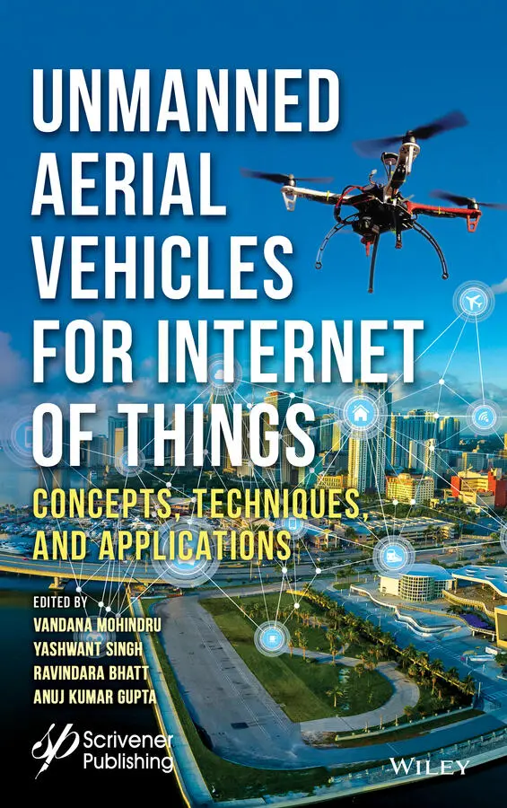
Unmanned Aerial Vehicles for Internet of Things (IoT)
Здесь есть возможность читать онлайн «Unmanned Aerial Vehicles for Internet of Things (IoT)» — ознакомительный отрывок электронной книги совершенно бесплатно, а после прочтения отрывка купить полную версию. В некоторых случаях можно слушать аудио, скачать через торрент в формате fb2 и присутствует краткое содержание. Жанр: unrecognised, на английском языке. Описание произведения, (предисловие) а так же отзывы посетителей доступны на портале библиотеки ЛибКат.
- Название:Unmanned Aerial Vehicles for Internet of Things (IoT)
- Автор:
- Жанр:
- Год:неизвестен
- ISBN:нет данных
- Рейтинг книги:4 / 5. Голосов: 1
-
Избранное:Добавить в избранное
- Отзывы:
-
Ваша оценка:
Unmanned Aerial Vehicles for Internet of Things (IoT): краткое содержание, описание и аннотация
Предлагаем к чтению аннотацию, описание, краткое содержание или предисловие (зависит от того, что написал сам автор книги «Unmanned Aerial Vehicles for Internet of Things (IoT)»). Если вы не нашли необходимую информацию о книге — напишите в комментариях, мы постараемся отыскать её.
The book covers cover such subjects as:
Efficient energy management systems in UAV based IoT networks IoE enabled UAVs Mind-controlled UAV using Brain-Computer Interface (BCI) The importance of AI in realizing autonomous and intelligent flying IoT Blockchain-based solutions for various security issues in UAV-enabled IoT The challenges and threats of UAVs such as hijacking, privacy, cyber-security, and physical safety.
Unmanned Aerial Vehicles for Internet of Things (IoT) — читать онлайн ознакомительный отрывок
Ниже представлен текст книги, разбитый по страницам. Система сохранения места последней прочитанной страницы, позволяет с удобством читать онлайн бесплатно книгу «Unmanned Aerial Vehicles for Internet of Things (IoT)», без необходимости каждый раз заново искать на чём Вы остановились. Поставьте закладку, и сможете в любой момент перейти на страницу, на которой закончили чтение.
Интервал:
Закладка:
In closing, we would like to thank our contributing authors for their valuable work, without which it would have been impossible to complete this book. We would also like to express our deepest appreciation to our reviewers for submitting their valuable comments in a timely manner. Last but not least, we thank GOD for giving us the strength and wisdom to carry out this work successfully even during tough circumstances due to the COVID-19 pandemic.
We hope that the quality research work published in the 15 chapters of this book will serve the needs of those in the academic, research, science and technology communities along with all of humanity.
Dr. Vandana MohindruAssistant Professor, Chandigarh Group of Colleges, Mohali, Punjab, India Dr. Yashwant SinghAssociate Professor & Head, Department of Computer Science and IT, Central University of Jammu, J&K, India Dr. Ravindara BhattAssistant Professor (Senior Grade), Jaypee University of Information Technology, Solan, H.P., India Dr. Anuj Kumar GuptaProfessor, Chandigarh Group of Colleges, Mohali, Punjab, India
1
Unmanned Aerial Vehicle (UAV): A Comprehensive Survey
Rohit Chaurasia and Vandana Mohindru*
Department of Computer Science & Engineering, Chandigarh Group of Colleges, Mohali, India
Abstract
Research on Unmanned Aircraft Vehicle (UAV) or unmanned aircraft system (UAS) are increasingly becoming popular in recent times and are widely used for various commercial purposes like photogrammetry, surveying, remote sensing for mapping, rescuing as well as for military purposes and so on. This chapter presents a wider explanation of UAV in terms of working, communication, various types along with various technologies, starting from the various platforms of different types of drones to various categories, its working, types, sizes, and various other technologies employed in making of it. The communication aspect of a UAV is critical from both security and safety points of view and it is discussed in a separate section thoroughly. UAVs have tremendous applications in various fields and therefore their recent advancement has also raised concern for their misuse in a certain activity. Still, UAVs have a lot of limitations to overcome to properly meet the demand of the market in the 21st century. It also discusses the latest on-going technology used in drones and their recent advancement that will likely be the wave of the future.
Keywords :UAV types, radio communication, tactical & strategic drones, military drones, photogrammetry, UAV application, mapping
1.1 Introduction
An Unmanned Aerial Vehicle or UAV (also known as a drone) is an aircraft without a human pilot on-board and can be piloted remotely or can fly autonomously with predefined paths [1]. UAV is a component of an unmanned aircraft system (UAS) which further includes a remote control station and a system of communication between the two. UAV is a term mostly referenced to be used in military use cases while in civil it is “drone”. A drone is a general term used to refer to the UAVs [2].
UAVs are becoming increasingly famous because of their numerous good applications in various fields and scopes. E.g. Disaster monitoring, assessment and management, aerial mapping, Asset Inspection & Videography, Mapping & Surveying, Aerial Photography, Real estate photography [3], Crop spraying & monitoring, Agriculture, Payload carrying, different applications requiring Multispectral/thermal/NIR cameras, Mining, Search and Rescue, Disaster-zone mapping, Live-streaming events, Marine Rescue, Forensics, Disaster Relief, Emergency Response, Monitoring Poachers, Roof inspections, Firefighting, Product Delivery, Meteorology, Aviation, etc. and with further advancement in technology UAV can survive extreme weather condition which makes them a perfect fit for it [4, 16].
1.2 Related Work
According to the research, it is found that UAVs have powerful applications in both civil as well as in the military. With their mobility, low-cost, safety & reliability, now UAVs can replace a manned-aerial vehicle in similar tasks as well as outperform them in many curriculums. However, several usage challenges have to be overcome first and one of these challenges is the avoidance of collision with the other objects. For proper use and advancement, UAVs must have the feature of avoiding collision with both static and moving obstacles. It is quite similar to that of mobile robots & air traffics. UAVs have unique characteristics that make them considerable and interesting research ground. Vision-based UAV navigation is a slight modification of this because UAVs are unable to perceive their surrounding environment clearly and therefore they act accordingly due to limitations in the perception ability of their sensors and in communication [5]. A considerable amount of work is done to improve this weakness. However, a still effective and systematic method is needed to be developed. Hence, high-performance robust autonomous navigation is of immense importance.
Apart from this, there is also one significant aspect of drone and i.e. photogrammetry and mapping which is the concept of acquiring imagery for any useful purpose, it can be for disaster research and management, automatic forest fire monitoring, detection & fighting, mapping the terrain or for any commercial purpose. Due to such a wide variety of applications, it not only becomes the most engaging but also a vital area of research and development. In this case, UAV photogrammetry & mapping proves a much viable and economical option than traditional methods like satellite imagery [6]. The main contribution of our work is to give a brief overview and introduction of various terms, techniques, latest technologies, and their implementation in modern UAVs through a holistic approach.
1.3 UAV Technology
1.3.1 UAV Platforms
Given the great diversity of UAVs, there are varying numbers of UAV platforms and they can be classified broadly in terms of their sizes, design, usage, how high, and how long a UAV can fly. Nevertheless, the most basic categorization is determined by the weight of the drone. Here are some classifications done on various features.
Classification based on the weight of UA (Unmanned Aircraft) as follows [16]:
• Micro: Less than two kilograms (<2 kg).
• Mini: Greater than 2 kg and less than 20 kg.
• Small: Greater than 20 kg and less than 150 kg.
• Large: Greater than 150 kg.
Classification based on the aerial platform according to which there are four types of drones [7, 8]:
1. Fixed-wing drones
2. Multirotor drones
3. Single-rotor helicopter
4. Fixed-wing hybrid VTOL (Vertical Take-Off & Landing).
1.3.1.1 Fixed-Wing Drones
Fixed-wing type of drone is the type of drone that uses a ‘wing’ like the normal airplanes out there. They never use their energy to stay afloat rather they cruise in the air. They move forward as remotely controlled by a human or they could be made autonomous through guided GPS coordinates. Most fixed-wing drones have a couple of hours of average flying time as shown in Figure 1.1. Liquid fuel or gas-powered drones have high endurance and can fly up to 10 h or longer [9]. Fixed-wing is ideal for long-distance operations such as surveillance or mapping owing to their flight time and fuel efficiency. Still, they can be handy when aerial-photography involves loitering over a particular area for a longer duration of time. Also, there are some other downsides which include the higher cost and skill required for flying. It is not easy to put this type of drone in the air. One either needs a ‘runway’ or a catapult for the launch and the same goes for the landing you either need a runway or a parachute or a net to land them back in the ground safely.
Читать дальшеИнтервал:
Закладка:
Похожие книги на «Unmanned Aerial Vehicles for Internet of Things (IoT)»
Представляем Вашему вниманию похожие книги на «Unmanned Aerial Vehicles for Internet of Things (IoT)» списком для выбора. Мы отобрали схожую по названию и смыслу литературу в надежде предоставить читателям больше вариантов отыскать новые, интересные, ещё непрочитанные произведения.


Обсуждение, отзывы о книге «Unmanned Aerial Vehicles for Internet of Things (IoT)» и просто собственные мнения читателей. Оставьте ваши комментарии, напишите, что Вы думаете о произведении, его смысле или главных героях. Укажите что конкретно понравилось, а что нет, и почему Вы так считаете.