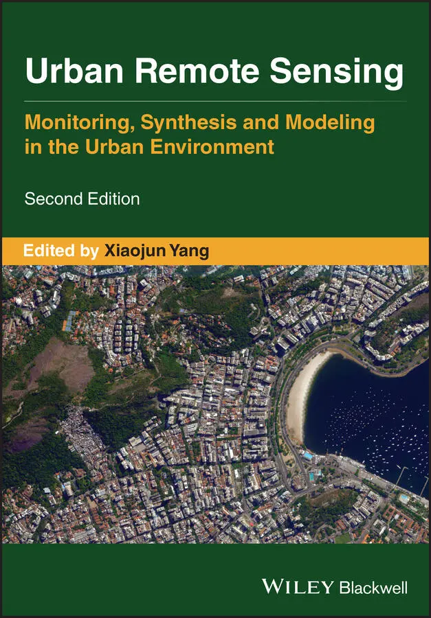
Urban Remote Sensing
Здесь есть возможность читать онлайн «Urban Remote Sensing» — ознакомительный отрывок электронной книги совершенно бесплатно, а после прочтения отрывка купить полную версию. В некоторых случаях можно слушать аудио, скачать через торрент в формате fb2 и присутствует краткое содержание. Жанр: unrecognised, на английском языке. Описание произведения, (предисловие) а так же отзывы посетителей доступны на портале библиотеки ЛибКат.
- Название:Urban Remote Sensing
- Автор:
- Жанр:
- Год:неизвестен
- ISBN:нет данных
- Рейтинг книги:4 / 5. Голосов: 1
-
Избранное:Добавить в избранное
- Отзывы:
-
Ваша оценка:
Urban Remote Sensing: краткое содержание, описание и аннотация
Предлагаем к чтению аннотацию, описание, краткое содержание или предисловие (зависит от того, что написал сам автор книги «Urban Remote Sensing»). Если вы не нашли необходимую информацию о книге — напишите в комментариях, мы постараемся отыскать её.
is a state-of-the-art review of the latest progress in the subject. The text examines how evolving innovations in remote sensing allow to deliver the critical information on cities in a timely and cost-effective way to support various urban management activities and the scientific research on urban morphology, socio-environmental dynamics, and sustainability.
Chapters are written by leading scholars from a variety of disciplines including remote sensing, GIS, geography, urban planning, environmental science, and sustainability science, with case studies predominately drawn from North America and Europe.
A review of the essential and emerging research areas in urban remote sensing including sensors, techniques, and applications, especially some critical issues that are shifting the directions in urban remote sensing research. Illustrated in full color throughout, including numerous relevant case studies and extensive discussions of important concepts and cutting-edge technologies to enable clearer understanding for non-technical audiences.
will be of particular interest to upper-division undergraduate and graduate students, researchers and professionals working in the fields of remote sensing, geospatial information, and urban & environmental planning.
Urban Remote Sensing — читать онлайн ознакомительный отрывок
Ниже представлен текст книги, разбитый по страницам. Система сохранения места последней прочитанной страницы, позволяет с удобством читать онлайн бесплатно книгу «Urban Remote Sensing», без необходимости каждый раз заново искать на чём Вы остановились. Поставьте закладку, и сможете в любой момент перейти на страницу, на которой закончили чтение.
Интервал:
Закладка:
29 Li, X., Zhang, C., Li, W., Ricard, R., Meng, Q. and Zhang, W., 2015b. Assessing street‐level urban greenery using Google Street View and a modified green view index. Urban Forestry and Urban Greening, 14(3): 675–685.
30 Li, X., Zhou, Y., Asrar, G.R., Mao, J., Li, X. and Li, W., 2017. Response of vegetation phenology to urbanization in the conterminous United States. Global Change Biology, 23(7): 2818–2830.
31 Liu, X., Hu, G., Chen, Y., Li, X., Xu, X., Li, S., Pei, F. and Wang, S., 2018. High‐resolution multi‐temporal mapping of global urban land using Landsat images based on the Google Earth Engine Platform. Remote Sensing of Environment, 209: 227–239.
32 Maggiori, E., Tarabalka, Y., Charpiat, G. and Alliez, P., 2017. Convolutional neural networks for large‐scale remote‐sensing image classification. IEEE Transactions on Geoscience and Remote Sensing, 55(2): 645–657.
33 Meng, X., Currit, N., Wang, L. and Yang, X., 2012. Detect residential buildings from LIDAR and aerial photographs through object‐oriented land‐use classification. Photogrammetric Engineering & Remote Sensing, 78(1): 35–44.
34 Mennis, J., Mason, M. and Ambrus, A., 2018. Urban greenspace is associated with reduced psychological stress among adolescents: a Geographic Ecological Momentary Assessment (GEMA) analysis of activity space. Landscape and Urban Planning, 174: 1–9.
35 Netzband, M., Stefanov, W. L. and Redman, C. L. (eds.) 2007. Applied Remote Sensing for Urban Planning, Governance and Sustainability. Springer, 220p.
36 Norton, B.A., Coutts, A.M., Livesley, S.J., Harris, R.J., Hunter, A.M. and Williams, N.S., 2015. Planning for cooler cities: a framework to prioritise green infrastructure to mitigate high temperatures in urban landscapes. Landscape and Urban Planning, 134: 127–138.
37 Patel, N.N., Angiuli, E., Gamba, P., Gaughan, A., Lisini, G., Stevens, F.R., Tatem, A.J. and Trianni, G., 2015. Multitemporal settlement and population mapping from Landsat using Google Earth Engine. International Journal of Applied Earth Observation and Geoinformation, 35: 199–208.
38 Patidar, N. and Keshari, A.K., 2018. A multi‐model ensemble approach for quantifying sub‐pixel land cover fractions in the urban environments. International Journal of Remote Sensing, 39 (12): 3939–3962.
39 Schneider, A., 2012. Monitoring land cover change in urban and peri‐urban areas using dense time stacks of Landsat satellite data and a data mining approach. Remote Sensing of Environment, 124: 689–704.
40 Seiferling, I., Naik, N., Ratti, C. and Proulx, R., 2017. Green streets ‐ quantifying and mapping urban trees with street‐level imagery and computer vision. Landscape and Urban Planning, 165: 93–101.
41 Seto, K.C., Sánchez‐Rodríguez, R. and Fragkias, M., 2010. The new geography of contemporary urbanization and the environment. Annual Review of Environment and Resources, 35: 167–194.
42 Seto, K.C., Reenberg, A., Boone, C.G., Fragkias, M., Haase, D., Langanke, T., Marcotullio, P., Munroe, D.K., Olah, B. and Simon, D., 2012. Urban land teleconnections and sustainability. Proceedings of the National Academy of Sciences, 109 (20): 7687–7692.
43 Seto, K.C., Golden, J.S., Alberti, M. and Turner, B.L., 2017. Sustainability in an urbanizing planet. Proceedings of the National Academy of Sciences, 114 (34): 8935–8938.
44 Sharma, A., Liu, X., Yang, X. and Shi, D., 2017. A patch‐based convolutional neural network for remote sensing image classification. Neural Networks, 95: 19–28.
45 Sharma, A., Liu, X. and Yang, X., 2018. Land cover classification from multi‐temporal, multi‐spectral remotely sensed imagery using patch‐based recurrent neural networks. Neural Networks, 105: 346–355.
46 Shen, H., Lin, Y., Tian, Q., Xu, K. and Jiao, J., 2018. A comparison of multiple classifier combinations using different voting‐weights for remote sensing image classification. International Journal of Remote Sensing, 39 (11): 3705–3722.
47 Shi, D. and Yang, X., 2017. Mapping vegetation and land cover in a large urban area using a multiple classifier system. International Journal of Remote Sensing, 38 (16): 4700–4721.
48 Smits, P.C., 2002. Multiple classifier systems for supervised remote sensing image classification based on dynamic classifier selection. IEEE Transactions on Geoscience and Remote Sensing, 40(4): 801–813.
49 Soille, P., Burger, A., De Marchi, D., Kempeneers, P., Rodriguez, D., Syrris, V. and Vasilev, V., 2018. A versatile data‐intensive computing platform for information retrieval from big geospatial data. Future Generation Computer Systems, 81: 30–40.
50 Stokes, E.C. and Seto, K.C., 2019. Characterizing urban infrastructural transitions for the Sustainable Development Goals using multi‐temporal land, population, and nighttime light data. Remote Sensing of Environment, 234: 111430.
51 Wang, Q. and Atkinson, P.M., 2018. Spatio‐temporal fusion for daily Sentinel‐2 images. Remote Sensing of Environment, 204: 31–42.
52 Wang, J., Huang, B., Fu, D., Atkinson, P.M. and Zhang, X., 2016. Response of urban heat island to future urban expansion over the Beijing–Tianjin–Hebei metropolitan area. Applied Geography, 70: 26–36.
53 Weng, Q. and Quattrochi, D. (eds.) 2007. Urban Remote Sensing. CRC Press, 412p.
54 Weng Q., Quattrochi, D. and Gamba, P. (eds.) 2018. Urban Remote Sensing (2nd). CRC Press, 315p.
55 Wulder, M.A., Loveland, T.R., Roy, D.P., Crawford, C.J., Masek, J.G., Woodcock, C.E., Allen, R.G., Anderson, M.C., Belward, A.S., Cohen, W.B. and Dwyer, J., 2019. Current status of Landsat program, science, and applications. Remote Sensing of Environment, 225: 127–147.
56 Yang, X., 2011. What is urban remote sensing? In: Yang, X. (ed.) Urban Remote Sensing: Monitoring, Synthesis and Modelling in the Urban Environment, Wiley‐Blackwell, pp. 3–12.
57 Zhang, F. and Yang, X., 2020. Improving land cover classification in an urbanized coastal area by random forests: the role of variable selection. Remote Sensing of Environment, 251: 112105. DOI: org/10.1016/j.rse.2020.112105.
58 Zhu, Z., 2017. Change detection using Landsat time series: a review of frequencies, preprocessing, algorithms, and applications. ISPRS Journal of Photogrammetry and Remote Sensing, 130: 370–384.
59 Zhu, Z., Zhou, Y., Seto, K.C., Stokes, E.C., Deng, C., Pickett, S.T. and Taubenböck, H., 2019. Understanding an urbanizing planet: strategic directions for remote sensing. Remote Sensing of Environment, 228: 164–182.
60 Zipper, S.C., Schatz, J., Singh, A., Kucharik, C.J., Townsend, P.A. and Loheide II, S.P., 2016. Urban heat island impacts on plant phenology: intra‐urban variability and response to land cover. Environmental Research Letters, 11(5): 054023.
PART II
Sensors and Systems for Urban Areas
Part II ( Chapters 2– 7) discusses several advanced and emerging platforms or systems, such as unmanned aircraft systems (UAS) and social sensing, which offer new opportunities advancing urban studies. It begins with Chapter 2discussing an effort to examine urban built‐up volume through three‐dimensional analyses with lidar and radar data. The authors used spaceborne radar data to monitor built‐up volume that was further validated with lidar data. Chapter 3discusses the opportunities and challenges of UAS for urban studies. UAS platforms represent a new frontiers of remote sensing applications. The remaining chapters ( Chapters 4– 7) in Part II focus on big geotagged‐data from mobile phones, social media, vehicle trajectories, and street views, which provide new opportunities for understanding human behaviors and characteristics of cities. Chapter 4reviews various analytical methods, such as temporal signature analysis, text analysis, and image analysis, for social sensing research. Chapter 5reviews the utilities of ground‐based street view images for urban remote sensing research. Chapter 6discusses the usefulness of social media outlets such as Twitter for geographic research on human activities in urban areas. Finally, Chapter 7discusses the potential of integrating remote sensor data with location‐based social media data to examine socioeconomic dynamics.
Читать дальшеИнтервал:
Закладка:
Похожие книги на «Urban Remote Sensing»
Представляем Вашему вниманию похожие книги на «Urban Remote Sensing» списком для выбора. Мы отобрали схожую по названию и смыслу литературу в надежде предоставить читателям больше вариантов отыскать новые, интересные, ещё непрочитанные произведения.


Обсуждение, отзывы о книге «Urban Remote Sensing» и просто собственные мнения читателей. Оставьте ваши комментарии, напишите, что Вы думаете о произведении, его смысле или главных героях. Укажите что конкретно понравилось, а что нет, и почему Вы так считаете.