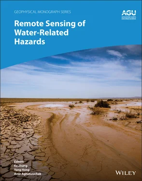
Remote Sensing of Water-Related Hazards
Здесь есть возможность читать онлайн «Remote Sensing of Water-Related Hazards» — ознакомительный отрывок электронной книги совершенно бесплатно, а после прочтения отрывка купить полную версию. В некоторых случаях можно слушать аудио, скачать через торрент в формате fb2 и присутствует краткое содержание. Жанр: unrecognised, на английском языке. Описание произведения, (предисловие) а так же отзывы посетителей доступны на портале библиотеки ЛибКат.
- Название:Remote Sensing of Water-Related Hazards
- Автор:
- Жанр:
- Год:неизвестен
- ISBN:нет данных
- Рейтинг книги:5 / 5. Голосов: 1
-
Избранное:Добавить в избранное
- Отзывы:
-
Ваша оценка:
- 100
- 1
- 2
- 3
- 4
- 5
Remote Sensing of Water-Related Hazards: краткое содержание, описание и аннотация
Предлагаем к чтению аннотацию, описание, краткое содержание или предисловие (зависит от того, что написал сам автор книги «Remote Sensing of Water-Related Hazards»). Если вы не нашли необходимую информацию о книге — напишите в комментариях, мы постараемся отыскать её.
Remote Sensing of Water-Related Hazards Remote Sensing of Water-Related Hazards
The American Geophysical Union promotes discovery in Earth and space science for the benefit of humanity. Its publications disseminate scientific knowledge and provide resources for researchers, students, and professionals.
Remote Sensing of Water-Related Hazards — читать онлайн ознакомительный отрывок
Ниже представлен текст книги, разбитый по страницам. Система сохранения места последней прочитанной страницы, позволяет с удобством читать онлайн бесплатно книгу «Remote Sensing of Water-Related Hazards», без необходимости каждый раз заново искать на чём Вы остановились. Поставьте закладку, и сможете в любой момент перейти на страницу, на которой закончили чтение.
Интервал:
Закладка:
Table of Contents
1 Cover
2 Series Page
3 Title Page Remote Sensing of Water‐Related Hazards Geophysical Monograph 271 Ke Zhang Yang Hong Amir AghaKouchak Editors This Work is a co‐publication of the American Geophysical Union and John Wiley and Sons, Inc.
Geophysical Monograph 271
4 Copyright Page
5 LIST OF CONTRIBUTORS
6 PREFACE
7 1 Interdisciplinary Perspectives on Remote Sensing for Monitoring and Predicting Water‐Related Hazards 1.1. BACKGROUND 1.2. ADVANCES IN REMOTE SENSING TECHNOLOGIES 1.3. OBJECTIVES AND ORGANIZATION OF THE BOOK REFERENCES
8 Part I: Remote Sensing of Precipitation and Storms 2 Progress in Satellite Precipitation Products over the Past Two Decades 2.1. INTRODUCTION 2.2. STUDY AREA AND DATASETS 2.3. METHODOLOGY 2.4. RESULTS 2.5. SUMMARY AND CONCLUSION ACKNOWLEDGMENTS REFERENCES 3 Observations of Tornadoes and Their Parent Supercells Using Ground‐Based, Mobile Doppler Radars 3.1. INTRODUCTION: THE MOTIVATION FOR GROUND‐BASED, MOBILE DOPPLER RADARS 3.2. A HISTORY OF GROUND‐BASED, MOBILE DOPPLER RADARS AND ANALYSIS TECHNIQUES 3.3. OBSERVATIONS OF THE STRUCTURE OF TORNADOES AND THEIR PARENT STORMS 3.4. OBSERVATIONS OF TORNADOGENESIS AND TORNADO EVOLUTION 3.5. FUTURE RADAR DEVELOPMENT AND OTHER RADAR‐RELATED ACTIVITIES ACKNOWLEDGMENTS REFERENCES
9 Part II: Remote Sensing of Precipitation and Storms 4 Remote Sensing Mapping and Modeling for Flood Hazards in Data‐Scarce Areas 4.1. INTRODUCTION 4.2. METHODOLOGY 4.3. STUDY AREA AND DATA 4.4. RESULTS AND DISCUSSION 4.5. CONCLUSION REFERENCES 5 Multisensor Remote Sensing and the Multidimensional Modeling of Extreme Flood Events 5.1. INTRODUCTION 5.2. THE DETECTABILITY OF REMOTE SENSING TECHNOLOGY OVER THE EXTREME EVENT 5.3. INTEGRATION OF REMOTE SENSING AND CREST FOR HURRICANE HARVEY FLOOD SIMULATION 5.4. CONCLUSION AND FUTURE OUTLOOK REFERENCES 6 A Multisource, Data‐Driven, Web‐GIS‐Based Hydrological Modeling Framework for Flood Forecasting and Prevention 6.1. INTRODUCTION 6.2. MATERIALS AND METHODS 6.3. EVALUATIONS AND RESULTS 6.4. DISCUSSION 6.5. CONCLUSION ACKNOWLEDGMENTS REFERENCES 7 An Ensemble‐Based, Remote‐Sensing‐Driven, Flood‐Landslide Early Warning System 7.1. INTRODUCTION 7.2. METHODOLOGY 7.3. STUDY AREA 7.4. RESULTS 7.5. CONCLUSIONS AND SUMMARY REFERENCES 8 Detection of Hazard‐Damaged Bridges Using Multitemporal High‐Resolution SAR Imagery 8.1. INTRODUCTION 8.2. BACKSCATTERING MODEL OF BRIDGES OVER WATER 8.3. THE STUDY AREA AND IMAGE DATA 8.4. METHODOLOGY FOR DAMAGE ASSESSMENT OF BRIDGES 8.5. RESULTS AND DISCUSSIONS 8.6. CONCLUSIONS ACKNOWLEDGMENTS REFERENCES
10 Part III: Remote Sensing of Precipitation and Storms 9 Drought Monitoring Based on Remote Sensing 9.1. INTRODUCTION 9.2. PROGRESS IN RS‐BASED DROUGHT MONITORING 9.3. CASE STUDY 9.4. CONCLUSIONS AND OUTLOOK REFERENCES 10 Remote Sensing of Vegetation Responses to Drought Disturbances Using Spaceborne Optical and Near‐Infrared Sensors 10.1. INTRODUCTION 10.2. DROUGHTS AND THEIR ECOPHYSIOLOGICAL IMPACTS ON ECOSYSTEMS 10.3. REMOTE SENSING OF VEGETATION RESPONSES TO DROUGHTS 10.4. CASE STUDY IN YUNNAN PROVINCE, CHINA 10.5. SUMMARY AND CONCLUSIONS REFERENCES 11 Recent Advances in Physical Water Scarcity Assessment Using GRACE Satellite Data 11.1. INTRODUCTION 11.2. MATERIAL AND METHODS 11.3. RESULTS AND DISCUSSION 11.4. SUMMARY AND CONCLUSION ACKNOWLEDGMENTS REFERENCES 12 Study of Water Cycle Variation in the Yellow River Basin Based on Satellite Remote Sensing and Numerical Modeling 12.1. INTRODUCTION 12.2. STUDY AREA 12.3. METHODS 12.4. RESULTS 12.5. SUMMARY ACKNOWLEDGMENTS REFERENCES 13 Assessing the Impact of Climate Change‐Induced Droughts on Soil Salinity Development in Agricultural Areas Using Ground and Satellite Sensors 13.1. INTRODUCTION 13.2. GROUND AND SATELLITE SENSOR APPROACHES FOR MEASSURING/MAPPING SOIL SALINITY 13.3. IMPACTS AND IMPLICATIONS OF CLIMATE CHANGE ON SOIL SALINITY DEVELOPMENT: WESTSIDE SAN JOAQUIN VALLEY CASE STUDY ACKNOWLEDGMENTS REFERENCES
11 Index
12 End User License Agreement
List of Tables
1 Chapter 2 Table 2.1 Summary of satellite and reanalysis precipitation data sets used ...
2 Chapter 4Table 4.1 Summary of data sets and their sources used in this study.Table 4.2 Summary of the model‐simulated and satellite‐detected inundation ...Table 4.3 Potential flooded areas with different water depths for three flo...
3 Chapter 5Table 5.1 Summary of characteristics of the precipitation products in this ...Table 5.2 Summary of the statistical evaluations of county‐averaged and gri...Table 5.3 Four extreme precipitation events collected in Texas. The Bill, C...Table 5.4 Summary of hydrological simulation of Spring Creek.
4 Chapter 6Table 6.1 Parameters of lumped CREST model.Table 6.2 Parameters of HyMOD model.Table 6.3 Pseudocode and description of database queries.
5 Chapter 7Table 7.1 Models’ performance.
6 Chapter 8Table 8.1 Crustal movements observed at the four stations located in the st...Table 8.2 Details of the nine severely damaged or collapsed bridges in the ...Table 8.3 The obtained difference ( d ) and correlation coefficient ( r ) value...Table 8.4 Error matrix for all the target bridges using the threshold value...
7 Chapter 9Table 9.1 SPI‐based drought severity categories.
8 Chapter 11Table 11.1 Thresholds/indicator for WSI.Table 11.2 Summary of major water stress/scarcity indicators. Most of the i...Table 11.3 Sources and information about the utilized data sets.Table 11.4 WSI and PAW indices for 48 African countries using Falkenmark’s ...
9 Chapter 12Table 12.1 Main abbreviations used in this chapter.Table 12.2 Evaluation of the reconstructed ET over the YRB (unit: cm/year)....Table 12.3 Elasticities of naturalized streamflow in seven sub‐basins of th...Table 12.4 Summary of modeling approaches for the effects of vegetation cha...
10 Chapter 13Table 13.1 Apparent soil electrical conductivity (EC a) protocols for mappin...
List of Illustrations
1 Chapter 1 Figure 1.1 Structure and organization of this book.
2 Chapter 2 Figure 2.1 (a) Spatial distributions rain gauges in China and (b) DEM and th... Figure 2.2 Topographical map and locations of flash flood events from 2011 t... Figure 2.3 Spatial distributions of KGE' on the daily scale from 2000 to 201... Figure 2.4 Boxplots of five metrics at the daily scale from 2000 to 2018 bas... Figure 2.5 Taylor diagrams on the daily scale from 2000 to 2018 for differen... Figure 2.6 Performance diagrams on the daily scale from 2000 to 2018 for dif... Figure 2.7 Spatial distributions of snowfall from 2000 to 2018 for (a–d) CGD... Figure 2.8 CC and RMSE of CGDPA, ERA5, MERRA2, and IMERG according to the tr... Figure 2.9 Snowfall trends of CGDPA, ERA‐Interim, MERRA2, and IMERG from 200... Figure 2.10 The performance of the flash floods captured by the three produc... Figure 2.11 Percentage of flash floods caught by CMA, IMERG‐E, and IMERG‐F, ...
3 Chapter 3 Figure 3.1 Doppler spectra from the LANL portable CW Doppler radar. (a)–(c) ... Figure 3.2 A weak‐echo hole (WEH) and spiral reflectivity bands in a tornado... Figure 3.3 Example of a debris ball (ellipse) (a) and polarimetric debris si... Figure 3.4 Example of debris signatures in a large cyclonic tornado (c) and ... Figure 3.5 Variation with distance from the center of a tornado, near its ma... Figure 3.6 Superposition of GBVTD‐derived wind field (yellow vectors), with ...Figure 3.7 Examples of mobile Doppler radar data showing secondary vortices ...Figure 3.8 A satellite tornado rotating cyclonically around a larger, strong...Figure 3.9 Vertical cross‐sections through tornadoes showing a WEH extending...Figure 3.10 Quasi‐horizontal cross‐sections of horizontally polarized radar .
Читать дальшеИнтервал:
Закладка:
Похожие книги на «Remote Sensing of Water-Related Hazards»
Представляем Вашему вниманию похожие книги на «Remote Sensing of Water-Related Hazards» списком для выбора. Мы отобрали схожую по названию и смыслу литературу в надежде предоставить читателям больше вариантов отыскать новые, интересные, ещё непрочитанные произведения.
Обсуждение, отзывы о книге «Remote Sensing of Water-Related Hazards» и просто собственные мнения читателей. Оставьте ваши комментарии, напишите, что Вы думаете о произведении, его смысле или главных героях. Укажите что конкретно понравилось, а что нет, и почему Вы так считаете.
