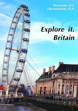
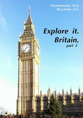
Н. Овсянникова - Explore it. Britain
Здесь есть возможность читать онлайн «Н. Овсянникова - Explore it. Britain» — ознакомительный отрывок электронной книги совершенно бесплатно, а после прочтения отрывка купить полную версию. В некоторых случаях можно слушать аудио, скачать через торрент в формате fb2 и присутствует краткое содержание. ISBN: , Жанр: foreign_language, Языкознание, на английском языке. Описание произведения, (предисловие) а так же отзывы посетителей доступны на портале библиотеки ЛибКат.
- Название:Explore it. Britain
- Автор:
- Жанр:
- Год:неизвестен
- ISBN:9785447496661
- Рейтинг книги:4 / 5. Голосов: 1
-
Избранное:Добавить в избранное
- Отзывы:
-
Ваша оценка:
- 80
- 1
- 2
- 3
- 4
- 5
Explore it. Britain: краткое содержание, описание и аннотация
Предлагаем к чтению аннотацию, описание, краткое содержание или предисловие (зависит от того, что написал сам автор книги «Explore it. Britain»). Если вы не нашли необходимую информацию о книге — напишите в комментариях, мы постараемся отыскать её.
Explore it. Britain — читать онлайн ознакомительный отрывок
Ниже представлен текст книги, разбитый по страницам. Система сохранения места последней прочитанной страницы, позволяет с удобством читать онлайн бесплатно книгу «Explore it. Britain», без необходимости каждый раз заново искать на чём Вы остановились. Поставьте закладку, и сможете в любой момент перейти на страницу, на которой закончили чтение.
Интервал:
Закладка:
Explore it. Britain
Н. А. Овсянникова
Д. С. Ведунова
© Н. А. Овсянникова, 2016
© Д. С. Ведунова, 2016
© Роман Алексеевич Голобоков, cover design, 2016
Created with intellectual publishing system Ridero
Geographical location and characteristics of the country
Features of the geographical location and the United Kingdom, located in the British Isles in the north-western coast of continental Europe, traditionally called (by the name of the largest island), the United Kingdom, and the name of its main part of England. Officially it is called the United Kingdom of Great Britain and Northern Ireland. In fact the UK has three historical and geographical areas: England, Wales and Scotland. The structure of the United Kingdom also includes Northern Ireland, which occupies the north-eastern part of the island of Ireland. This is the fourth region of the country. British Isles is the most extensive archipelago in Europe. It consists of two large islands – Great Britain and Ireland, separated by the Irish Sea, and another 5 thousand small islands, among which highlights the three island groups in the North: Hebrides, Orkney, Shetland and the Isle of Man, England and others. The UK is an archipelago of an irregular shape with a very diverse landscape and nature. The last one is due to the fact that the British Isles were once part of Europe, but were cut off from the mainland after the flooding of low-lying land, and now is the bottom of the North Sea and the English Channel. Northern Ireland, which is politically complements the United Kingdom, located on the second largest island of Ireland, and is the western extension of the Scottish mountains. These mountain areas are separated by a narrow channel of the North. The western coast of the island of Great Britain is rocky and steep, east is more gentle. The area of the UK is about 240842 km 2Most of it is the land, and the rest are rivers and lakes. England area is 129,634 km 2, Wales is 20637 km 2, Scotland is 77179 km 2and Northern Ireland is 13438 km 2. Thus, England is bigger than the other countries of the United Kingdom, and has the largest population. These factors explain the dominance of England in British history. The southern end of the island of Great Britain is Cornwall peninsula – is at 50° NL (North latitude), and the most northern part of the archipelago of Shetland Islands are at 60° N.L. The length of the island of Great Britain from the north to south is 966 km. The British archipelago which is located on the Continental Shelf, is separated by the shallow North Sea from Sweden, Norway, Denmark and Germany and by the narrow English Channel (the British call it the English Channel) and Pas-de-Calais from France. Historically, the UK geographic features have influenced human settlement, migration, armed conquest and political union. They also identified the location and operation of industry, transport systems, agriculture, fishing industry, forests, energy and communications. Today, they continue to determine the life of the British, and in addition, they are closely related to public concern about the environment and wildlife. England (population – 48.2 million people) consists mainly of hilly or flat lowland areas with several mountain zones in the north and south-east. But the low hills stretch across most of the country, interspersed with low-lying lands and plains. The population is concentrated mainly around the city of London and even in the south-east of England, west of Birmingham, Leeds, Bradford and Sheffield, north-western industrial Liverpool and Manchester and the north-east of Newcastle and Sunderland. Wales (population – 2.9 million people) is a mountainous country with a territory stretching across the mountains and hills, often terminates in the deep valleys by riverbeds. These mountains gradually decrease and become the highest hills in the east of England. The highest mountains of Wales, located in the north-west, where Mount Snowdon reaches 1085 m. Lowland lands are limited by narrow coastal zones and river valleys in South Wales, where two-thirds of the Welsh population live. In the past, the Welsh mountain terrain hampered the war, agriculture and human settlement. Scotland (population – 5.1 million people) can be divided into three main parts. The first part is the north-western and central mountains with a lot of islands in the western and northern coasts. These lands are densely populated, and account for half of the whole territory of Scotland. The second part is the central low-lying lands, which make up one-fifth of all the Scottish territory, and three-quarters of the population of Scotland, most of the industrial and commercial centers and arable land. The third part is the southern hills, which include a range of hills stretching to the border with England. The highest mountain in Scotland is Ben Nevis (1342 m), which is also the highest mountain of Great Britain. Northern Ireland (population – 1.6 million people) is separated by only 21 kilometers from the Scottish coast, that was the reason for the migration of peoples in the distant past. Since the partition of Ireland in 1921 to the south and west, it borders with the Republic of Ireland. To the north there is a mountainous coast, in the center, close to the south there is fertile valley, and there are the mountains to the west, north-east and south-east.
Questions on the basis of the material studied:
1. What is the total population of the UK?
2. What is the full official name of the UK?
England
England is the most major historical and administrative part of the United Kingdom of Great Britain and Northern Ireland. England’s population is 84% of the total UK population. The capital of England is London, the largest city in the UK and the European Union. England is the place of origin of the English language and the Church of England, and English law forms the basis of the legal systems of many countries. In addition, London was the center of the British Empire, and the country was the birthplace of the Industrial Revolution. Britain was the first industrialized country in the world, and a country with parliamentary democracy, constitutional, governmental and legal innovations that have been adopted by other nations and countries. The Kingdom of England, including the Principality of Wales, was a separate state until 1 May 1707, when united with Scotland in the United Kingdom. England received its name in honor of the Angles, Germanic tribe settled in Britain in the V and VI centuries BC. Some historians believe that this tribe was descended from immigrants who lived on the Angeln peninsula, part of the Jutland peninsula, which is today part of northern Germany. The first mention of England was in the work entitled “Germany”, written in 98 BC. by Roman historian Tacitus. According to the Oxford English Dictionary, the earliest known mention of the term “England” in relation to the southern part of the island of Great Britain refers to the year 897.
England occupies two thirds of the island of Great Britain. It has borders with Scotland and Wales. The landscape of England consists mainly of gentle hills to the north where it becomes more mountainous. Mining and flat land conditionally divided by a line drawn between the mouth of the River Tees (Teesside) to the north-east and the mouth of the river Ex (Devon) in the southwest. To the east there is a low-lying marshland, which was mainly drained for agricultural use.
The six largest cities of England: London, Birmingham, Leeds, Sheffield, Liverpool and Manchester.
The territory of modern England at the time of the invasion of Julius Caesar 55 BC., as a century later, at the time of capture of the Emperor Claudius, it was inhabited by Celtic tribes, called the Britons. As a result, capturing the entire southern part of the island (modern England and Wales) became part of the Roman Empire until its collapse in the V century BC.
Читать дальшеИнтервал:
Закладка:
Похожие книги на «Explore it. Britain»
Представляем Вашему вниманию похожие книги на «Explore it. Britain» списком для выбора. Мы отобрали схожую по названию и смыслу литературу в надежде предоставить читателям больше вариантов отыскать новые, интересные, ещё непрочитанные произведения.
Обсуждение, отзывы о книге «Explore it. Britain» и просто собственные мнения читателей. Оставьте ваши комментарии, напишите, что Вы думаете о произведении, его смысле или главных героях. Укажите что конкретно понравилось, а что нет, и почему Вы так считаете.
