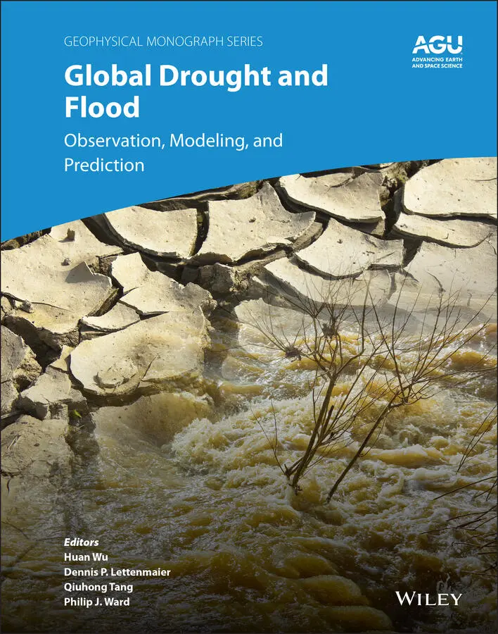
Global Drought and Flood
Здесь есть возможность читать онлайн «Global Drought and Flood» — ознакомительный отрывок электронной книги совершенно бесплатно, а после прочтения отрывка купить полную версию. В некоторых случаях можно слушать аудио, скачать через торрент в формате fb2 и присутствует краткое содержание. Жанр: unrecognised, на английском языке. Описание произведения, (предисловие) а так же отзывы посетителей доступны на портале библиотеки ЛибКат.
- Название:Global Drought and Flood
- Автор:
- Жанр:
- Год:неизвестен
- ISBN:нет данных
- Рейтинг книги:5 / 5. Голосов: 1
-
Избранное:Добавить в избранное
- Отзывы:
-
Ваша оценка:
Global Drought and Flood: краткое содержание, описание и аннотация
Предлагаем к чтению аннотацию, описание, краткое содержание или предисловие (зависит от того, что написал сам автор книги «Global Drought and Flood»). Если вы не нашли необходимую информацию о книге — напишите в комментариях, мы постараемся отыскать её.
Global Drought and Flood: Observation, Modeling, and Prediction Volume highlights include:
Remote sensing approaches for mapping droughts and floods Physical and statistical models for monitoring and forecasting hydrologic hazards Features of various drought and flood systems and products Use by governments, humanitarian, and development stakeholders in recent disaster cases Improving the collaboration between hazard information provision and end users The American Geophysical Union promotes discovery in Earth and space science for the benefit of humanity. Its publications disseminate scientific knowledge and provide resources for researchers, students, and professionals.
Global Drought and Flood — читать онлайн ознакомительный отрывок
Ниже представлен текст книги, разбитый по страницам. Система сохранения места последней прочитанной страницы, позволяет с удобством читать онлайн бесплатно книгу «Global Drought and Flood», без необходимости каждый раз заново искать на чём Вы остановились. Поставьте закладку, и сможете в любой момент перейти на страницу, на которой закончили чтение.
Интервал:
Закладка:
219 Watkins, M.M., Wiese, D.N., Yuan, D., Boening, C., & Landerer, F.W. (2015). Improved methods for observing Earth’s time variable mass distribution with GRACE using spherical cap mascons. Journal of Geophysical Research: Solid Earth, 120(4), 2648–2671.
220 Whitcraft, A.K., Becker‐Reshef, I., & Justice, C.O. (2015). A framework for defining spatially explicit earth observation requirements for a global agricultural monitoring initiative (GEOGLAM). Remote Sensing, 7(2), 1461–1481.
221 Wilhite, D.A., & Buchanan‐Smith, M. (2005). Drought as hazard: understanding the natural and social context. In D.A. Wilhite (Ed.), Drought and water crises: Science, technology, and management issues (pp. 3–29). Boca Raton, FL: CRC Press.
222 Wilhite, D.A., & Glantz, M.H. (1985). Understanding: the drought phenomenon: the role of definitions. Water international, 10(3), 111–120.
223 Williams, A.P., Seager, R., Abatzoglou, J.T., Cook, B.I., Smerdon, J.E., & Cook, E.R. (2015). Contribution of anthropogenic warming to California drought during 2012–2014. Geophysical Research Letters, 42(16), 6819–6828.
224 WMO, 1975. Drought and agriculture (WMO Technical Note 138). Geneva: World Meteorological Organization.
225 WMO, 2006. Systematic observation requirements for satellite‐based products for climate: Supplemental details to the satellite‐based component of the implementation plan for the global observing system for climate in support of the UNFCCC (WMO/TD‐ No. 1338; GCOS‐ No. 107). Geneva: World meteorological Organization.
226 WMO, 2009. Inter‐regional workshop on indices and early warning systems for drought (8–11 December). Lincoln, Nebraska: World Meteorological Organization.
227 Wolff, D.B., & Fisher, B.L. (2008). Comparisons of instantaneous TRMM ground validation and satellite rain‐rate estimates at different spatial scales. Journal of Applied Meteorology and Climatology, 47(8), 2215–2237.
228 Xie, P., & Arkin, P.A. (1997). Global precipitation: A 17‐year monthly analysis based on gauge observations, satellite estimates, and numerical model outputs. Bulletin of the American Meteorological Society, 78(11), 2539–2558.
229 Xu, H., Bailey, J.O., Barrett, E.C., & Kelly, R.E.J. (1993). Monitoring snow area and depth with integration of remote sensing and GIS. International Journal of Remote Sensing, 14(17), 3259–3268.
230 Xu, R., Tian, F., Yang, L., Hu, H., Lu, H., & Hou, A. (2017). Ground validation of GPM IMERG and TRMM 3B42V7 rainfall products over southern Tibetan Plateau based on a high‐density rain gauge network. Journal of Geophysical Research: Atmospheres, 122(2), 910–924.
231 Yang, Y., & Shang, S. (2013). A hybrid dual‐source scheme and trapezoid framework‐based evapotranspiration model (HTEM) using satellite images: Algorithm and model test. Journal of Geophysical Research: Atmospheres, 118(5), 2284–2300.
232 Yao, Y., Liang, S., Qin, Q., & Wang, K. (2010). Monitoring drought over the conterminous United States using MODIS and NCEP Reanalysis‐2 data. Journal of Applied Meteorology and Climatology, 49(8), 1665–1680.
233 Zacharias, S., Bogena, H., Samaniego, L., Mauder, M., Fuß, R., Pütz, T., et al. (2011). A network of terrestrial environmental observatories in Germany. Vadose Zone Journal, 10(3), 955–973.
234 Zaitchik, B.F., Rodell, M., & Reichle, R.H. (2008). Assimilation of GRACE terrestrial water storage data into a land surface model: Results for the Mississippi River basin. Journal of Hydrometeorology, 9(3), 535–548.
235 Zampieri, M., D’Andrea, F., Vautard, R., Ciais, P., de Noblet‐Ducoudré, N., & Yiou, P. (2009). Hot European summers and the role of soil moisture in the propagation of Mediterranean drought. Journal of Climate, 22(18), 4747–4758.
236 Zamuda, C., Mignone, B., Bilello, D., Hallett, K. C., Lee, C., Macknick, J., et al. (2013). US energy sector vulnerabilities to climate change and extreme weather. Washington, DC: U.S. Department of Energy.
237 Zhang, A., & Jia, G. (2013). Monitoring meteorological drought in semiarid regions using multi‐sensor microwave remote sensing data. Remote Sensing of Environment, 134, 12–23. https://doi.org/10.1016/j.rse.2013.02.023
238 Zhang, X., Chen, N., Li, J., Chen, Z., & Niyogi, D. (2017). Multi‐sensor integrated framework and index for agricultural drought monitoring. Remote Sensing of Environment, 188, 141–163. https://doi.org/10.1016/j.rse.2016.10.045
239 Zreda, M., Shuttleworth, W.J., Zeng, X., Zweck, C., Desilets, D., Franz, T., & Rosolem, R. (2012). COSMOS: The cosmic‐ray soil moisture observing system. Hydrology and Earth System Sciences, 16(11), 4079–4099.
2 Remote Sensing of Evapotranspiration for Global Drought Monitoring
Xiwu Zhan1, Li Fang1,2, Jifu Yin1,2, Mitchell Schull1,2, Jicheng Liu1,2, Christopher Hain3, Martha Anderson4, William Kustas4, and Satya Kalluri5
1 NOAA NESDIS Center for Satellite Applications and Research, College Park, Maryland, USA
2 UMD‐CISESS Cooperative Institute for Satellite Earth System Studies, College Park, Maryland, USA
3 NASA Marshall Space Flight Center, Huntsville, Alabama, USA
4 Agricultural Research Service, United States Department of Agriculture, Beltsville, Maryland, USA
5 Raytheon, Upper Marlboro, Maryland, USA
ABSTRACT
Evapotranspiration (ET) is one of the main components of the hydrological or water cycle. The latent heat from evapotranspiration is also one of the most important components of the energy cycle because it is the largest energy source for the atmosphere and thus is significant for weather and climate formation. Local scale evapotranspiration is mostly observed with ground instruments such as a lysimeter, Bowen ratio, or eddy covariance tower. Regional scale evapotranspiration is estimated from surface water balance or atmospheric water balance. Remote sensing approaches have been developed to retrieve regional or global scale evapotranspiration in recent decades. As the lack or reduction of evapotranspiration indicates drought, remote sensing of evapotranspiration has been applied to monitoring regional or global droughts in recent years. In this chapter we briefly review ET remote sensing studies, starting with a historical sketch before introducing the Geostationary Operational Environmental Satellites’ (GOES) ET and Drought (GET‐D) product system that is operational at the National Environmental Satellite, Data, and Information Service (NESDIS). The GET‐D system implements the Atmosphere–Land Exchange Inversion (ALEXI) model for estimating regional daily ET from observations of the NESDIS Geostationary Operational Environmental Satellites. The Evaporative Stress Index (ESI) based on ALEXI ET is used for monitoring drought currently for North America. An approach to merging the ESI data into microwave soil moisture observations and land‐surface model soil‐moisture simulations for a blended drought index is presented. The feasibility of using the ALEXI ET estimates from global satellite observations for drought monitoring is discussed.
2.1. INTRODUCTION
Evapotranspiration (ET) is the sum of water evaporated from Earth’s surface, from both land and ocean, and water transpired from vegetation. Thus, ET is commonly referred to as evaporation from the land surface, including soil surface evaporation, the evaporation of water intercepted by vegetation canopy, and the transpiration from vegetation stomata.
The latent heat needed for the evapotranspiration processes and transferred to the atmosphere is one of the most important components of the global or regional energy cycle. Partitioning of the available energy of a surface between latent heat (LE) and sensible heat fluxes can affect atmospheric motions and can influence local and regional weather via temperature and moisture advection and atmospheric motion. Evapotranspiration, or LE, is the largest energy source for the atmosphere and thus it is a critical factor for weather and climate formation (Rabin et al., 1990).
Читать дальшеИнтервал:
Закладка:
Похожие книги на «Global Drought and Flood»
Представляем Вашему вниманию похожие книги на «Global Drought and Flood» списком для выбора. Мы отобрали схожую по названию и смыслу литературу в надежде предоставить читателям больше вариантов отыскать новые, интересные, ещё непрочитанные произведения.


Обсуждение, отзывы о книге «Global Drought and Flood» и просто собственные мнения читателей. Оставьте ваши комментарии, напишите, что Вы думаете о произведении, его смысле или главных героях. Укажите что конкретно понравилось, а что нет, и почему Вы так считаете.