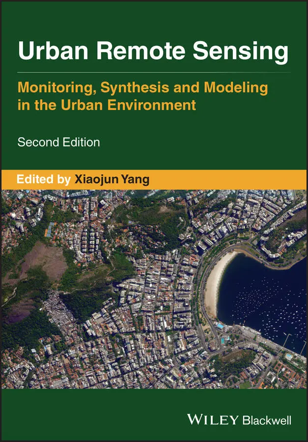
Urban Remote Sensing
Здесь есть возможность читать онлайн «Urban Remote Sensing» — ознакомительный отрывок электронной книги совершенно бесплатно, а после прочтения отрывка купить полную версию. В некоторых случаях можно слушать аудио, скачать через торрент в формате fb2 и присутствует краткое содержание. Жанр: unrecognised, на английском языке. Описание произведения, (предисловие) а так же отзывы посетителей доступны на портале библиотеки ЛибКат.
- Название:Urban Remote Sensing
- Автор:
- Жанр:
- Год:неизвестен
- ISBN:нет данных
- Рейтинг книги:4 / 5. Голосов: 1
-
Избранное:Добавить в избранное
- Отзывы:
-
Ваша оценка:
Urban Remote Sensing: краткое содержание, описание и аннотация
Предлагаем к чтению аннотацию, описание, краткое содержание или предисловие (зависит от того, что написал сам автор книги «Urban Remote Sensing»). Если вы не нашли необходимую информацию о книге — напишите в комментариях, мы постараемся отыскать её.
is a state-of-the-art review of the latest progress in the subject. The text examines how evolving innovations in remote sensing allow to deliver the critical information on cities in a timely and cost-effective way to support various urban management activities and the scientific research on urban morphology, socio-environmental dynamics, and sustainability.
Chapters are written by leading scholars from a variety of disciplines including remote sensing, GIS, geography, urban planning, environmental science, and sustainability science, with case studies predominately drawn from North America and Europe.
A review of the essential and emerging research areas in urban remote sensing including sensors, techniques, and applications, especially some critical issues that are shifting the directions in urban remote sensing research. Illustrated in full color throughout, including numerous relevant case studies and extensive discussions of important concepts and cutting-edge technologies to enable clearer understanding for non-technical audiences.
will be of particular interest to upper-division undergraduate and graduate students, researchers and professionals working in the fields of remote sensing, geospatial information, and urban & environmental planning.
Urban Remote Sensing — читать онлайн ознакомительный отрывок
Ниже представлен текст книги, разбитый по страницам. Система сохранения места последней прочитанной страницы, позволяет с удобством читать онлайн бесплатно книгу «Urban Remote Sensing», без необходимости каждый раз заново искать на чём Вы остановились. Поставьте закладку, и сможете в любой момент перейти на страницу, на которой закончили чтение.
Интервал:
Закладка:
54 Nghiem, S.V., Small, C., Jacobson, M.Z., Brakenridge, G.R., Balk, D., Sorichetta, A., Masetti, M., Gaughan, A.E., Stevens, F. R., Mathews, A.J., Frazier, A.E., and Das, N.N. (2017). Multi‐sourced satellite observations of land cover and land use change in south and Southeast Asia with challenging environmental and socioeconomic impacts. Abstract GC51D‐0834 Presented at the 2017 AGU Fall Meeting (San Francisco, CA, 11–15 December).
55 Nghiem, S.V. and Science Team (2019). Land and Sea Environmental Changes and Impacts Observed by NASA and International Radars in Synergy with Multitype Sensors, Earth Science and Applications of Satellite X‐Band Synthetic Aperture Radars in Synergy with Multi‐Frequency Sensors, Surface Networks, and Modeling (Hanoi, Vietnam, 20–22 February 2019).
56 Nguyen, L.H., Nghiem, S.V., and Henebry, G.M. (2018). Expansion of major urban areas in the US Great Plains from 2000 to 2009 using satellite scatterometer data. Remote Sensing of Environment 204: 524–533. doi: 10.1016/j.rse.2017.10.004.
57 Palmer, T.C., and Shan, J. (2002). A comparative study on urban visualization using LIDAR data in GIS. URISA Journal 14(2): 19–25.
58 Paloscia, S., Pettinato, S., and Santi, E. (2019). Applications of COSMO‐SkyMed Coherence Data for the Detection of Urban Changes in Southeast Asia, Earth Science and Applications of Satellite X‐Band Synthetic Aperture Radars in Synergy with Multi‐Frequency Sensors, Surface Networks, and Modeling (Hanoi, Vietnam, 20–22 February 2019).
59 Priestnall, G., Jaafar, J., and Duncan, A. (2000). Extracting urban features from LiDAR digital surface models. Computers, Environment and Urban Systems 24: 65–78. doi: 10.1016/S0198‐9715(99)00047‐2.
60 Qi, W., and Dubayah, R.O. (2016). Combining tandem‐X InSAR and simulated GEDI lidar observations for forest structure mapping. Remote Sensing of Environment 187: 253–266. doi: 10.1016/j.rse.2016.10.018.
61 Qiu, C., Schmitt, M., and Zhu, X.X. (2018). Towards automatic SAR‐optical stereogrammetry over urban areas using very high resolution imagery. ISPRS Journal of Photogrammetry and Remote Sensing 138: 218–231. doi: 10.1016/j.isprsjprs.2017.12.006.
62 Rottensteiner, F., and Briese, C. (2002). A new method for building extraction in urban areas from high‐resolution LiDAR data. The International Archives of Photogrammetry, Remote Sensing and Spatial Information Sciences 34(3/A): 295–301.
63 Schmidt, M., Esch, T., Klein, D., Thiel, M., and Dech, S. (2010). Estimation of building density using Terrasar‐X‐Data. 2010 IEEE International Geoscience and Remote Sensing Symposium (Honolulu) 1936–1939. doi: 10.1109/IGARSS.2010.5649543.
64 Şen, Z. (ed.) (2017). Spatial trend analysis. In: Innovative Trend Methodologies in Science and Engineering, New York: Springer. doi: 10.1007/978‐3‐319‐52338‐5_6.
65 Seto, K.C., Guneralp, B., and Hutyra, L.R. (2012). Global forecasts of urban expansion to 2030 and direct impacts on biodiversity and carbon pools. Proceedings of the National Academy of Sciences 109(40): 16083–16088. doi: 10.1073/pnas.1211658109.
66 Shan, J., and Toth, C.K. (2018). Topographic Laser Ranging and Scanning: Principles and Processing. Boca Raton, FL: CRC Press.
67 Small, C., and Elvidge. C.D. (2013). Night on earth: mapping decadal changes of anthropogenic night light in Asia. International Journal of Applied Earth Observation and Geoinformation 22: 40–52. doi: 10.1016/j.jag.2012.02.009.
68 Soergel, U., Schulz, K., Thoennessen, U., and Stilla, U. (2003). Determination of optimal SAR illumination aspects in build‐up areas. 2003 IEEE International Geoscience and Remote Sensing Symposium (IGARSS) Proceedings 6: 3662–3664. doi: 10.1109/IGARSS.2003.1295230.
69 Sorichetta, A., Nghiem, S.V., Masetti, M., Linard, C., and Richter, A. (2020). Transformative urban changes of Beijing in the decade of the 2000s. Remote Sensing 12(4): 652. doi: 10.3390/rs12040652, 2020.
70 Sportouche, H., Tupin, F., and Denise, L. (2011). Extraction and three‐dimensional reconstruction of isolated buildings in urban scenes from high‐resolution optical and SAR spaceborne images. IEEE Transactions on Geoscience and Remote Sensing 49(10): 3932–3946. doi: 10.1109/TGRS.2011.2132727.
71 Stal, C. Tack, F., De Maeyer, P., De Wulf, A., and Goossens, R. (2013). Airborne photogrammetry and lidar for DSM extraction and 3D change detection over an urban area – a comparative study. International Journal of Remote Sensing 34(4): 1087–1110. doi: 10.1080/01431161.2012.717183.
72 Stevenazzi, S., Masetti, M., Nghiem, S.V., and Sorichetta, A. (2014). Use of scatterometer data in groundwater vulnerability assessment. Rendiconti Online: Della Societa Geologica Italiana 30: 45–50. doi: 10.3301/ROL.2014.10.
73 Stevenazzi, S., Masetti, M., Nghiem, S.V., and Sorichetta, A. (2015). Groundwater vulnerability maps derived from time dependent method using satellite scatterometer data. Hydrogeology Journal 23(4): 631–647. doi: 10.1007/s10040‐015‐1236‐3.
74 Stevenazzi, S., Bonfanti, M., Masetti, M., Nghiem, S.V., and Sorichetta, A. (2017). A versatile method for groundwater vulnerability projections in future scenarios. Journal of Environmental Management 187: 365–374. doi: 10.1016/j.jenvman.2016.10.057.
75 Strozzi, T., and Wegmuller, U. (1998). Delimitation of urban areas with SAR interferometry. 1998 IEEE International Geoscience and Remote Sensing. Symposium (IGARSS) Proceedings 3: 1632–1634. doi: 10.1109/IGARSS.1998.691660.
76 Taubenböck, H., Esch, T., Felbier, A., Wiesner, M., Roth, A., and Dech, S. (2012). Monitoring urbanization in mega cities from space. Remote Sensing of Environment 117: 162–176. doi: 10.1016/j.rse.2011.09.015.
77 Taubenböck, H., Weigand, M., Esch, T., Staab, J., Wurm, M., Mast, J., and Dech, S. (2019) A new ranking of the world's largest cities—do administrative units obscure morphological realities? Remote Sensing of Environment 232: 111353. doi: 10.1016/j.rse.2019.111353.
78 Teo, T.A., and Shih, T.Y. (2013). Lidar‐based change detection and change‐type analysis determination in urban areas. International Journal of Remote Sensing, 34(3): 968–981. doi: 10.1080/01431161.2012.714504.
79 Thiele, A., Cadario, E., Schulz, K., Thonnessen, U., and Soergel, U. (2007). Building recognition from multi‐aspect high‐resolution InSAR data in urban areas. IEEE Transactions on Geoscience and Remote Sensing 45(11): 3583–3593. doi: 10.1109/TGRS.2007.898440.
80 Tsang, L., Kong, J.A., and Shin, R.T. (1985). Theory of Microwave Remote Sensing. Hoboken, NJ: Wiley‐Interscience.
81 Ulaby, F.T., Moore, R.K., and Fung, A.K. (1986). Microwave Remote Sensing Active and Passive, Vol. I‐III. Norwood, MA: Artech House.
82 United Nations (2014). World Urbanization Prospects: The 2014 Revision ‐ Highlights. New York: United Nations.
83 US Census (2019). United States Census Bureau – American FactFinder. https://factfinder.census.gov(accessed 17 December 2019).
84 Vu, T.T., Matsuoka, M., and Yamazaki, F. (2004). LIDAR‐based change detection of buildings in dense urban areas. IEEE International Geoscience and Remote Sensing Symposium 3413–3416. doi: 10.1109/IGARSS.2004.1370438.
85 Wentz, E.A., York, A.M., Alberti, M., Conrow, L., Fischer, H., Inostroza, L., Jantz, C., Pickett, S.T.A., Seto, K.C., and Taubenbock, H. (2018). Six fundamental aspects for conceptualizing multidimensional urban form: a spatial mapping perspective. Landscape and Urban Planning 179: 55–62. doi: 10.1016/j.landurbplan.2018.07.007.
86 Wu, Q., Chen, R., Sun, H., and Cao, Y. (2011). Urban building density detection using high resolution SAR imagery. 2011 Joint Urban Remote Sensing Event (Munich), 45–48. doi: 10.1109/JURSE.2011.5764715.
87 Yu, B., Liu, H., Wu, J., and Lin, W.M. (2009). Investigating impacts of urban morphology on spatio‐temporal variations of solar radiation with airborne LIDAR data and a solar flux model: a case study of downtown Houston. International Journal of Remote Sensing 30(17): 4359–4385. doi: 10.1080/01431160802555846.
Читать дальшеИнтервал:
Закладка:
Похожие книги на «Urban Remote Sensing»
Представляем Вашему вниманию похожие книги на «Urban Remote Sensing» списком для выбора. Мы отобрали схожую по названию и смыслу литературу в надежде предоставить читателям больше вариантов отыскать новые, интересные, ещё непрочитанные произведения.


Обсуждение, отзывы о книге «Urban Remote Sensing» и просто собственные мнения читателей. Оставьте ваши комментарии, напишите, что Вы думаете о произведении, его смысле или главных героях. Укажите что конкретно понравилось, а что нет, и почему Вы так считаете.