Olivier Cavalie - Surface Displacement Measurement from Remote Sensing Images

Здесь есть возможность читать онлайн «Olivier Cavalie - Surface Displacement Measurement from Remote Sensing Images» — ознакомительный отрывок электронной книги совершенно бесплатно, а после прочтения отрывка купить полную версию. В некоторых случаях можно слушать аудио, скачать через торрент в формате fb2 и присутствует краткое содержание. Жанр: unrecognised, на английском языке. Описание произведения, (предисловие) а так же отзывы посетителей доступны на портале библиотеки ЛибКат.

Surface Displacement Measurement from Remote Sensing Images: краткое содержание, описание и аннотация

Предлагаем к чтению аннотацию, описание, краткое содержание или предисловие (зависит от того, что написал сам автор книги «Surface Displacement Measurement from Remote Sensing Images»). Если вы не нашли необходимую информацию о книге — напишите в комментариях, мы постараемся отыскать её.
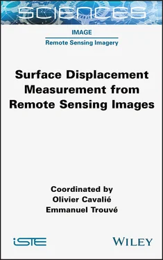
Drastic improvements in both access to satellite images and data processing tools today allow near real-time observation of Earth surface deformations. Remote sensing imagery is thus a powerful, reliable and spatially dense source of information that can be used to understand the Earth and its surface manifestations as well as mitigate natural hazards.<br /><br />This book offers for the first time a complete overview of the methodological approaches developed to measure surface displacement using synthetic aperture radar (SAR) and optical imagery, as well as their applications in the monitoring of major geophysical phenomena. More specifically, the first part of the book presents the theory behind SAR interferometry (InSAR) and image correlation and its latest developments. In the second part, most of the geophysical phenomena that trigger Earth surface deformations are reviewed.<br /><br /><i>Surface Displacement Measurement from </i><i>Remote Sensing Images</i> unveils the potential and sensitivity of the measurement of Earth surface displacements from remote sensing imagery.

Surface Displacement Measurement from Remote Sensing Images — читать онлайн ознакомительный отрывок

Ниже представлен текст книги, разбитый по страницам. Система сохранения места последней прочитанной страницы, позволяет с удобством читать онлайн бесплатно книгу «Surface Displacement Measurement from Remote Sensing Images», без необходимости каждый раз заново искать на чём Вы остановились. Поставьте закладку, и сможете в любой момент перейти на страницу, на которой закончили чтение.

Тёмная тема
Сбросить

Интервал:

Закладка:

Сделать
Satellite Year of launch End of life Highest spatial resolution (m) Panchromatic spectral range (nm) No. of XS bands Swath width for highest resolution (km) Dynamic range (bits)
Alos 2006 2011 2.5 520–770 4 70 -
Alsat-1B 2016 - 12 - 3 - -
Alsat-2A/2B 2010, 2016 - 2.5 - 4 17.5 -
Asnaro 2014 - 0.5 - - 10 12
BKA (Belka-2) 2012 - 2.1 - 4 23 -
BlackSky constellation 2020 2018 (2), 2019 (2), (4), 2021 - 0.8–1 - - - -
Carbonite-2 2018 - 1 - 4 5(x5) -
Cartosat-1 (IRS-P5) 2005 - 2.5 500–850 0 30 -
Cartosat-2A/2B 2008, 2010 - 1/0.8 500–850 0 9.8 -
Cartosat-2C–2F 2016–2018 - 0.65 500–850 4 10 -
Cartosat-3/3A/3B 2019 - 0.28 500–850 4 17 -
CBERS-4/4A 2014, 2019 - 5 510–730 16 60 8
CESAT-1 2017 - 1 - - 6x4 -
Deimos-1 2009 - 22 - 3 600 -
Deimos-2 2014 - 0.75 450–900 4 12/24 10
Dove PlanetScope 2018 - 2.7–3.2 - 4 24x8 12
Dove PlanetScope 2 (PS2) 2020 - 3.7–4.9 - 4/8 24x16,32x19.6 12
DubaiSat-1 2009 2017 2.5 420–720 4 20 8
DubaiSat-2 2013 - 1 420–890 4 12/24 -
DubaiSat-3 (KhalifaSat) 2017 - 0.70 420–890 4 16/12 -
Eros B 2006 - 0.7 500–900 0 7 10
Eros C 2019 - 0.38 450–900 4 11.5 12
Gaofen-1 2013 - 2 450–900 8 70 -
Gaofen-2 2014 - 0.8 450–890 4 45 -
Gaofen-6 2018 - 2 450–900 - 90 -
Gaofen-7 2019 - <1 m - - - -
GeoEye-1 2008 - 0.46 450–800 4 15.2 -
Jilin-1/7/8 2015 - 0.72–0.8 450–900 4 48 -
Kanopus-V-IK 2018 - 2.5 540-860 6 23 12
Kanopus-V1–V6 2012–2018 - 2.1 540–860 4 23 12
KazeoSat 1 2014 - 1 450–750 4 20 12
KazeoSat 2 2014 - 6.5 - 5 77 12
Kompsat-2 2006 - 1 500–900 4 15 10
Kompsat-3 2012 - 0.72 450–900 4 16 14
Kompsat-3A 2015 - 0.55 450–900 5 12 14

Table 1.11. Instrument characteristics (2/2)

Satellite Year of launch End of life Highest spatial resolution (m) Panchromatic spectral range (nm) No. of XS bands Swath width for highest resolution (km) Dynamic range (bits)
Landsat 8 2013 - 15 500–680 10 185 12
Nemo-HD 2020 - 2.8 400–900 4 10 -
Pléiades-1A 2011 - 0.7/0.5 457–848 4 20 12
Pléiades-1B 2012 - 0.5 457–848 4 20 12
Prisma 2019 - 5 400–700 66 + 171 30 12
RapideEye 2008 2020 6.5/5 - 5 77 12
ResourceSat-2 2016 - 5.8 - 11 23/70 -
Resurs-P 1, 2, 3/GEOTON 2013, 2014 2016 - 1 580–800 5 38 -
Resurs-P 1, 2, 3/SHMSA-VR 2013, 2014 2016 - 12 430–700 6 97 -
Sentinel-2-A/B 2015, 2017 - 10 - 13 290 -
SkySat-1 2013 - 0.8 450–900 4 2/8 -
SkySat-2-21 2014 - 0.65–0.8 450–900 4 2/8 -
SPOT-6 2012 - 1.5 455–745 4 60 12
SPOT-7 2014 - 1.5 455–745 4 60 12
SuperView-1–4 2016, 2018 - 0.5 450–890 4 12 11
TeLEOS-1 2015 - 1 - 0 12 10
TH-1 2010, 2012, 2015 2018, 2020 2–5 510–690 4 60 -
TripleSat/DMC3/SSTL-S1-2-3 2015 - 1 450–650 3 23.8 10
TripleSat/DMC3/SSTL-S4 2018 - 1 450–650 3 23.8 10
UK-DMC2 2009 - 22 - - 600 -
Vision-01 2018 - 0.9 450–650 4 20.8 10
VRSS-1 2012 - 2.5 450–900 4 + 4 57 10
VRSS-2 2017 - 1 - 4 + 5/6 - -
WorldView-1 2007 - 0.46 448–895 0 17.6 11
WorldView-2 2009 - 0.46 464–801 4 + 4 16.4 11
WorldView-3 2014 - 0.31 450–800 8 + 8 + 12 13.1 11
WorldView-4 Zhuhai-1 2016 2019 0.31 450–800 4 13.1 11
Zhuhai-1 OHS-2A-2D/3A-3D 2018, 2019 - 10 - - 150 -
Zhuhai-1 OVS-1A/1B/2 2017, 2018 - 0.9–2.0 - - 22.5 -
Ziyuan-3/ZY-3 01-03 2012, 2016, 2020 - 2.5 500–800 4 51 10

– Pléiades: Pléiades represents the new generation of French satellites with submetric resolution. The main characteristics of Pléiades are the high image quality, the high agility of the satellites, high image geolocation, the ability to provide images with a short delay (exemplified with the International Charter “Space and Major Disasters”) and the ability to take stereo or tri-stereo images on a single track.

Читать дальше
Тёмная тема
Сбросить

Интервал:

Закладка:

Сделать

Похожие книги на «Surface Displacement Measurement from Remote Sensing Images»

Представляем Вашему вниманию похожие книги на «Surface Displacement Measurement from Remote Sensing Images» списком для выбора. Мы отобрали схожую по названию и смыслу литературу в надежде предоставить читателям больше вариантов отыскать новые, интересные, ещё непрочитанные произведения.


Отзывы о книге «Surface Displacement Measurement from Remote Sensing Images»

Обсуждение, отзывы о книге «Surface Displacement Measurement from Remote Sensing Images» и просто собственные мнения читателей. Оставьте ваши комментарии, напишите, что Вы думаете о произведении, его смысле или главных героях. Укажите что конкретно понравилось, а что нет, и почему Вы так считаете.

x