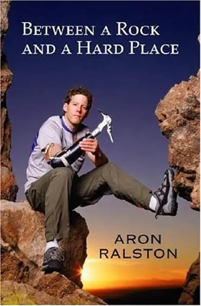
Aron Ralston - Between a Rock and a Hard Place
Здесь есть возможность читать онлайн «Aron Ralston - Between a Rock and a Hard Place» весь текст электронной книги совершенно бесплатно (целиком полную версию без сокращений). В некоторых случаях можно слушать аудио, скачать через торрент в формате fb2 и присутствует краткое содержание. Жанр: Триллер, на английском языке. Описание произведения, (предисловие) а так же отзывы посетителей доступны на портале библиотеки ЛибКат.
- Название:Between a Rock and a Hard Place
- Автор:
- Жанр:
- Год:неизвестен
- ISBN:нет данных
- Рейтинг книги:3 / 5. Голосов: 1
-
Избранное:Добавить в избранное
- Отзывы:
-
Ваша оценка:
Between a Rock and a Hard Place: краткое содержание, описание и аннотация
Предлагаем к чтению аннотацию, описание, краткое содержание или предисловие (зависит от того, что написал сам автор книги «Between a Rock and a Hard Place»). Если вы не нашли необходимую информацию о книге — напишите в комментариях, мы постараемся отыскать её.
And so began six days of hell for Aron Ralston.
Between a Rock and a Hard Place — читать онлайн бесплатно полную книгу (весь текст) целиком
Ниже представлен текст книги, разбитый по страницам. Система сохранения места последней прочитанной страницы, позволяет с удобством читать онлайн бесплатно книгу «Between a Rock and a Hard Place», без необходимости каждый раз заново искать на чём Вы остановились. Поставьте закладку, и сможете в любой момент перейти на страницу, на которой закончили чтение.
Интервал:
Закладка:
“We had our guys out at the Black Box with some of the search-and-rescue team on off-road vehicles, but they didn’t find anything. Two deputies went out to Joe’s Valley, which I don’t think was on your list, but there’s a lot of hiking out there. Nothing there, either, though. We called everybody back in just before dark.”
Steve asked, “Did you get anyone down to Segers Hole?”
Segers had been next on Kyle’s list, but he hadn’t dispatched anyone, because it was nearly a three-hour drive from Castle Dale, in the northwest part of the county, down to the remote and unpaved southern region. With the increased manpower of the day shift, Kyle could afford to send a deputy with some volunteers from the county’s search-and-rescue team down to the Muddy. He said, “It’s a long way, but we’re going to check there. I was waiting for daylight and a couple more pairs of eyes, but that’s next. Is there anything else you can tell me?”
Steve paused and considered all the information he’d reviewed. It was mostly a hunch, but he told Kyle, “I’m pretty sure he’s in your county.”
Kyle promised to update Steve when the reports came back from the more far-flung locations, and thanked him for his involvement. After hanging up, the captain looked at his maps and thought through a short list of other places he would have his deputies and the SAR volunteers check while they were on the way out to Segers. “We’ve already covered the upper corners of the county,” the captain thought, “and most of the trailheads in the central part of the county. If he’s in the county, he’s down south. Where do people go down there? There aren’t even any roads.” But one dirt road, the Lower San Rafael Road, cuts a sidewinding curve through the southern section of Emery County, down into a no-man’s-land at the fringes of Canyonlands. “Maybe there, over in the Robbers Roost area,” he thought as he pored over his enlarged map of the county. There are dozens of canyons and dry washes out in the Roost, most on BLM land accessible from the Lower San Rafael Road and its continuation, the spur that dead-ends in the Maze. Kyle knew the Maze drew considerable numbers of people through Emery County down into Wayne County. It’d be worth a call, he figured, even if he didn’t send his guys over the county line.
Kyle dialed the Hans Flat ranger station at the entrance to the Maze District of Canyonlands, inquiring about a red Toyota Tacoma truck at nine-fifteen A.M. Ranger Glenn Sherrill answered the phone and immediately recognized the vehicle description. That truck had been at Horseshoe Canyon since the weekend.
“I was just there. I saw that vehicle, oh, three days ago, and it’s still there,” he told Kyle.
Typically, fewer than ten people visit Horseshoe Canyon each day, with maybe a few more on the weekends. Nearly everyone hikes in and out of the canyon in half a day. The National Park Service posts rangers in the canyon every day at the Great Gallery to monitor visitors and protect the five-thousand-year-old petroglyphs. Since they are typically the first to arrive and the last to leave the trailhead each day, the rangers are accustomed to finding the dirt parking lot empty, or with one or two vehicles and tents set up nearby. They are certainly attuned to notice when one vehicle sits in the parking lot for the better part of a week. Because my truck obnoxiously blocked the welcome sign directly across from the entrance road (I’d parked to make the rear bed level for sleeping), it was all the more conspicuous.
Even feeling 90 percent certain, Glenn paused and hedged his assertion. “Well, I think it’s the vehicle.”
Kyle asked, “Do you have anybody who can go check the license plate?”
“Yeah, will do. Let me call you back.”
Glenn signaled over the radio to his rangers in the parking lot who were preparing to hike into the canyon. They confirmed that the truck was still there and verified the license plate. Glenn phoned Kyle and reported the positive identification. “We have his truck.”
“Thank you for your help. We’re going to get somebody on-scene.”
The captain dispatched Sergeant Mitch Vetere to drive out to the trailhead and then had his dispatcher try to get Sheriff Kurt Taylor from Wayne County on the radio. Sheriff Taylor was off-duty until the afternoon, but his chief deputy, Doug Bliss, called back within the hour.
Since the trailhead for Horseshoe Canyon resides just over the county line in Wayne County, the search had potentially moved beyond the purview of Kyle and his deputies. Although my vehicle was sitting in Wayne County, if I had gone to the north in the canyon, I would be in Emery County; if I went to the south, I would be in Wayne County. With Doug’s permission, Kyle continued as commander and began the process of initiating the Park Service’s incident-response command. He had already called the DPS dispatcher in Price, Utah, to ask for helicopter support.
The news of my truck’s discovery at Horseshoe Canyon reached Elliott at 9:37 A.M. He spent the next hour on his cell phone to spread word of the breakthrough. It was the focal point of new hope for my friends around the country. In Aspen, Rachel sent e-mails to my friends in the Roaring Fork Valley in 48-point font. Down in New Mexico, Steve Patchett talked with Jason Halladay on the phone at 10:31 A.M. Within the hour, they had coordinated two groups of my friends, search-and-rescue colleagues, and climbing partners in Albuquerque and Los Alamos who were making immediate plans to drive to Horseshoe Canyon. Steve called Kyle Ekker to let him know a team from the Albuquerque Mountain Rescue Council was responding. Captain Ekker assured Steve they would be welcome to participate in the search.
At our home in Denver, Ann Fort and my mom were working on a different plan. They were creating a missing person’s poster to send via fax to a list of United Methodist churches in the Grand Junction area, asking them to take the flyer to gas stations around town and find out if anyone had seen me on my way to Utah. My mom had dug out the Aspen Times article from back in March, and cut out the self-portrait I’d taken on Capitol Peak. She taped the picture onto a piece of copier paper and, below the four-by-six picture, wrote out my physical description and the best information that she had regarding my whereabouts:
Aron Ralston, 10/27/75, age 27. 6’2”, approx. 175 lbs., brown un-kempt hair. Last seen Thursday 4/24 approx. 6pm near Carbondale, COL. Used credit card at a gas station in Glenwood Springs early evening 4/24. Very athletic-possibly headed to Utah camping, biking, or skiing.
Adding my truck description and the correct license-plate number, my mom finished the poster with the phone number for the Aspen police. She and Ann were at the copy machine when the doorbell rang.
“I wonder who that is?” my mom inquired aloud. Without crossing the room to peek out the window, she went downstairs and answered the door. It was Sue Doss, another friend from church. Sue and her husband, Keith, had been the codirectors of the high school youth programs at Hope when I was at Cherry Creek. I had spent dozens of weekends with them and traveled to Wyoming on two trips with the youth group to volunteer at church camps; I had even given their daughter Jamie her first lessons on the piano. After I graduated and went on to college, the Doss family had remained close to my parents.
Sue had come directly from Hope UMC, where she heard about my mom’s request for support during the crisis. My mother quickly told Sue the limited amount she knew about my situation. There were more tears and hugs and sobs, but shortly, Sue, Ann, and my mom were ready to get back to work.
The threesome began a long-distance distribution of the freshly made poster. My mom asked the office administrator at Hope Church to fax over a phone list of United Methodist churches in Grand Junction. Juggling two phones to collect fax numbers, my mom also got the fax machine warmed up. At nine-forty-five A.M., they were about to go into high gear when my mom’s cell phone rang.
Читать дальшеИнтервал:
Закладка:
Похожие книги на «Between a Rock and a Hard Place»
Представляем Вашему вниманию похожие книги на «Between a Rock and a Hard Place» списком для выбора. Мы отобрали схожую по названию и смыслу литературу в надежде предоставить читателям больше вариантов отыскать новые, интересные, ещё непрочитанные произведения.


Обсуждение, отзывы о книге «Between a Rock and a Hard Place» и просто собственные мнения читателей. Оставьте ваши комментарии, напишите, что Вы думаете о произведении, его смысле или главных героях. Укажите что конкретно понравилось, а что нет, и почему Вы так считаете.