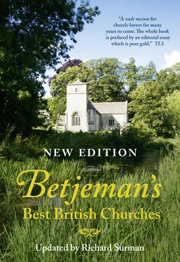
BETJEMAN’SBEST BRITISH CHURCHES
UPDATED BY RICHARD SURMAN
With photographs by Michael Ellis and Richard Surman

Contents
Cover
Title Page BETJEMAN’S BEST BRITISH CHURCHES UPDATED BY RICHARD SURMAN With photographs by Michael Ellis and Richard Surman
How to find a Church
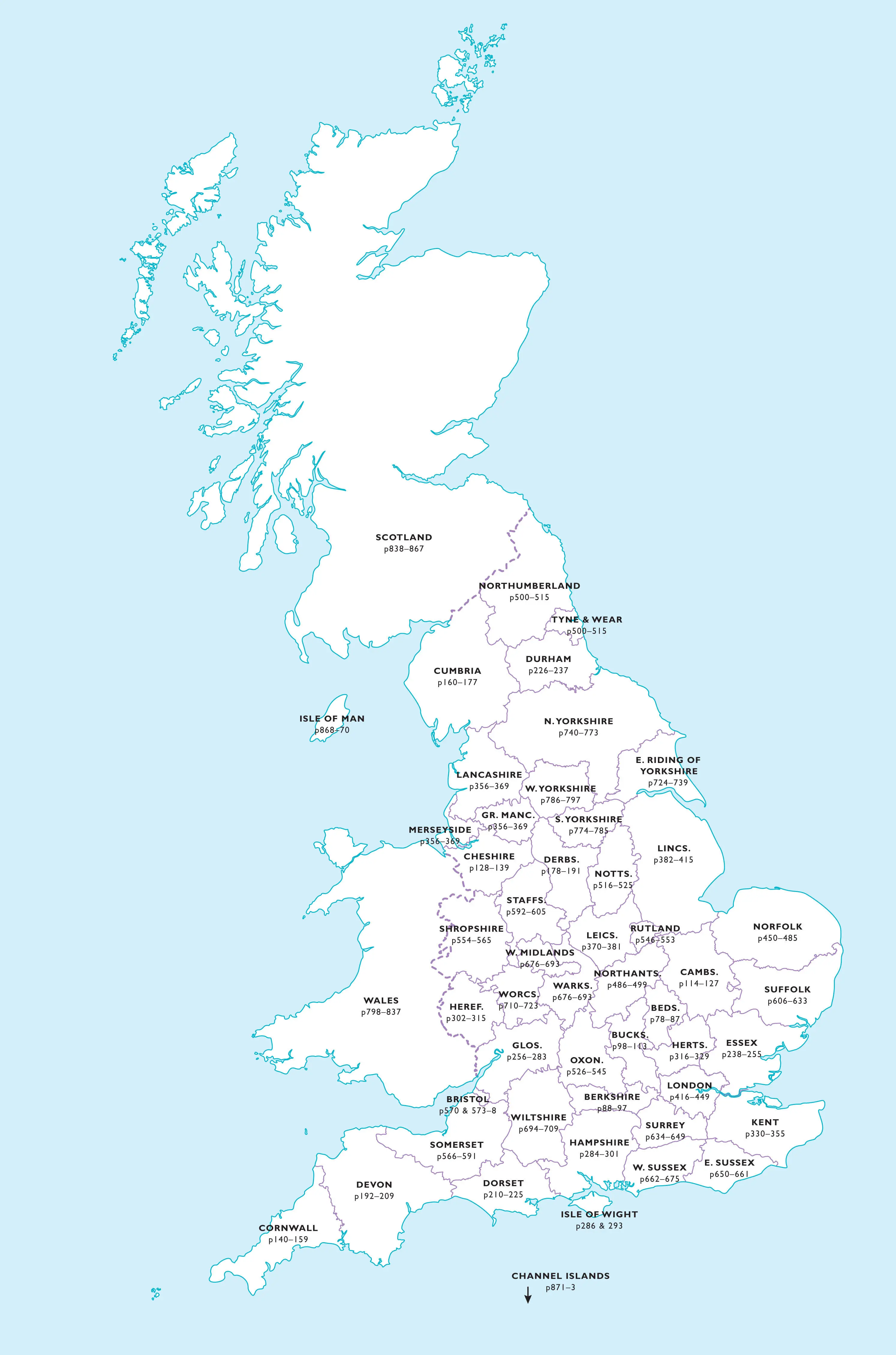
County Locator
PREFACE by Richard Surman
INTRODUCTION by Sir John Betjeman
ENGLAND BY COUNTY
BEDFORDSHIRE
BERKSHIRE
BUCKINGHAMSHIRE
CAMBRIDGESHIRE
CHESHIRE
CORNWALL
CUMBRIA
DERBYSHIRE
DEVON
DORSET
DURHAM
ESSEX
GLOUCESTERSHIRE
HAMPSHIRE & THE ISLE OF WIGHT
HEREFORDSHIRE
HERTFORDSHIRE
KENT
LANCASHIRE, MERSEYSIDE & GREATER MANCHESTER
LEICESTERSHIRE
LINCOLNSHIRE
LONDON
GREATER LONDON
NORFOLK
NORTHAMPTONSHIRE
NORTHUMBERLAND AND TYNE & WEAR
NOTTINGHAMSHIRE
OXFORDSHIRE
RUTLAND
SHROPSHIRE
SOMERSET & BRISTOL
STAFFORDSHIRE
SUFFOLK
SURREY
SUSSEX – EAST
SUSSEX – WEST
WARWICKSHIRE & WEST MIDLANDS
WILTSHIRE
WORCESTERSHIRE
YORKSHIRE – EAST RIDING
YORKSHIRE – NORTH
YORKSHIRE – SOUTH
YORKSHIRE – WEST
WALES
SCOTLAND
THE ISLE OF MAN
THE CHANNEL ISLANDS
Glossary
Index of Architects and Artists
Index of Places
Acknowledgements
Copyright
About the Publisher
How to find a Church
This book includes Ordnance Survey (OS) and Global Positioning System (GPS) coordinates to help readers locate the churches with precision.
USING THE OS COORDINATES
The OS grid references work on all the paper Ordnance Survey maps and the Ordnance Survey’s OpenData service on its website (www.ordnancesurvey.co.uk). If using the website, simply type the full grid reference into the OpenData search bar – e.g. SE966710 – which will take you directly to a map page showing the church, usually identifiable as ‘PW’ for ‘place of worship’.
If you are using an Ordnance Survey paper map, the same six-digit grid reference will work as follows:
• THE FIRST TWO LETTERS – e.g. the SE of SE966710 – refer to the Ordnance Survey’s division of Great Britain into 100 x 100 km major grid squares, each identified by two letters. On the paper maps, the letters can be seen in large lettering in the corner 1km grid squares and also where the major squares butt up to each other.
• THE FIRST TWO DIGITS – e.g. 96 – refer to the horizontal grid lines, called the ‘eastings’, which are numbered left to right on the paper maps.
• THE THIRD DIGIT – e.g. 6 – refers to the eastings grid in tenths. Thus the 6 in this example is six-tenths east of grid line 96.
• THE FOURTH AND FIFTH DIGITS – e.g. 71 – refer to the vertical grid lines, called the ‘northings’, which are numbered bottom to top on the paper maps.
• THE SIXTH DIGIT – e.g. 0 – refers to the northings grid in tenths. Thus the 0 in this example is within one-tenth north of grid line 71.
The division of tenths on the six-digit OS references in this book should be accurate to within 100 metres of the church.
USING THE GPS COORDINATES
These references give the latitude and longitude of locations in a digital format used by many car SatNav systems, mobile devices with GPS, and major online mapping applications such as Google and Bing.
Car SatNavs
First check if your SatNav allows the input of latitude and longitude / GPS coordinates. There are several reference systems in operation, so select ‘digital’ if given the option. In some SatNavs you will need to key in the full GPS coordinates with letters – e.g. 54.12669N, 0.52226W – while in others the letters may have to be selected separately.
Note that the GPS coordinates given in this book are centred on the church building itself, rather than an access point into the grounds or the nearest car park. Churches sited in remote fields, woods or parks may be some distance from the nearest public highway, and in such cases SatNavs won’t necessarily guide you to the best access point or parking place, although they should indicate where the church stands.
If your car SatNav does not offer the option to input the coordinates, we would suggest that you search for the village name and then the church name as a point of interest within the village, or, failing that, searching for ‘Church Street’ in a village often yields results!
Google Maps and Bing
Google Maps, Bing and some other online maps directly read the digital coordinates given in this book. Simply type the coordinates – e.g. 54.12669N, 0.52226W – into the map’s search bar.
Mobile phones and Other GPS Devices
Handheld devices that support GPS can read the GPS coordinates. On an iPhone, BlackBerry or Android device, for example, open the Google Maps application and type the coordinates into the search bar. Devices that use Full GPS (linking directly to satellites) are more accurate than those using Assisted GPS (via mobile phone masts).
If your device does not recognize the letters in the references, try leaving out the letters and substituting a minus sign before the longitude reference – e.g. 54.12669, -0.52226. (The minus sign is not necessary for longitude references ending in E.)
County Locator
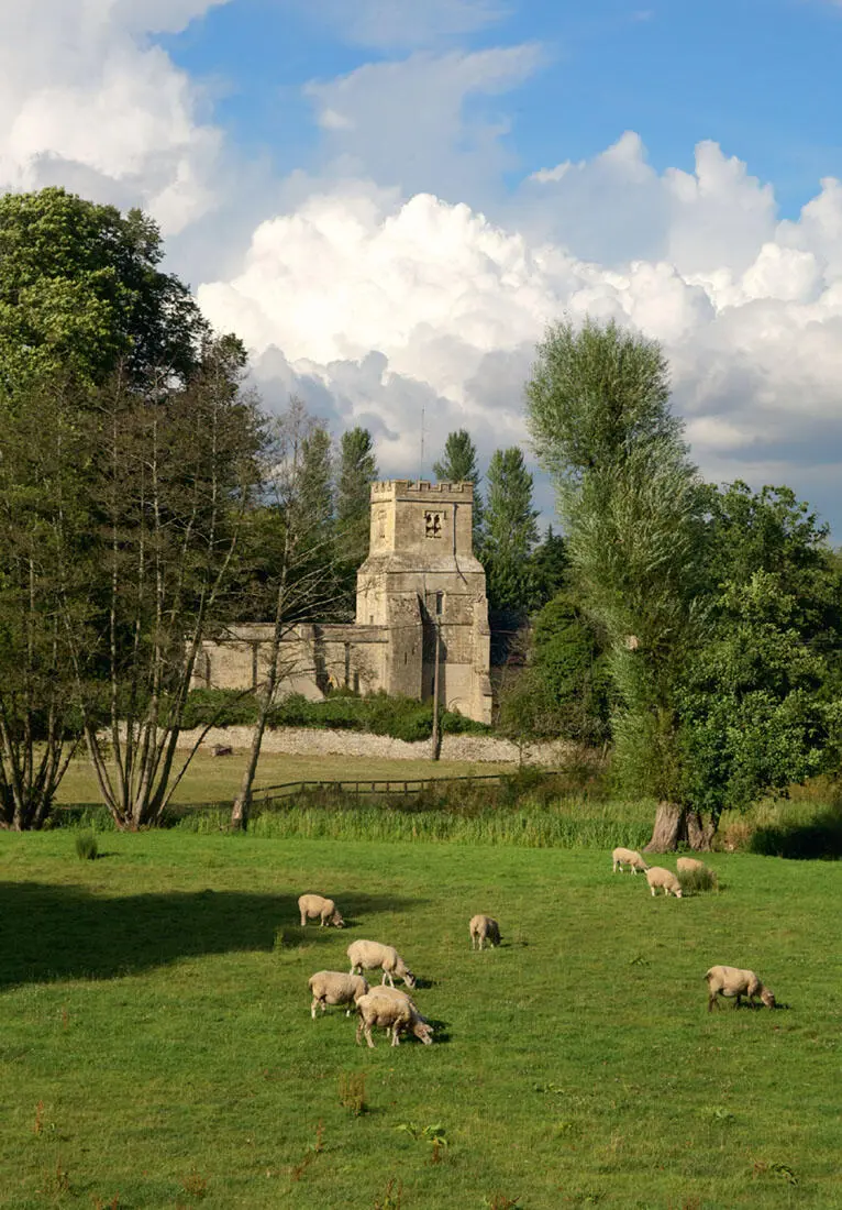
COLN ST DENYS: ST JAMES THE GREAT – sunk into the picturesque Gloucestershire landscape, the church retains its Norman ground plan and tower
© Richard Surman
PREFACE by Richard Surman
Since John Betjeman compiled the first 1958 edition of the Collins Guide to English Parish Churches, it has become a classic of its kind, and has been reprinted several times, most notably in the two-volume Collins Pocket Guide to English Parish Churches, published in 1968, and the 1980 edition, in which the scope of the book was extended to take in churches in Wales. The background to the book is a story all of its own. To many, Sir John Betjeman was latterly the Poet Laureate, whose work was reviled and adored in equal measure. But Betjeman was many things apart from being a poet: as a young boy holidaying in Trebetherick he went church-hunting, and in adolescence, churches became a passion for him. He would always talk about his childhood impressions of buildings as being crucial in determining his later responses to architecture.
Friendships with James Lees-Milne, the noted architectural advisor to the National Trust, Betjeman’s work on the Architectural Review, where he met and formed a life-long friendship with the artist John Piper, a spell as the film critic for the Evening Standard – all these fed Betjeman’s limitless and sometimes mischievous imagination, which was equally exercised by his colourful private life.
His working life would take a different emphasis however, when he proposed the idea of a series of county guides to Jack Beddington, publicity manager of Shell-Mex BP. Beddington was known for his patronage of artists and writers, and Betjeman found himself working alongside Paul Nash and a coterie of friends to whom he handed out work on the Shell Guide series. What always characterised Betjeman’s reactions to architecture and countryside was a sense of place – the setting – as well as architectural and topographical detail. However mannered Betjeman might sometimes appear, one of his great gifts was to let landscape, architecture and art speak for themselves. After the war, Betjeman worked on many magazines, as well as writing poetry, and appearances on television became more and more regular. His presenting of the ABC of Churches programmes was a great success, not least to the crew, with whom he got on famously (although he did disconcert at least one member of the crew by taking his teddy bear Archibald Ormsby Gore wherever he went).
Читать дальше
