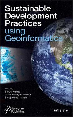
Geoinformatics, including Remote Sensing (RS), Geographical Information System (GIS), and Global Positioning System (GPS), has tremendous potential to effectively monitor the natural resources and addressing the concerns related to sustainable development and planning of society. RS is a quick and cost-effective technique to measure the location and spectral properties of earth surface features in comparison to traditional ground-based surveying. It provides reliable geospatial information for comprehensive sustainable development plans, policy making, and decision. GIS is a computer-based system used to digitize remotely sensed data matched with various ground-truth data, which are geo-coded using a GPS. It is able to manipulate, analyze, and display spatial database. Applications of Geoinformatics include land use change and planning, agriculture and soil, water resource management, forest resource mapping and management, glacier mapping and monitoring, climate change, disaster management, and many more.
Sustainable applications of Geoinformatics have become more essential in understanding various characteristics of Earth surfaces with the launch of Landsat mission in the 1970s. Many studies of direct relevance to the sustainable development and management have been reported. However, few studies have been reported using the harmonized approach of core science and research basics, as there are larger concerns of capacity building to use Geoinformatics in sustainable development practices and management. This could be overcome by taking the advantages of Geoinformatics into consideration to the scientific and research communities. The book entitled “Sustainable Development Practices Using Geoinformatics” contains chapters written by well-known researchers, academicians, and experts. The potential readers of this book are scientists, environmentalists, ecologists, policy makers, administrators, university students, urban planners, land managers, and professionals working in the field of sustainable development and management of natural resources.
In Chapter 1, multi-temporal Landsat images are used to investigate the change in variability of surface temperature in the Barasat municipal area, West Bengal, India. A correlation analysis is performed between Normalized Difference Vegetation Index (NDVI), and Land Surface Temperature (LST) to show the urban growth and its pattern and trend in relation to surface temperature variation. This study is very useful for investigating the changes in environmental condition due to human activity in an urban area.
In Chapter 2, attempts are made to estimate the geo-environmental hazards and risks in South Karanpura Coalfield region using information on land use/land cover (LU/LC), aerosol optical thickness (AOT), precipitable water vapor (PWV), and temperature conditions integrated with socio-economic vulnerability using Geoinformatics approach. Most of the risk-prone zones are found to present in the vicinity of industry and mining areas with higher population density. This study provides a basis to allocate resources for risk mitigation, improve community preparedness, and prepare cost-effective emergency planning.
In Chapter 3, a co-polarized radar system is investigated for the estimation of soil moisture along specular direction. The data are collected by indigenously designed ground-based scatterometer system for 20°–60° incidence angles at steps of 10° in the specular direction for HH- and VV-polarizations at L-band. In this study, a hybrid machine learning algorithm combined with fuzzy inference system and artificial neural network called neuro-fuzzy inference system were evaluated for the estimation of soil moisture. The performance index Root Mean Squared Error (RMSE) was used to evaluate the estimation efficiency of the algorithm. This study is very useful for accurate and timely soil moisture estimation for agricultural practices.
In Chapter 4, a study is conducted for detailed morphometric analysis of Tapi basin using Geographic Information System (GIS) technique. Different morphometric parameters analyzed, viz ., stream order, stream length, bifurcation ratio, drainage density, relief ratio, drainage density, stream frequency, texture ratio, form factor, circulatory ratio, elongation ratio, etc., are calculated. The stream order of the basin is mainly controlled by lithological and physiographic conditions of the area. The present study will be helpful for sustainable water resource management and agricultural applications.
In Chapter 5, the demand for fossil fuels is increasing speedily with the rapid population growth and development. It is a leading factor of greenhouse gases emission, global warming, and climate change. There are some satellites are available to monitor the concentration of these gases in the atmosphere. This chapter described the importance and capacity of GOSAT satellite to observe and monitor the global distribution of carbon dioxide (CO 2). The kriging method is applied to analyze the global distribution of CO 2during 2009 to 2020 for the months of December, January, February, and March.
In Chapter 6, a study is performed for micro-level planning and development of natural resources available in Jangal Aurahi village, Gorakhpur district, using high resolution satellite images like CARTOSAT-I, LISS IV merged, and DEIMOS. The basic objectives are to map, monitor, and manage existing resources, facilities, and infrastructures of a village. This kind of study will be very useful for the decision makers and planners to prepare the action plans for all the resources available within the rural area
In Chapter 7, land suitability evaluation has been performed for potato crop in the Sagar Island using multi-criteria decision-making (MCDM) and Analytical Hierarch Process (AHP) methods. To find out more accurate suitability for potato crops, the derived suitability zones for the have been veteran by compared criteria-based suitability map and present land-use map using weighted sum overlay techniques in spatial analysis method. The techniques employed in this study provide valuable information that could be utilized by farmers to choose the suitable cultivation areas for potatoes at local level.
In Chapter 8, a geospatial technology assisted overlay and index approach is applied to derive a landslide susceptibility zonation map for Western Ghats, India. Different thematic layers responsible for landslide are developed in GIS platform. The sub-class weightage indexes are feed in to the respective thematic layer in the GIS platform to generate landslide vulnerability zonation map into very low, low, moderate, high, and very high categories. An accurate spatial mapping of landslide vulnerability is important for disaster mitigation and regional planning.
In Chapter 9, the underground mining activities may have devastating effect on the forest land and its soil. This chapter provided the review of existing information of the subsidence impacts on forest lands. It showed that there are reasonably impacts on the topography, hydrology, and soil properties of the area. These multiple impacts need to be considered at local level with particular concern to the interaction of subsidence disturbances with the forest ecosystems. This work can be useful to suggest appropriate adaptation strategies during subsidence for the suitable sustenance of healthy forest environments.
In Chapter 10, an approach based on GI Science is demonstrated for Morphometric analysis of Gomati watershed from the lesser Himalaya terrain in district Bageshwar, Uttarakhand. Several morphometric parameters are calculated and analyzed. The drainage density for Gomati river basin is found to be 0.81 km/km 2which show the high runoff in the channels. The methods utilized in this study will be helpful for the planners and decision makers in the development and management of the basin.
Читать дальше
