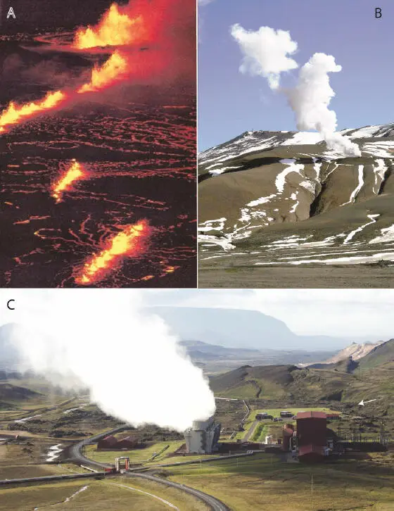
Figure I.14. (A) Fissural eruption of Krafla in 1980, along fractures arranged en échelon. (B and C) The geothermal power plant (C) narrowly escaped destruction by lava flows (flow with white arrow) (B-C: Brigitte Van Vliet-Lanoë©)
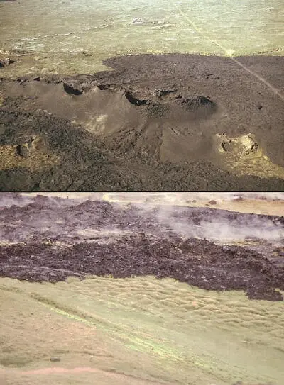
Figure I.15. Eruption of Krafla in 1980: hornitos on fractures and lava flows in 1997 (Brigitte Van Vliet-Lanoë©)
The latter were the locus of a first submarine eruption in 1963 (building of the Surtsey volcano), then of a fissural eruption (followed by a strombolian phase) partially destroying the town of Vestmanayer on the main island of Heimaey in 1973.
In relation to volcanic activity and especially to tectonic activity, seismicity is permanent in Iceland and major earthquakes have regularly occurred, particularly in the northern peninsulas (Húsavík region) and in the whole south of the island. When crossing the lava fields between Hveragerði and the Hekla, many remarkably preserved traces of major historical earthquakes (M > 6) can be observed ( Figure I.17).
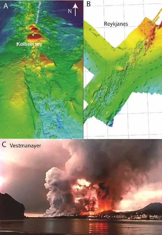
Figure I.16. (A) The submarine ridges of Kolbeinsey and (B) of Reykjanes (multibeam echosounder images, HAFRO.is). (C) The eruption of Heimaey, building the “Mountain of Fire” (Eldfell) in 1973
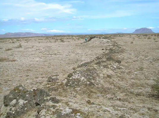
Figure I.17. Trace of the Réttarnes seismic fault (1294 or 1732) in the Rangavellir: South Iceland Seismic Zone (Françoise Bergerat©)
If in the north of the island the current earthquakes occur mainly offshore, the Húsavík and Kopasker agglomerations are however far from being sheltered from a significant seismic event, and in the south, several major earthquakes have occurred very recently (M w6–7; June 2000, May 2008).
While Icelandic houses are relatively insensitive to earthquakes ( Figure I.18), the same cannot be said for road infrastructure or greenhouses. The temporary rise or fall of water tables or lakes is frequent, reactivating or deactivating geysers and causing fluid escapes. This is particularly the case in the Hveragerði or Geysir region: Strokkur is currently the most active and Great Geysir is currently intermittent ( Figure I.19).
The cold pole of Iceland is represented by its glaciers, currently relatively little extended but which covered practically all the island at the time of the last glaciation, inhibiting the activity of a great majority of the volcanoes. Most of the time, they settled at the top of the volcanic edifices constituting the high points of the island such as Vatnajökull (2,009 m at Bárðarbunga) or Hofsjökull (1,765 m at Habunga; Figure I.20).
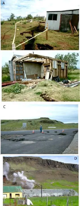
Figure I.18. Destruction caused during the earthquakes of June 2000 in Bitra: (A and B) farm buildings, (C) main highway (N1) (A-B-C Françoise Bergerat©), and at the end of May 2008 in Hveragerði: (D) dislocated pipes and damaged greenhouses (Brigitte Van Vliet-Lanoë©)
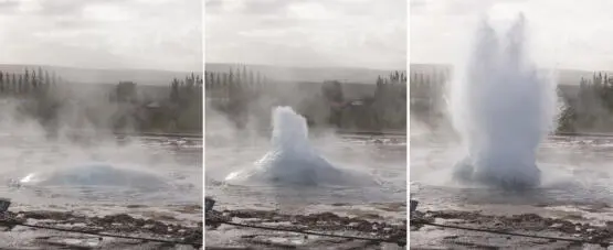
Figure I.19. Successive phases of an explosion of the Strokkur geyser, Geysir geothermal field (Brigitte Van Vliet-Lanoë©)
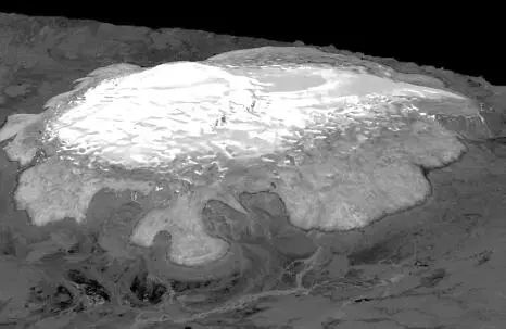
Figure I.20. The Hofsjökull. Document made from radar images (CNES©). The caldera is located at the top left of the picture
These glaciers have profoundly carved the island since the Neogene, with deep glacial valleys, ice-smoothed or striated rocks, countless drumlins and large areas of abandoned glacial sediments on the central plateau, especially around the Kerlingarfjöll ( Figure I.21). Some volcanoes have typically subglacial morphologies, such as tabular volcanoes or tuyas, the best known of which is Herðubreið ( Figure I.22). Others form alignments of ridges, the tindar , which formed at the margin of the melting caps ( Figure I.23).
The waters from these glaciers have also shaped canyons with huge waterfalls, on powerful, gray and loaded water rivers, the jökullsá ( Figures I.23and I.24). These waters are currently collected for an important hydroelectric production with mainly industrial purposes (aluminum and rare metals extracted from imported ores). This resource accounts for 72% of Iceland’s electricity production.
Various cap outlets are currently being developed and managed, with water stored in very large dams, generally superimposed on the same course and designed to resist jökulhlaups of interglacial rank. Global warming in recent decades and potentially induced volcanism are likely to call this policy into question.
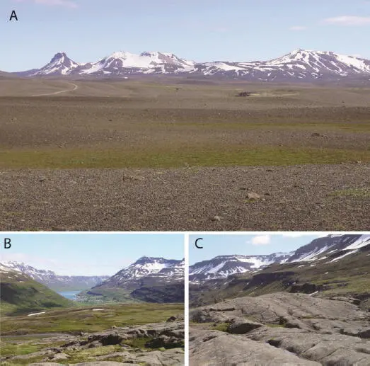
Figure I.21. (A) The Kerlingarfjöll surrounded by its glacial desert. (B) Perched upper cirque and (C) ice-smoothed rocks of the eastern fjords (Mjóifjörður, south of Seiðifjörður) (Brigitte Van Vliet-Lanoë©)
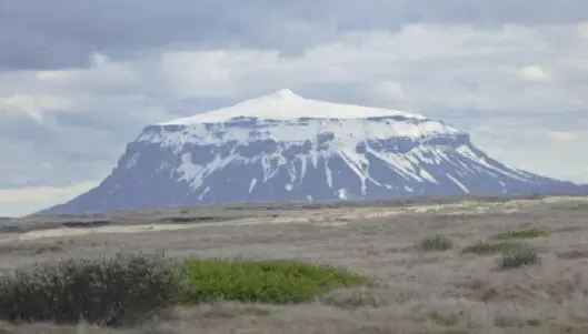
Figure I.22. A subglacial tabular volcano: the Herðubreið, north of Vatnajökull, North Volcanic Zone (Brigitte Van Vliet-Lanoë©)
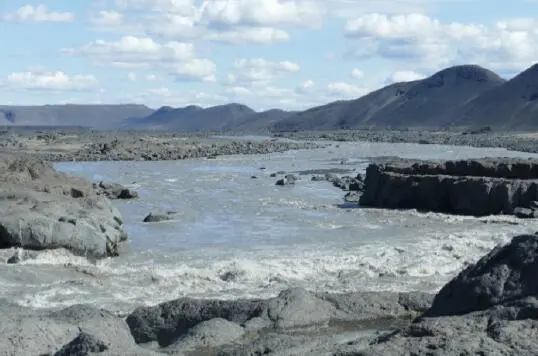
Figure I.23. Jökulsá á Kreppa north of Vatnajökull with hyaloclastite or tindar ridges (Brigitte Van Vliet-Lanoë©)
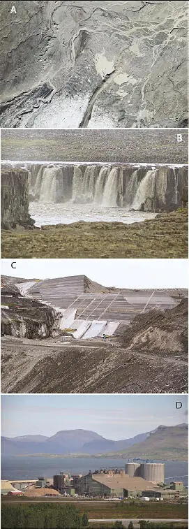
Figure I.24. A key Icelandic resource: water. (A) Bruarjökull outlet (the glacier is at the bottom of the photograph) (LMIs©). (B) One of the Dettifoss waterfalls (Jökulsá á Fjöllum). (C) The Haslsón dam on the Jökulsá á Brú. (D) The Fannahlið aluminum plant (Hvalfjörður) (photos B, C and D: Brigitte Van Vliet-Lanoë©)
On land, Iceland’s only important and renewable resources are its water and, as a result, its hydroelectricity, as well as its many geothermal sites related to the presence of the hot spot.
In this two-volume book, we will present the geological and glacial history of this island, its current tectonic and volcanic activity and the impact of its formation on the climatic evolution of the last few millions of years. Volume 1 replaces Iceland within the geological framework of the North Atlantic, and describes its tectonic and geodynamic evolution. Volume 2 (Van Vliet-Lanoë 2021) is dedicated to the study of the interactions between Icelandic volcanism and external geodynamics, i.e. with glaciations and the climatic evolution of the Atlantic zone during the Neogene and the Quaternary.
Читать дальше
