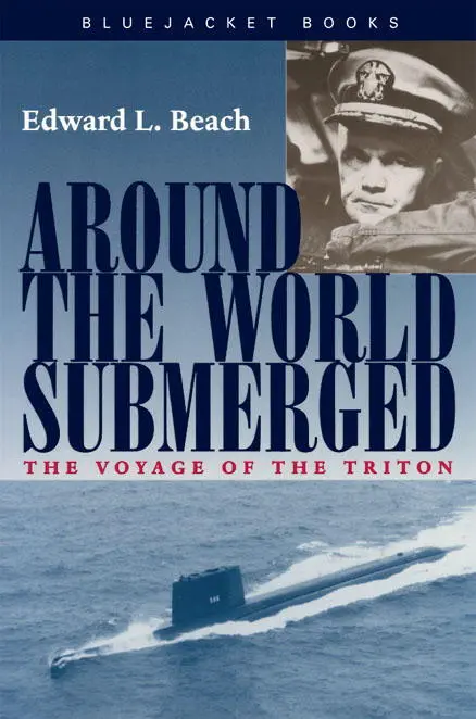
Edward Beach - Around the World Submerged
Здесь есть возможность читать онлайн «Edward Beach - Around the World Submerged» весь текст электронной книги совершенно бесплатно (целиком полную версию без сокращений). В некоторых случаях можно слушать аудио, скачать через торрент в формате fb2 и присутствует краткое содержание. Город: Annapolis, MD, Год выпуска: 2001, ISBN: 2001, Издательство: Bluejacket Books, Жанр: military_history, Биографии и Мемуары, на английском языке. Описание произведения, (предисловие) а так же отзывы посетителей доступны на портале библиотеки ЛибКат.
- Название:Around the World Submerged
- Автор:
- Издательство:Bluejacket Books
- Жанр:
- Год:2001
- Город:Annapolis, MD
- ISBN:978-1-61251-198-6
- Рейтинг книги:5 / 5. Голосов: 1
-
Избранное:Добавить в избранное
- Отзывы:
-
Ваша оценка:
Around the World Submerged: краткое содержание, описание и аннотация
Предлагаем к чтению аннотацию, описание, краткое содержание или предисловие (зависит от того, что написал сам автор книги «Around the World Submerged»). Если вы не нашли необходимую информацию о книге — напишите в комментариях, мы постараемся отыскать её.
was commissioned in November 1959, its commanding officer, Captain Edward L. Beach, planned a routine shakedown cruise in the North Atlantic. Two weeks before the scheduled cruise, however, Beach was summoned to Washington and told of the immediate necessity to prove the reliability of the Rickover-conceived submarine. His new secret orders were to take the Triton around the world, entirely submerged the total distance.
This is Beach’s gripping firsthand account of what went on during the 36,000 nautical-mile voyage whose record for speed and endurance still stands today. It brings to life the many tense events in the historic journey: the malfunction of the essential fathometer that indicated the location of undersea mountains and shallow waters, the sudden agonizing illness of a senior petty officer, and the serious problems with the ship’s main hydraulic oil system.
Intensely dramatic, Beach’s chronicle also describes the psychological stresses of the journey and some touching moments shared by the crew. A skillful story teller, he recounts the experience in such detail that readers feel they have been along for the ride of a lifetime.
Around the World Submerged — читать онлайн бесплатно полную книгу (весь текст) целиком
Ниже представлен текст книги, разбитый по страницам. Система сохранения места последней прочитанной страницы, позволяет с удобством читать онлайн бесплатно книгу «Around the World Submerged», без необходимости каждый раз заново искать на чём Вы остановились. Поставьте закладку, и сможете в любой момент перейти на страницу, на которой закончили чтение.
Интервал:
Закладка:
1749 Resumed base course and speed. Now transiting Flores Sea.
Tuesday, 5 April 1960 This morning, as we passed through the last shallow water areas before Lombok, a final try was made to fix our fathometer. Results were both success and failure—success on the theoretical plane, failure on the practical. Our second transducer, converted from a general announcing speaker, indeed produced a signal, and it did receive sounds transmitted through air or water. But like its predecessor, it could not penetrate the heavy steel of the ship’s hull.
We do, however, have one hole in the bottom of the ship—the garbage ejector. To use it, we first have to secure the fathometer head inside the garbage ejector, then shut the upper cap and open the lower door. Our first homemade transducer had been too large to fit into the garbage ejector, but our second attempt, constructed out of one of the ship’s regular announcing system speakers, fits into it neatly.
No luck at all, not even theoretical, attended this attempt. The speaker was put into the garbage ejector, connected up. All appeared well; but when the inner cap was secured, it dislodged the speaker, causing it to fall to the bottom of the garbage ejector where it became wedged sideways. For a time could neither fish it up nor get rid of it, and it looked as though we might have lost use of our garbage ejector and gained nothing. The situation was retrieved with expenditure of a great deal of effort, and the garbage ejector given a normal flushing, after which inspection showed that the modified speaker now rests somewhere in the Flores Sea.
0650 Approaching Lombok Strait to enter the Indian Ocean. Lombok Strait was one of the principal submerged highways for submarines based in Australia during the war. Situated between the islands of Bali and Lombok, it is one of the widest straits through the Malay Archipelago and is spectacular in that it has precipitous volcanic peaks on both sides. The water in the Strait is deep, but treacherous because of strong currents. During the war, there were reported cases of submarines spending hours at maximum sustained submerged speed only to surface at night and find that they had been going backwards. The Japanese knew that Lombok Strait was “Submarine Highway” and made efforts to close it. Generally, you could depend upon at least two patrol vessels being somewhere in the area and frequently there were more than that. Toward the end of the war, before the Japanese were pushed out of this area, they took to flying patrol planes back and forth also.
The last submarine sunk in the war, USS Bullhead, commanded by my Naval Academy and submarine school classmate and good friend E. R. (Skillet) Holt, Jr., was most likely destroyed here on 6 August, 1945. This was “Skillet’s” first patrol as skipper, after a number in lesser capacity. He had been ordered into the Java Sea, just north of Java, and was due to transit Lombok Strait and enter his assigned area on the 6th of August, 1945. On that day, in position 8°—20’ S, 115°—40’ E, a Japanese patrol plane attacked a submarine, claiming two direct hits. The report went on to say that for ten minutes or more air bubbled to the surface and the water was slick with oil.
1030 Our position is exactly 8°—20’ South, 115°—40’ East.
The last time I saw “Skillet” was when we both graduated from submarine school on 20 December, 1941. Our careers paralleled each other; we arrived at the submarine school and achieved our first commands at approximately the same time. We departed for our respective first command patrols within a few days of each other; both of us were due to report to our new stations on the 6th of August, and on that very day both patrols were, in effect, terminated by bombs. In my case it was the bomb on Hiroshima.
While transiting Lombok Strait, we sighted several ships of various types. One was a small sailing ship similar to the one we had seen yesterday in Makassar Strait, except it had only a single mast. Later, at 0950, sighted 3 ships, apparently small Naval or Coast Guard craft, heading north up Lombok Strait.
In attempting to determine the course and speed of these last-sighted vessels we experienced considerable difficulty in fixing an accurate angle on the bow. Every time the periscope was raised for an observation, they seemed to be heading in a different direction. There was no indication of a search pattern or deliberately erratic steering, but no two of them ever got together on a course, and they were never seen heading in the same direction twice. Finally, after some time, they steadied out and proceeded past us up Lombok Strait on a steady course and speed. We forgot the problem until later.
During a period, relatively free from near contacts, the opportunity was seized to inspect Bali carefully. Bali is a spectacular volcanic mountain, now extinct. Viewed from Lombok Strait, it is perfectly symmetrical, in many ways similar to Mt. Fuji in Japan, but without a snow cap. According to the chart, however, Bali Peak is not quite as symmetrical as Fuji, for the northwestern side was blown off by an eruption a long time ago.
On the eastern side of Lombok Strait there is another mountain, even higher than Mt. Bali: Mt. Rindjani. Both shores could be seen clearly. A village was visible at the foot of Mt. Rindjani on Lombok, but none on Bali, which only had terraced hillsides up a goodly portion of the steep sides of the volcano.
Although there were also many bare spots, Bali was bright with green verdure and held promise of many lovely valleys tucked away here and there amid the crags and outcroppings worn by centuries of weather and covered [in most places] with a skin of fertile soil. One could well believe the many stories told of the delightful living conditions and handsome, friendly inhabitants. It looks like a good life.
1029 In connection with our hydrographic and oceanographic work, of which very little can be told in this report, we seized the opportunity while in Lombok Strait to obtain deep-water samples, measure the general density, and observe temperature and other characteristics of the water. One of the simplest ways of measuring density is by behavior of the ship herself, since she will be considerably lighter in denser water and heavier in less-dense water. Correlation with known constants can give us a very good measure of the actual water conditions. To this is added careful analysis of the sample itself.
Upon going deep in Lombok Strait there were two distinct layers where the temperature changed rather rapidly, and at maximum submergence Triton was some 20 tons lighter than at periscope depth. This was easily understood, for directly to the south were the cool, deep waters of the Indian Ocean, while to the north were the warmer, saltier and shallow waters of the Sunda Sea and Flores Sea.
The heavy currents reported to exist here at various depths we can also well believe, and we have measured them. The existence of these currents bears out theories regarding the meeting of the Indian Ocean and the Flores Sea, and the resulting water density changes.
1215 Sighted ship bearing 205° true, at 7000 yards. Once again, in tracking the vessel, it proved difficult at first to determine his angle on the bow because he was continually changing course. Finally, he straightened out as the others did earlier today, and came by us at a reasonable range, steady course and speed. The vessel was a small but beautifully maintained trawler type. Probably a fisherman, possibly a government vessel or even a small yacht.
1300 Through the periscope sighted ahead a ridge of water several feet high, apparently caused by the confluence of the waters sweeping down from the north through Lombok Strait and those of the Indian Ocean coming up from the south. About this time the Diving Officer [Jim Hay] was having difficulty maintaining periscope depth at ⅓ speed. ⅔ speed was ordered to give him a little more control. In spite of this, and with a slight up angle, the ship slowly drifted downward. We thought all the time this would shortly stop, when suddenly the depth gauges began to spin; depth increased to 125 feet in the space of 40 seconds. Standard speed was ordered to pull out of the involuntary dive, and we steadied out at 125 feet, shortly thereafter regaining periscope depth with an entirely new set of trim readings.
Читать дальшеИнтервал:
Закладка:
Похожие книги на «Around the World Submerged»
Представляем Вашему вниманию похожие книги на «Around the World Submerged» списком для выбора. Мы отобрали схожую по названию и смыслу литературу в надежде предоставить читателям больше вариантов отыскать новые, интересные, ещё непрочитанные произведения.


Обсуждение, отзывы о книге «Around the World Submerged» и просто собственные мнения читателей. Оставьте ваши комментарии, напишите, что Вы думаете о произведении, его смысле или главных героях. Укажите что конкретно понравилось, а что нет, и почему Вы так считаете.