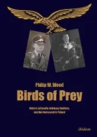
Philip W. Blood - Birds of Prey
Здесь есть возможность читать онлайн «Philip W. Blood - Birds of Prey» — ознакомительный отрывок электронной книги совершенно бесплатно, а после прочтения отрывка купить полную версию. В некоторых случаях можно слушать аудио, скачать через торрент в формате fb2 и присутствует краткое содержание. Жанр: unrecognised, на английском языке. Описание произведения, (предисловие) а так же отзывы посетителей доступны на портале библиотеки ЛибКат.
- Название:Birds of Prey
- Автор:
- Жанр:
- Год:неизвестен
- ISBN:нет данных
- Рейтинг книги:4 / 5. Голосов: 1
-
Избранное:Добавить в избранное
- Отзывы:
-
Ваша оценка:
Birds of Prey: краткое содержание, описание и аннотация
Предлагаем к чтению аннотацию, описание, краткое содержание или предисловие (зависит от того, что написал сам автор книги «Birds of Prey»). Если вы не нашли необходимую информацию о книге — напишите в комментариях, мы постараемся отыскать её.
Professor Richard E. Holmes (18 February 2001).
Birds of Prey is a microhistory of the Nazi occupation of Białowieźa Forest, Poland’s national park. The narrative stretches from Göring’s palatial lifestyle to the common soldier on the ground killing Jews, partisans, and civilians. Based entirely on previously unpublished sources, the book is the synthesis of six areas of research: Hitler’s Luftwaffe, the hunt and environmental history, military geography, Colonialism and Nazi Lebensraum, the Holocaust, and the war in the East. By weaving together a narrative about Hermann Göring, his inner circle, and ordinary soldiers, the book reveals the Nazi ambition to draw together East Prussia, the Bialystok region, and Ukraine into a common eastern frontier of the Greater German state, revealing how the Luftwaffe, the German hunt, and the state forestry were institutional perpetrators of Lebensraum and genocide. Up until now the Luftwaffe had not been identified in specific acts of genocide or placed at large scale killings of Jews, civilians, and partisans. This gap in the historical record had been facilitated by the destruction of the Luftwaffe’s records in 1945. Through a forensic and painstaking process of piecing together scraps of evidence over two decades, and utilizing Geographical Information System software, Philip W. Blood managed to decipher previously obscure reports and expose patterns of Nazi atrocities.
Birds of Prey — читать онлайн ознакомительный отрывок
Ниже представлен текст книги, разбитый по страницам. Система сохранения места последней прочитанной страницы, позволяет с удобством читать онлайн бесплатно книгу «Birds of Prey», без необходимости каждый раз заново искать на чём Вы остановились. Поставьте закладку, и сможете в любой момент перейти на страницу, на которой закончили чтение.
Интервал:
Закладка:
In the military context, the expansion of the eastern frontier produced significant security administration requirements of a colonising scale, rather than for a political annexation. The challenge for the military-security services was to meet the Nazi goal. To excel in military geography was the German officers’ mantra. Field Marshall Schlieffen’s staff rides, his battlefield tours, were lessons in reading maps to better understand the nature of battle. 5Göring’s fitness for command could be partly gauged by his map skills and understanding of the terrain. In the first instance, he had acquired knowledge as a user of military geography. As an officer cadet, he was schooled in terrain and geography; as an airman-observer, he was an expert of map interpretation; and as a squadron leader conducted his command through maps—but was he suited to command-control Białowieźa from the comfort of Rominten? In the Second World War, German military cartographers not only plotted the movements of armies and the positions of enemies, but also the distribution of populations and strategic raw materials. The search and acquisition of local information were paramount to military and civilian occupations. Consequently, the daily production of maps was essential to both warfare and racial engineering. By 1942–43, it is estimated were that the armies in the east were printing and distributing upwards of 25,000 maps per day. 6
German military geography was not well documented to assist this research, 7but an indication of the German cartographical system can be located in other sources. In July 1945, British Army intelligence interrogated a senior NCO from the Wehrmacht’s military geography branch. His interrogators isolated the German administration of military geography as the focus of their questions. They learned that Lieutenant General Gerlach-Hans Hemmerich (1879–1969) was reactivated in October 1936 as Chief of Abteilung für Kriegskarten- und Vermessungswesen, the Mapping and Surveying department within the Chief of Staff of the Army (OKH). He remained chief of army mapping until April 1945. The department was designated MIL-GEO, with its head office in Berlin and with smaller satellite departments dispersed throughout the army. Maps remained its primary mission throughout the war. 8Following the outbreak of war, MIL-GEO’s offices and personnel expanded through the conscription of elderly professors and civilians with geographical expertise. The Berlin university system was particularly important in providing staff. Professors also recommended good students for staff posts, and the army designated them Heeresbeamter, a military-civil service rank. This process of conscription was later extended to geography schoolteachers and local government surveyors. Following Germany’s early conquests, the MIL-GEO established outposts in most occupied cities. The scope of their work extended to gathering information recorded on a card index system. The breadth of data collected included physical geography, economics, water sources, traffic routes, roads, and anything deemed essential to military operations. Once compiled into maps and reports, they were packaged in comprehensive volumes and distributed to the higher commands as topographical intelligence. In effect, each high command of the army received a collection of detailed maps and cartographical information to conduct operations.
The British interrogators also raised questions about (Lw) Lieutenant Otto Schulz-Kampfhenkel (1910–1989), chief of the Forschungstaffel zbV des OKW. They learned that Schultz-Kampfhenkel was a geographer and was Göring’s special advisor on political-military geography. Before the war, he founded Forschungsgruppe-Schultz-Kampfhenkel, a consultancy with a reputation for applying a ‘total approach’ to explorations and surveys. He led an anthropological-cartographical expedition to Amazonia (1935–37) in a joint venture organised by the Kaiser-Wilhelm-Institut für Biologie and Brazil’s National Museum. 9The expedition’s mission was to examine Urwald and understand its special qualities. During the war, his Forschungstaffel was turned into a small office, attached to the OKW, and called Sonderkommando Dora. 10Schulz-Kampfhenkel was also tasked with exploring and surveying parts of North Africa. As the chief exponent of Urwald, Schultz-Kampfhenkel advocated the incorporation of forests into the German national defence system. While there was a sacred relationship between the German hunt and Urwald, Schulz-Kampfhenkel’s ideas for a forested border in the east gained a powerful grip on Nazi homeland security. Schulz-Kampfhenkel’s ‘hidden-hand’ was behind Göring’s plans for Białowieźa. In effect, the forest was set to become part of Germany’s national boundaries, and with a central strategic purpose of defence.

Map 2: Bezirk Bialystok circa 1944.
The area within the black box approximates to the Białowieźa security arena discussed in this book.
Source: Wikicommons|Public Domain
The Luftwaffe’s Białowieźa operation’s map the Karte des Urwaldes Bialowies is held by the Bundesarchiv-Militarärchiv. The map has a 1:100,000 scale and was produced in digital format of six sections. When put together they filled a small lecture room. The map had a legend that included the positions of troops, strongpoints, command posts, and wireless posts. During the war, the map was arranged as a single item on a large map-table in the Tsar’s former hunting palace, that served as the battalion’s headquarters. Trying to reconstruct the battalion’s cartographical activity was impossible: trying to locate the position of companies and squads beyond the major towns was a ‘hit and miss’ exercise. A conundrum materialized that came from not being able to integrate the map with the documents. The operational administration and orderly filing of the Luftwaffe combat reports contrasted with the content of the reports, that implied random, haphazard, and chaotic killing. Actions were too far at odds with reporting. The actions in the combat reports did not reflect the known understanding of the German way of war or small-unit actions. The maps were the primary form of command and control for German operations, and were pertinent to the Białowieźa story. Reports without the maps were largely incoherent beyond killing, fighting, or deporting. If the behaviour of the Germans was deliberate, it could only be proven by unlocking the map codes. A neutral, and important, issue within the documents, was the geographical references buried within the combat reports. These references could not be disputed. Attempting to reconstruct cartographical movements with this map approved impractical with marginal results. This confirmed Hobsbawm’s dictum that grassroots history has its challenges: it ‘doesn’t produce quick results, but requires elaborate, time-consuming and expensive processing.’ 11
II. The science of maps
The aphorism ‘a map is worth a thousand words’ was never more pertinent than in the research behind this book. The conversion to historical GIS (Geographical Information System) was a drawn-out process. Today, GIS is routinely applied to a full range of historical fields, including the Holocaust. 12Before that time, we relied on discussions with the geographers at the Bundesarchiv to try to understand how the maps were used. There was some confusion because there was no working reference to how the Germans had used the maps. In discussions with Bettina Wunderling, a qualified GIS technician, we examined the theory of applying alternative methods to unlock the maps and connect them to the war diary. We agreed upon an experiment that should use the digitized map of Karte des Urwaldes Bialowies as the platform for conducting GIS-based forensic analyses. 13Transferring the research to a scientific basis was not an entirely alien prospect. During my MBA at Aston Business School, assignments involved quantitative analysis of large data sets, computer programming, systems engineering, and design, and had devised a research method for managing large quantities of diverse information. There were hidden benefits that Richard Holmes recognised, that elements of my MBA, which included management systems, organisational theory, and social psychology, would help to broaden the historical research.
Читать дальшеИнтервал:
Закладка:
Похожие книги на «Birds of Prey»
Представляем Вашему вниманию похожие книги на «Birds of Prey» списком для выбора. Мы отобрали схожую по названию и смыслу литературу в надежде предоставить читателям больше вариантов отыскать новые, интересные, ещё непрочитанные произведения.


Обсуждение, отзывы о книге «Birds of Prey» и просто собственные мнения читателей. Оставьте ваши комментарии, напишите, что Вы думаете о произведении, его смысле или главных героях. Укажите что конкретно понравилось, а что нет, и почему Вы так считаете.