Mark de Silva - Square Wave
Здесь есть возможность читать онлайн «Mark de Silva - Square Wave» весь текст электронной книги совершенно бесплатно (целиком полную версию без сокращений). В некоторых случаях можно слушать аудио, скачать через торрент в формате fb2 и присутствует краткое содержание. Год выпуска: 2016, Издательство: Two Dollar Radio, Жанр: Фантастика и фэнтези, на английском языке. Описание произведения, (предисловие) а так же отзывы посетителей доступны на портале библиотеки ЛибКат.
- Название:Square Wave
- Автор:
- Издательство:Two Dollar Radio
- Жанр:
- Год:2016
- ISBN:нет данных
- Рейтинг книги:4 / 5. Голосов: 1
-
Избранное:Добавить в избранное
- Отзывы:
-
Ваша оценка:
Square Wave: краткое содержание, описание и аннотация
Предлагаем к чтению аннотацию, описание, краткое содержание или предисловие (зависит от того, что написал сам автор книги «Square Wave»). Если вы не нашли необходимую информацию о книге — напишите в комментариях, мы постараемся отыскать её.
tells the story of a night watchman who discovers weaponized weather modification technologies. It sounds crazy, but in de Silva’s hands it all makes perfect (and terrifying) sense."
— "Part mystery, part sci-fi thriller… highly topical for Americans today."
— "Mark de Silva’s truly accomplished
defies all categories. Provocative, fascinating, and edifying,
is a fiercely intelligent and thrillingly inventive novel."
— Dana Spiotta
"Enticing and enthralling, [
] aims to hit all the literary neurons. This might be the closest we get to David Mitchell on LSD.
is the perfect concoction for the thirsty mind."
— "The novel of ideas is alive and well in de Silva's high-minded debut, in which the pursuit of art, the exercise of power, and climate control are strangely entwined."
— "Intriguing. A satisfying twist on more traditional dystopian fare… De Silva manages these varied plots skillfully."
— "A brilliant debut, ambitious with its ideas, extraordinary in their syntheses and execution, and its stylish prose lit up everywhere by a piercing intelligence."
— Neel Mukherjee
"
is, above all, just excellent. Mark de Silva’s prose is simultaneously uncompromising and unassailable. The resulting work is kinetic with an almost wistful erudition that relentlessly but organically plumbs the intersections between art, politics, and our baser human qualities. Ultimately, the novel's defiance of easy categorization or explication charges the story with a compelling mental resonance that somehow feels instructive."
— Sergio De La Pava
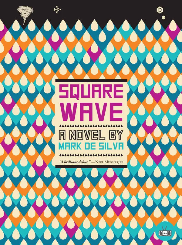
Carl Stagg, a writer researching imperial power struggles in 17th century Sri Lanka, ekes out a living as a watchman in a factionalized America where confidence in democracy has eroded. Along his nightly patrol, Stagg finds a beaten prostitute, one in a series of monstrous attacks. Suspicious of his supervisor's intentions, Stagg partners with a fellow part-time watchman, Ravan, to seek the truth. Ravan hails from a family developing storm-dispersal technologies, whose research is jointly funded by the Indian and American governments.
The watchmen's discoveries put a troubling complexion on Stagg's research, giving it new shape and impetus, just as the weather modification project begins to appear less about dispersing storms than weaponizing them.
By gracefully weaving a study of the psychological effects of a militarized state upon its citizenry with topics as diverse as microtonal music and cloud physics,
signals the triumphant arrival of a young writer certain to be considered one of the most ambitious and intelligent of his generation. Gatefold cover.
Mark de Silva
New York Times
Square Wave
Square Wave — читать онлайн бесплатно полную книгу (весь текст) целиком
Ниже представлен текст книги, разбитый по страницам. Система сохранения места последней прочитанной страницы, позволяет с удобством читать онлайн бесплатно книгу «Square Wave», без необходимости каждый раз заново искать на чём Вы остановились. Поставьте закладку, и сможете в любой момент перейти на страницу, на которой закончили чтение.
Интервал:
Закладка:
Democritus laughed at the world,
Heraclitus wept over it,
Epichthonius Cosmopolites portrayed it .
Epichthonius Cosmopolites—“Everyman”—a name that did not name. The picture didn’t give away its tragic element easily, though Rutland’s heart sank infinitesimally the longer he stood over it, studying the geography of a clown’s face.
Mercator’s map, from decades before, was there too, up on a table opposite the main stacks of books. Next to it was a kind of update of the mappa mundi , Desceliers’ plane-chart of 1550, but with significant interior detail, beyond the coastal outlines and seaports. In this way it was more than a mere sea chart.
On the table near Darasa Rutland found the double-hemisphere of Jean Rotz. On one corner of it lay a small atlas with further maps: the charts, Rutland knew, of Battiste Agnese.
There were more, and it astonished him to see them all here. Beneath the Mercator was Martin Waldseemuller’s Carta Marina: A Portuguese Navigational Sea Chart of the Known Earth and Oceans . A true mariner’s map. Unlike the Ptolemaic map he’d made earlier, the Universalis Cosmographia —Rutland wondered if there was also a copy of this in the room — with its scholarly deductions, this was a deeply empirical depiction, which meant there was an unruliness to its lines. There were the tensions thrown up by conflicting records coming in from so many sailors. A priori maps elided that sort of complexity, or more likely never knew it.
Rutland recognized all but the jester map (the Fool’s Cap ). His grandfather, a high-ranking officer in the English army, was something of an amateur mapmaker, not only collecting copies of all the watershed maps from Ptolemy onward but drafting his own. In doing so he would conjoin rational and empirical principles, thinking this was the key to definitive cartography. Most of his creations, in fact, were composites of ones in his collection. The results were as visually interesting as they were unusable, by sailor and scholar alike. The principles, it turned out, were incongruent. Still, he’d managed to pass his grasp of the history of the discipline to his grandson. It was some part of the reason Rutland had taken a sailor’s path.
Above the books, hanging from the wall, was the 1502 Cantino World Chart, an accretion of hard-won Portuguese seafaring knowledge from which the Carta Marina was derived. For its martial and commercial value, the Portuguese royals had carefully guarded it. The Italian spy Alberto Cantino, Rutland recalled, was sent by the Duke of Ferrara to find a copy of the map. Ultimately he did, by an unknown hand, and smuggled it out of Lisbon. The Italians’ worldview immediately grew: the Cantino map of 1502 depicted outlying areas unknown to most other Europeans, regions that might serve as trading posts to bring mineral wealth and exotic foodstuffs into Lisbon — or else be annexed outright in the name of the empire.
As the priest continued to search the stacks, Rutland examined the depiction of Ceylon on the map, the tiny teardrop, here more of a circle. The Cantino was published just three years before the Portuguese arrived on the island. It was this map that many of their sailors would have helped create, contributing fresh details, improving its fidelity bit by bit.
Later generations would have steered here with its help; hence its presence in the temple. It was fitted to a wooden board, to preserve it, Darasa would tell him. The deep yellow of the map contrasted with the stark line drawings of the shores in brown ink. Mostly seaports were noted. The interiors were largely voids. They had not been much explored at the time, as it mattered little to merchant sailors how exactly the interior was arranged. They needed only to understand the edges of continents, where exchange was conducted. They would oversee the loading and unloading of cargo, and occasionally help military personnel secure the port. But they spent their time thinking of the ocean, or of home, not of the lands they found themselves in, or the precise origins of the goods they carried. Martial sailors and the explorers too held different maps, different thoughts, ones that traced their inward steps.
Darasa set a copy of the King James Bible on top of the Carta Marina ’s Africa. Rutland half-bowed to the monk as gratitude washed over him. The book’s burgundy covers were worn so smooth the leather appeared grainless, though the vellum stock had stood up quite well to the marine air it would have seen in transit.
He fingered the slices of calfskin inscribed with the word of God, but strangely, without quite the conviction he expected to feel, given the many months since he had last seen a Bible. Carrying the residue of vast terrestrial movements, their geometries and schemata sketching historical trajectories without meaning to, the maps gave little ground, in his mind, to the Word. Most stubborn was the Fool’s Cap , at once a simple guide to the world and a shaping of it, an inscrutable transfiguration of history and futurity, both, into geography.
The Bible was something different. Cartography enforced a leanness of meaning; a coastline, a bay, or a mountain range could carry only so much sense. The Book, holy poem, was a thicket of sense, making it impossible to read its implications off cleanly.
The air had gone blue-black outside. Rutland insisted he would make his way back alone, and asked only if he might have use of a lantern, which he would return the next day. Darasa pulled a sheet of paper from the shelf. It was decorated with the emblem common to the temples, which resembled those of the kingdom: the seal of the lion, descending from the ancient north-Indian kingdom of Kalinga, where the Sinhalese, it was held, originated.
He inscribed a few lines, signed and folded it, and held it out to Rutland. He was to present it to anyone in the village, especially the village councilors, who might be suspicious of the evening excursion. He walked Rutland back down to the vehar’s side entrance and took up an unlit lantern, its twine wick poking out of yellow goat fat.
Rutland took the ball of twine from his pocket and dipped the end of it in the flame coming off the hanging temple lantern. He lit the one Darasa held with it and left through the tall grass, the letter tucked in the book.
When he reached the clearing with the abandoned fire — he’d never asked the monk why he’d made it, or why he put it out, or even if it was in fact his — he set the lamp down and opened the Bible to the page of the letter. It had settled in Leviticus. He opened the letter, and though he could read bits of Sinhalese now, he found the characters strange.
Later he would learn the letters were Pali. Understood only by the Buddhist monks, the characters would be recognized by the town’s officers as Pali, but they, like Rutland, would have no sense of its meaning except for the numerals indicating time and date. Its meaning, then, was effectively just its form. If he presented a letter in Pali with the right date and time, and with his name on it — he could see that much, as it was written in English — on temple paper with a senior priest’s signature, the officer would not bother to have another priest decipher it, and Rutland would be left alone.
But what did it mean, in Pali? Was it nonsense? Perhaps the priest had a sense of humor. Or maybe it was meant to be deciphered someday, when his descendants found it among his papers, in England, God willing.
Rutland tucked the letter back into the book and held it with the lantern in one hand. He picked up the bundle of sticks and headed home.
Stagg closed the laptop and drank deeply from a coffee mug full of flat champagne so cheap that it was hardly worse for having lost its life. He shut his eyes and blotted out the light of afternoon.
Читать дальшеИнтервал:
Закладка:
Похожие книги на «Square Wave»
Представляем Вашему вниманию похожие книги на «Square Wave» списком для выбора. Мы отобрали схожую по названию и смыслу литературу в надежде предоставить читателям больше вариантов отыскать новые, интересные, ещё непрочитанные произведения.

Обсуждение, отзывы о книге «Square Wave» и просто собственные мнения читателей. Оставьте ваши комментарии, напишите, что Вы думаете о произведении, его смысле или главных героях. Укажите что конкретно понравилось, а что нет, и почему Вы так считаете.